
Snow Season Outlook 2015 – New Zealand – The Bledisloe of Snow
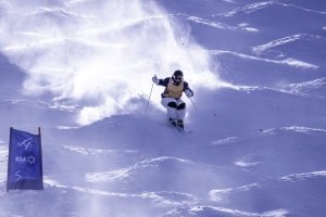
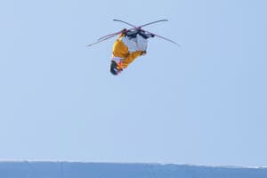
Last winter was less than disappointing in New Zealand, although there were still quite a few good days if you were there for them. Locals will be hanging for an improvement in 2015. The outlook is positive. Image:: Vaughan Brookfield
New Zealand Seasonal Snow Outlook | The Grasshopper
Australia won the cricket, but New Zealand’s got a good shot at clawing one back with a better ski season this winter.
We’re on our way to a strong El Nino event, and if you want more detail then I strongly suggest you check out my Australian outlook from a few days ago.
I’ll wait here while you go read it….
Done? Ok let’s go on.
The wild variations in surface pressure we see over Australia – depending on which flavour of El Nino turns up – change to much more sedate variations for New Zealand, and the distinction is not as relevant. The crucial and most basic point for New Zealand during El Nino is that pressures tend to be higher to the west, and lower to the east as in the image below.
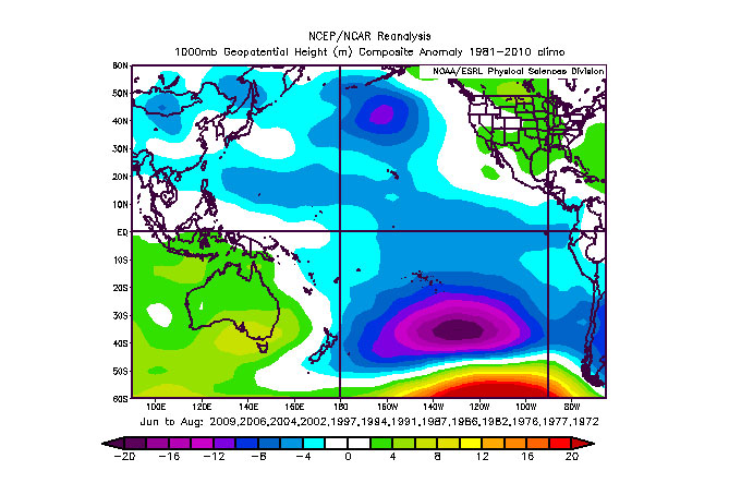
Positive values to the west of NZ denote higher pressures during El Nino winters.
This shift in the pressure patterns then leads to a greater prevalence of cold southerlies and south-westerlies over New Zealand during the winter months. Not all the time, mind you, but just more often than normal during winter. These cooler winds are great for ensuring that we make the most of whatever precipitation that turns up, scoring a greater proportion of snow and less rain, and it’s especially good for locations around Queenstown which are exposed to both the south and the southwest.
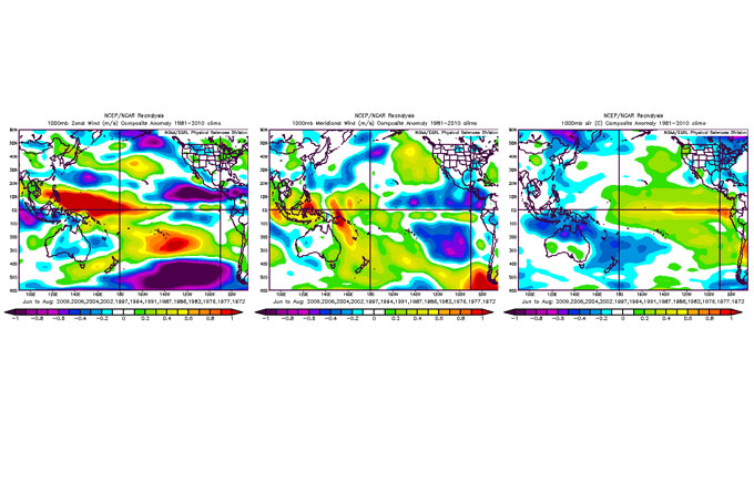
Left hand image shows winter westerly wind anomalies during El Nino. Positive values denote stronger and/or more frequent westerlies. Middle image shows southerly wind anomalies during El Nino. Positive values denote stronger and/or more frequent southerlies. Right hand image shows temperature anomalies during El Nino. Blue means colder.
But before you start jumping out of your chair and banking on a metre of powder, there’s a flipside to this shift in the winds. Air coming from the south-west or south also tends to be drier, and so it generally doesn’t have as much moisture available for the generation of snow. Furthermore, while we’re going to expect frequent fronts to fly by in this set-up, the high pressures in the Tasman Sea can also tend to keep a lid on the potential for the more gigantic weather systems.
From the paradise of the Southern Lakes to the mayhem of Ruapehu, this means that anyone exposed to the south and southwest can expect regular moderate snow activity this winter. It’s going to build gradually, slowly, steadily. The chances of a really crappy winter are much reduced, but so too are the chances of insane one-off storms. Like an All Black prop, we’re looking at a good solid reliable performance with few surprises. Just what those grooming crews need to ensure maximum fun for everyone. Their snowguns should get a nice workout, too.
My one note of caution: I’m not saying there won’t be winners and losers from this thing. Depending on exactly which wind direction dominates (south-west or southerly) you’ll see some places doing better than others. But overall, NZ is looking good. My pick this year, Q’town for the safe money, with a wild card of a big southerly storm or two possible in Canterbury. You book in June it’s always a gamble, you book in August you face the crowds. Good luck.
We’ll update this outlook in early May. If you’ve got a different theory on what’s going to happen this winter, or just want to provide feedback, then please hit me up on the discussion below. Or you can follow me on facebook.
The Remarkables forecasts,
snow reports and
live snow cams.
Treble Cone forecasts,
snow reports and
live snow cams.
Cardrona forecasts,
snow reports and
live snow cams.
Turoa forecasts,
snow reports and
live snow cams.
Coronet Peak forecasts,
snow reports and
live snow cams.
Whakapapa forecasts,
snow reports and
live snow cams.
Mount Hutt forecasts,
snow reports and
live snow cams.a>.