New Zealand Forecast, Monday July 1st – Heavy Rain Turns to Snow with an Icy Blast from Antarctica, Big Totals for the Southern Lakes
Mountainwatch | The Grasshopper
Published early Monday July 1st 2024
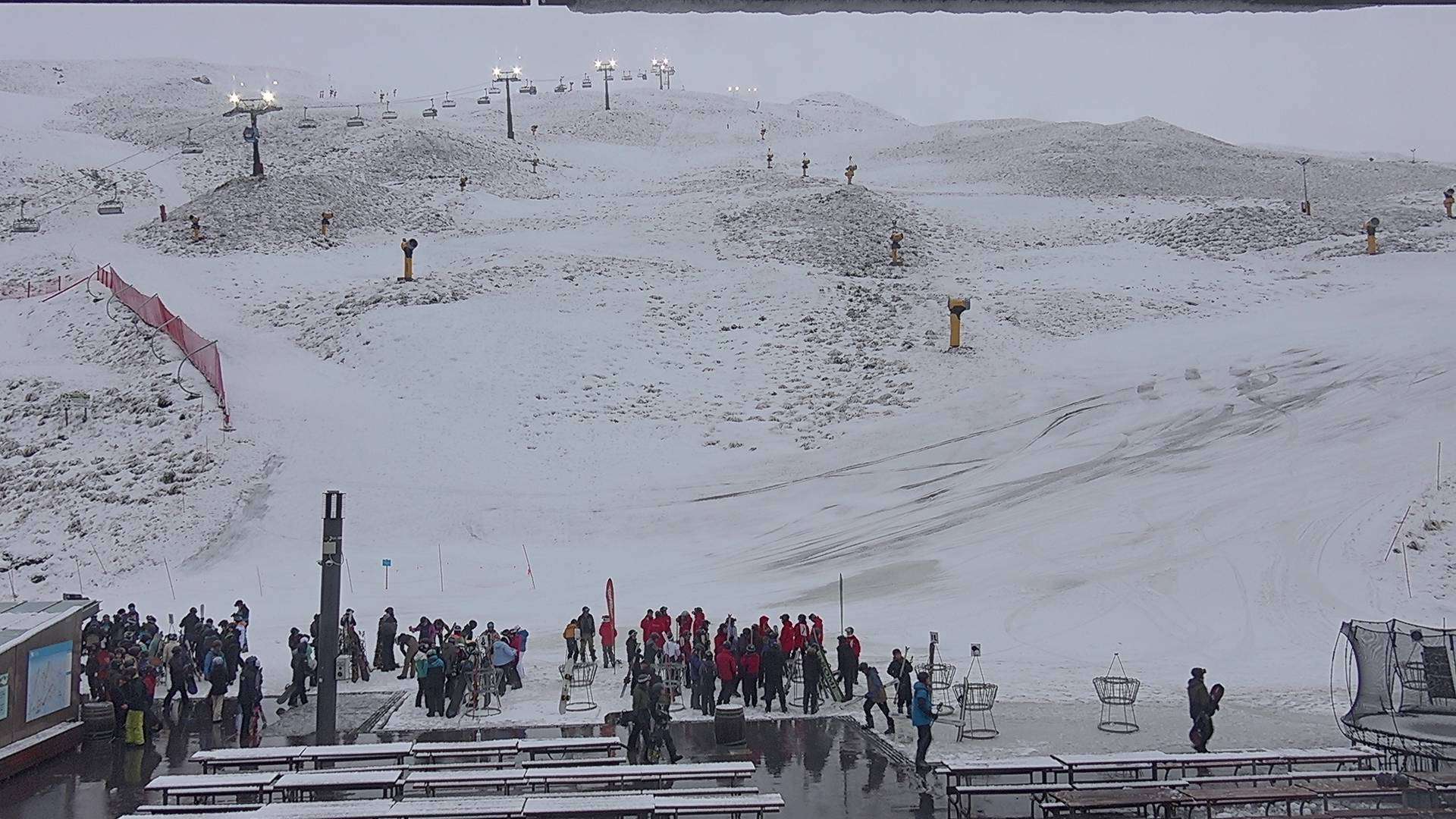
Turoa, Whakapapa and Treble Cone opened their gates and got things spinning for the season at the weekend. It was clear and calm for their respective Opening Days, so we couldn’t have asked for anything better given the limited snow cover.
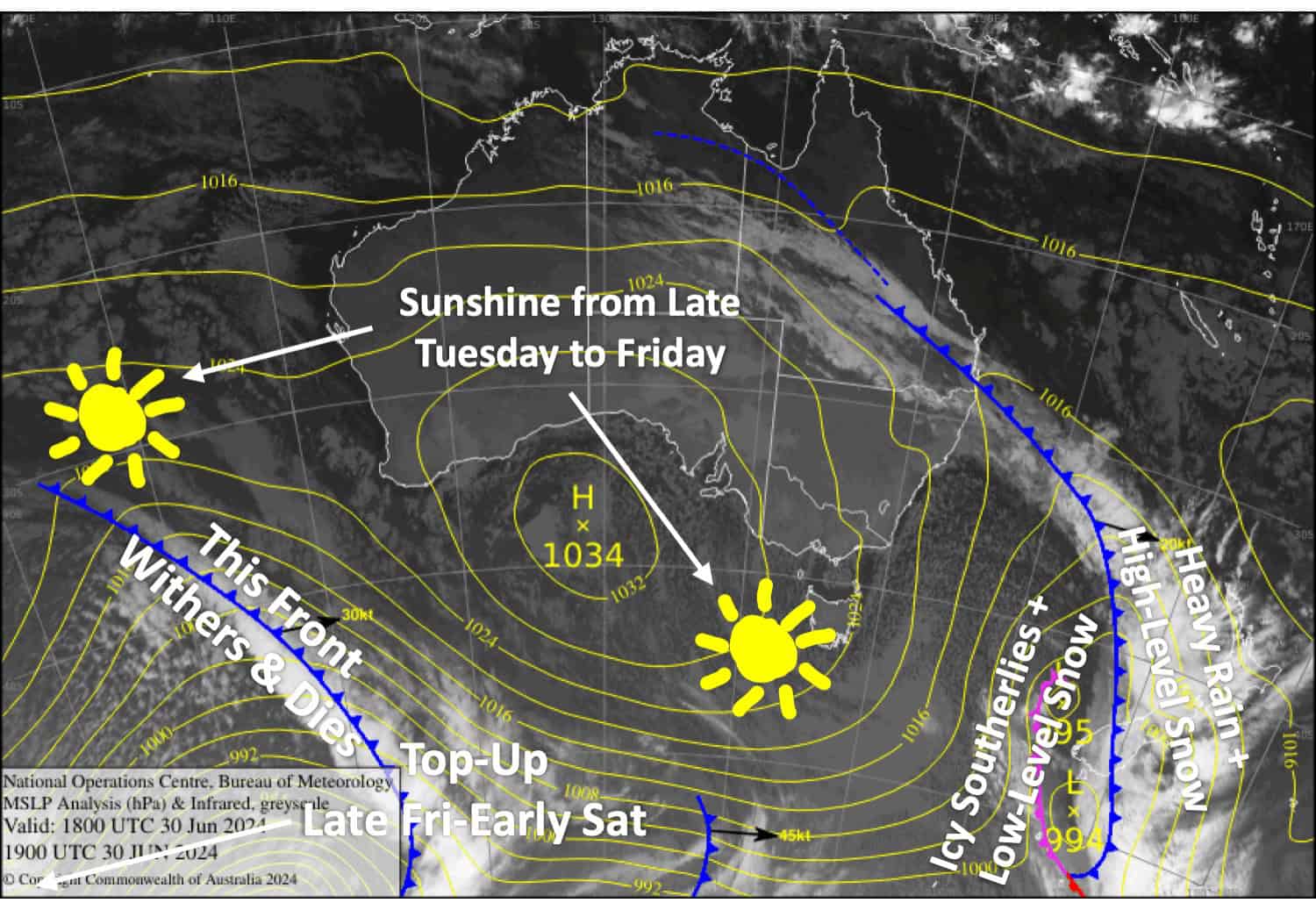
Today, Monday will see a strong front and low-pressure system cross the South Island. The front will bring heavy rain and mid-high level snow, before a strong, icy cold southerly straight off the Antarctica ice shelf blasts up the South Island, bringing a short, sharp dump of snow followed by lighter snow showers.
Snowfall totals for the Southern Lakes range from 25-60cm, but we could see a bit more up high and less down low due to a lot of it falling in the warm sector where it’ll be the dense variety. Still, it’s going to be amazing and Treble Cone will likely be at the top end of that range, the others closer to the middle-low end.
Canterbury will likely see a big spread of snowfall accumulations. Mt Hutt and Porter’s Pass will just receive a dusting or top-up as it looks mostly too warm there. The Craigieburn club fields should cop a heavy load about the upper slopes and a top-up down lower, while the McKenzie club fields should see totals in the 15-35cm range.
The snow showers clear Tuesday leaving mostly fine, but cold weather for Wednesday and Thursday as the icy southerlies gradually ease – a good couple of days to get amongst all the fresh powder while resorts should also get some good run time on the snow guns.
Monday July 1st
Heavy rain + dense mid-high-level snow over the South Island will turn to outright snow over the Southern Lakes early morning as colder southerlies start to arrive. Snowfall will pin back to snow showers in the afternoon, falling to low levels as southerlies strengthen and become even colder.
It’ll be a similar story in Canterbury, but all delayed by half a day or so. So for much of the day, it’ll rain with heavy falls and strong-gale northwesterlies, but that will all ease later in the afternoon. Then, cold southerlies hit overnight with snow falling to low levels.
Tuesday July 2nd
Brrr, it’ll be a cold one due to fairly strong, icy S-SW winds blowing over the South Island. Snow showers over South Island resorts will peter out early, although they may last into the afternoon for the Queenstown resorts, and then clouds will start to break apart, especially in Canterbury where it should fine up.
Mt Ruapehu will also see much-needed snow showers to base levels throughout much of the day.
Wednesday July 3rd
A fine day above low cloud for the Southern Lakes resorts where there’ll be a light, but cold S-SE breeze. Canterbury will remain partly cloudy as icy southerlies continue to abate. It’ll be a good day to make the most of the fresh snowfall.
Thursday July 4th
Clear and sunny above any low-level cloud, with light n’ cold breezes coming out of the south-southwest.
Extended Forecast
Another cold front is expected to move up the country from late Friday through Saturday, bringing a cold S-SW flow and a nice top-up from snow showers. The following several days will see the cold flow gradually ease as high-pressure inches towards the country.
That’s all from me today folks. The next forecast is Wednesday, enjoy the powder and see you then.
Grasshopper


