Australian Forecast – Mostly Warm, Sunny Skies for the Final Week of the Aussie Season
Published early Friday, 18th September 2026
Perisher’s slopes have had a timely little freshen-up for the home stretch, thanks to Tuesday night’s 4cm top-up and a couple of solid nights of snowmaking. We’ve now entered the final week of the Aussie season, with Perisher announcing Friday the 25th of September as closing day. That means this will also be my final Aussie forecast of the season, and it should see you right through to last turns.
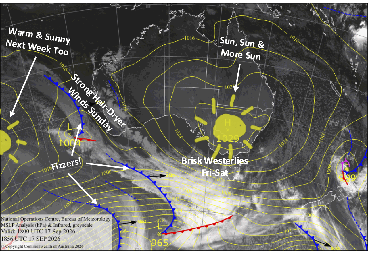
Mother Nature looks set to dish up plenty of sunshine for the grand finale. Friday and Saturday will be warm and sunny before hair-dryer northwesterlies crank up to gale force on Sunday, potentially affecting lifts and taking another decent bite out of the snowpack.
Things settle down again Monday as cooler southerlies arrive, bringing another big helping of blue sky and perhaps one last chance for the snow guns overnight. Tuesday then shapes up as an absolute bluebird corker, with more sunshine and warm weather expected through the final few days of the season. Not a bad way to see things out!
Friday 18th September
Another beautiful, warm, sunny day with a little high cloud as westerly winds pick up.
Saturday 19th September
Nice, warm and sunny with a brisk westerly.
Sunday 20th September
Clear and sunny again, but warm hair-dryer northwesterlies crank up to gale force, taking a sizable nibble out of the snowpack and possibly affecting lift operations.
Monday 21st September
Northwest winds die away early, with cooler, light southerlies then serving up a big helping of blue sky and sunshine, a little cloud on the side and perhaps a spit or two to wet the whistle. There may even be one last chance for the snow guns to fire overnight.
Tuesday 22nd September
Yet another stunning bluebird day, with barely a breath of wind to ruffle the feathers.
Extended Forecast
Sunshine and warm west-to-northwest breezes will dominate Perisher’s final three days of the season. However, a little atmospheric instability could spark a shower on Thursday and Friday afternoon, the 24th and 25th of September, with a chance of thunderstorms. Hopefully Mother Nature puts on a fitting light show to see the season out in style.
That’s all from me for today, and for the season, folks. It’s been a real pleasure riding the highs and lows of another Aussie winter with you. It certainly wasn’t an easy one, but hopefully you managed to scrounge up a few gems, score some good turns and make the most of what was dished up.
The NZ season is still cranking and will roll on into mid-October, while the Northern Hemisphere will start winding up in a couple of months, so there’s still plenty of snow to look forward to. Otherwise, enjoy the warmer months, and I’ll see you back here next season.
The Grasshopper, signing off!