New Zealand Forecast, August 26th – Fresh Dump of Powder and a Small Break in this Unruly Spring Pattern
Mountainwatch | The Grasshopper
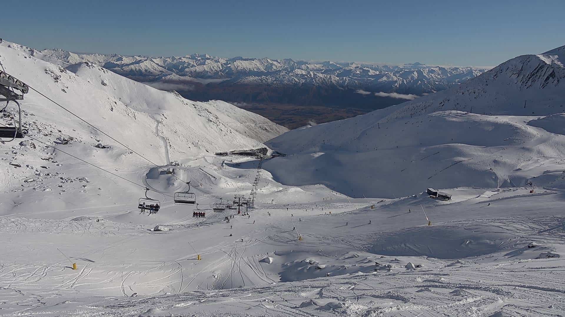
Today, Monday, will be the day of the season for the Southern Lakes after a front dumped 20-25cm on resorts there late yesterday and last night. Treble Cone went one up with 33cm up high. However, Ohau in the far south of Canterbury took the cake with a whopping 40cm!
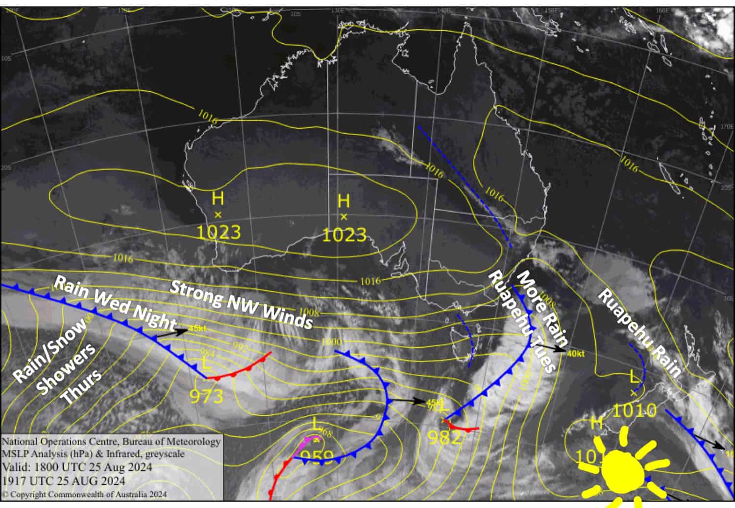
Other Canterbury resorts received between 5-15cm. Weather conditions will be great for shredding this new snow thanks to a narrow ridge providing a break in this relentless and unruly spring-like westerly regime that New Zealand has slipped into.
Conditions won’t be too bad for the South Island on Tuesday either, as a front crossing the country primarily aims for the North Island, with gales and heavy rain for Mt Ruapehu. However, winds will strengthen over the South Island again on Wednesday before a front passes over that night, bringing a bout of heavy rain, followed by showers of rain and snow spilling over the Main Divide on Thursday.
Monday August 26th
A ripper of a day for the Southern Lakes with fresh powder and mainly fine weather. Northerly breezes developing.
A partly cloudy day in Canterbury, which may turn murky at times this morning with drizzle at some resorts. Northwesterly winds gradually pick up.
A bit grotty for Mt Ruapehu where drizzle turns to rain in the afternoon and there’s a stiff northwester.
Tuesday August 27th
A fairly cloudy morning for South Island resorts with patchy drizzle. Cloud will break up for a mostly fine afternoon, but it’ll linger over the MacKenzie Basin where there’ll be a little more drizzle. Northwest winds, strong in Canterbury, will ease and turn southwest in the afternoon.
A bit gnarly on Ruapehu with heavy rain and gale northwest winds in the morning as a front passes over. The wind and rain will back off a bit for the afternoon, but it’ll still be unpleasant, although it’ll snow above 1800m from late afternoon.
Wednesday August 28th
A fine morning for South Island resorts, but clouds will build in the afternoon as northwest winds rise to gale force, likely affecting lift operations. Plus, there’ll be heavy rain at night.
Rain on Ruapehu will pin back to showers in the morning as brisk southwesterlies turn westerly, then gradually petering out by the end of the day. Snow levels will stick to 2000m and above.
Thursday August 29th
Strong northwest winds will see showers spilling over the Main Divide throughout the day. Winds will reach severe gale in Canterbury, no doubt limiting or closing lift operations. Snow levels gradually lower from mid slopes to the lower slopes in the Southern Lakes, and from upper slopes to mid slopes in Canterbury, and those resorts closest to the Main Divide will see the most of it.
Mt Ruapehu will have gale northwest winds while showers gradually build into heavy rain. Unfortunately, snow levels will be way too high for any snow.
Extended Forecast
Skies will clear, and winds will ease somewhat on Friday as a weak ridge passes over the country. However, another front this weekend will bring another period of heavy rain and strong northwest winds, which are picked to reach severe gale for a time. A little snow may fall on either side of the front, but the bulk of the precipitation is expected to be outright rain.
Next week, models expect the unruly spring-like pattern will continue, with strong winds and regular fronts crossing the country. A colder airmass may also arrive early in the week, giving resorts a good chance for fresh snowfall.
That’s all from me today, folks. The next forecast is Wednesday. See you then, and have a great couple of days.
Grasshopper


