Grasshopper’s 2025 New Zealand Season Outlook – Spring Update
Mountainwatch | The Grasshopper
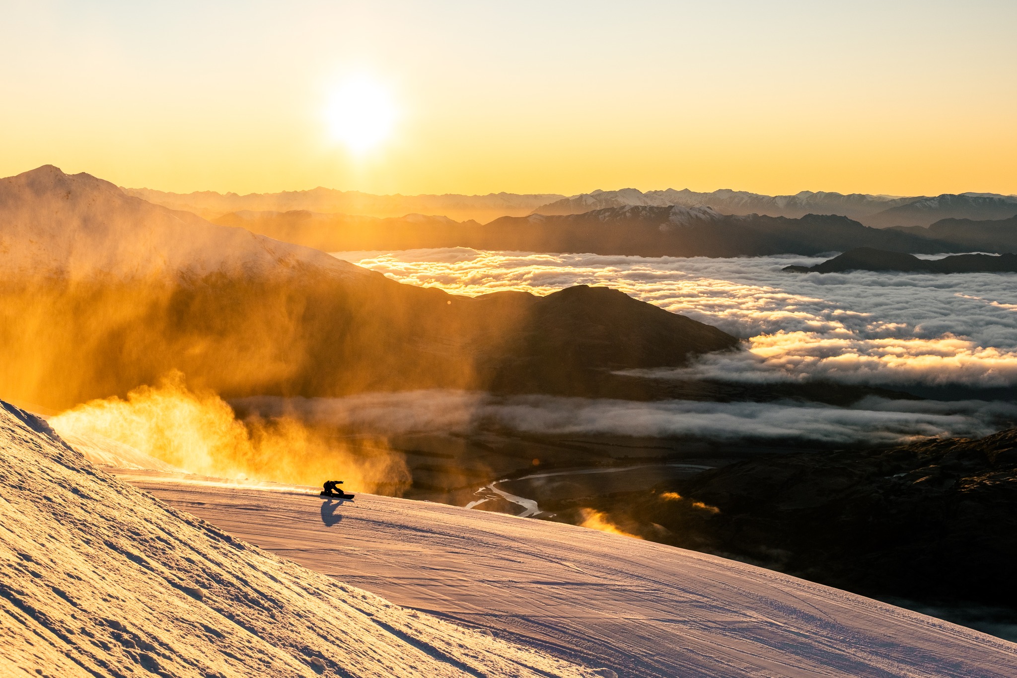
Another month down and we are back to revisit the 2025 season in New Zealand where there is fair coverage across the major resorts at the peak of the season with Mt Hutt faring the best. It has been a mixed bag in New Zealand this season with a few healthy storm cycles but with prolonged periods of warmth and fine conditions. This comes after a slow starts, espcially for North Island resorts with didn’t;t really get going until early August
Right now the bases across the resorts are looking OK after last week’s snow falls which dropped 15-20cm across South island resorts while Turoa received a greatly 50cms. In the short-term high pressure has taken hold across the country until mid-week when with a relatively healthy system could see a major change. As outlined in my forecast yesterday models have an initial system moving through from Tuesday followed by another healthy front into the weekend which could bring a welcome top up to the South Island as we head into spring.
Current Climate Situation
A quick recap of the outlook for this season, with largely neutral drivers and apressure pattern that is not ideal, the forecast was for warm temperatures and average to below average snowfall across alpine areas of the country.
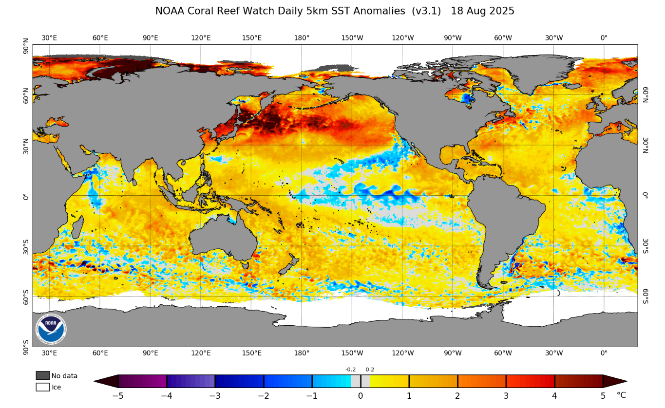
Below we have the global SST anomaly with some cooler waters showing in the central eastern Pacific, but ENSO remains comfortably at neutral right now with the most likely case being this remains the case for the rest of the winter season. There is some variability in the models with some forecasting a dip into La Nina areas in the late spring period but for right now there does not look to be any major Pacific Ocean impact on the remainder of the NZ season.
Over in the Indian Ocean outlooks have become more consistent that a negative IOD event will develop through the rest of the winter. Hoewever, unlike Australia the IOD does not play as large a role in NZ snowfall. But it does introduce more tropical moisture and may help to beef up some activity and promote some increases in precipitation
Another feature which we’ve noted in previous outlooks is the warm waters surrounding NZ are a factor, influencing the outlook for warmer temperatures that we have had for this season.
Highs and Lows
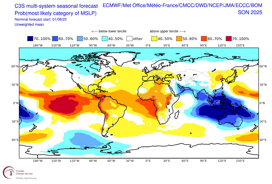
As we discussed in previous updates, the outlook for the winter in terms of MSLP (Mean Sea Level Pressure) promoted an east/northeasterly flow which is typically not ideal for snowfall, compared to south-westerly flow which drives more cold air and fronts from the Southern Ocean.
Below we have a three-monthly MSLP outlook moving through the springtime. As a result of a modelled negative IOD event occurring an increase of activity across much of Australia is why we see a strong lower-than normal pressure anomaly in the below chart. Connected to this we see a strengthened high-pressure anomaly in the Southern Ocean below the South Island. This pattern suggests a strengthened east/northeasterly flow which again is not ideal for heavy snowfall but may suggest more precipitation on the north/eastern side of the country compared to the west.
So where are we?
Without any large revelations we sit in a similar spot to last month with the potential for some increased moisture from the IOD, but warm temperatures remain the most likely outcome.
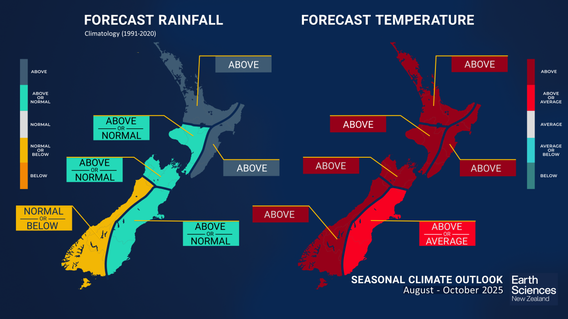
Below is the latest outlook from NIWA for precipitation and temperature and high chances of above average temperatures are no surprise here. Looking at the precipitation outlook we can see increased chances in the north and east possibly thanks to an increase in moisture and that east/northeasterly flow we touched on earlier. For the west of the South Island the outlook remains average to below average. In short there are still some fun days ahead with a system rolling through next week across the south. However, we may be more susceptible to warming with above average temperatures across the board the most likely outcome.
Summing It Up
There is still a long way to go this winter and the snow rolling through for the second half of next week will give a timely boost to the snowpack heading into September. For the rest of the winter warm temperatures in between storm cycles look to be public enemy number one. For now, get out there and enjoy some calm conditions over the next few days!
Hopefully we’ll get a few storms breaking through and you can stay across any incoming snow through my New Zealand forecasts on Monday,. Wednesday and Friday.


