Weekly Japan Forecast, Thursday, January 8th – An Even Deeper Week with Three Storms

Mountainwatch | The Grasshopper
Written Thursday morning, 8th January (Japan Standard Time)
The winter storm regime is well underway here in Japan, and we’ve seen around half to a whole metre of Japow pile up in the last seven days. Geto Kogen in northern Honshu has had close to two metres!
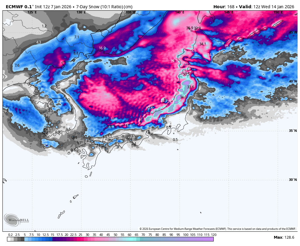
The next seven days will be even deeper, as three more storms are lined up to pound the country. The forecast has been broken up accordingly, and all up, we should be looking at 0.5 to 2m or more added to the rapidly expanding snowpack.
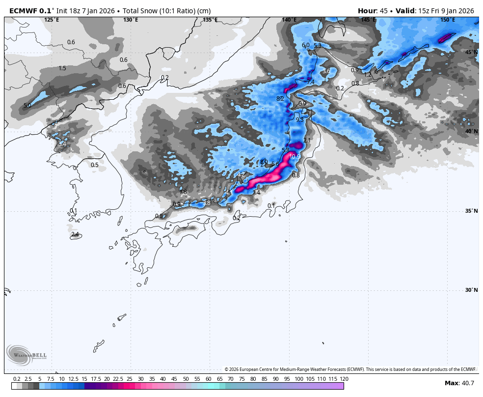
Thursday January 8th & Friday January 9th
The storm that hit Hokkaido late yesterday (Wednesday) has now spread south, reaching central Honshu in the wee hours this Thursday morning. There are some decent blobs on the radar, indicating heavy inbound snowfall for Honshu and moderate falls for Hokkaido.
The storm started mild, but cold air will pile on throughout the day (Thursday) with improving snow quality. The storm reaches its coldest point tonight, and from then on, it’ll start to wind down as high pressure pushes in from the southwest.
Snowfall clears central Honshu by around dawn Friday, then gradually clears northern Honshu throughout the day while light snow persists on Hokkaido. It’ll be one heck of a powder day, with a fresh spread of 25 to 70cm throughout most resorts on Honshu, and 20 to 50cm on Hokkaido.
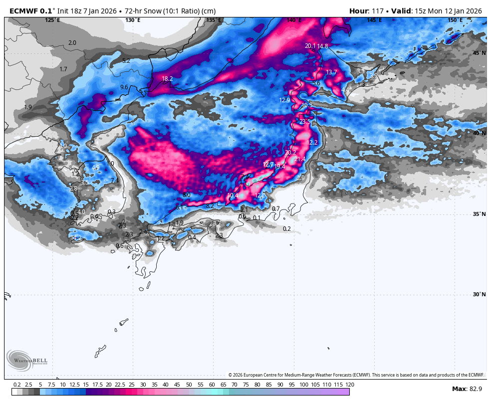
Saturday January 10th to Monday January 12th
Saturday will be mild and sunny for central Honshu as high pressure moves away to the east, allowing a south-to-southwest flow to strengthen over the country. Light snowfall on Hokkaido and the very north of Honshu will build into heavy falls through the latter half of the day as the next storm arrives. However, rain will be mixed in at lower levels, and the winds will blow a gale.
The storm spreads south to Central Honshu Saturday evening, where heavy rain and upper-level snow will also get underway. Colder air will gradually filter in on Sunday as winds turn more westerly, and snowfall will back off into the light-to-moderate category while creeping down to lower levels.
The real cold northwesters won’t hit till Sunday night/overnight, with a period of moderate-to-heavy, high-quality snowfall down to base levels. Snowfall rates gradually ease through Monday, likely clearing central Honshu around midday for an epic powder-filled afternoon. Another massive load of between 30 to 80+cm is expected to fall during this three-day period.
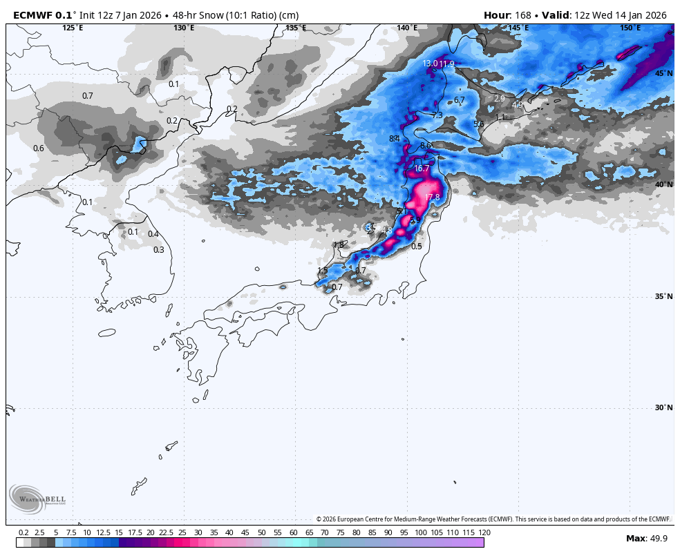
Tuesday January 13th & Wednesday January 14th
The weather cycle repeats itself on Tuesday and Wednesday as a third storm hits the country, with another 20 to 50+cm casually added to the tally. Central Honshu will start dry on Tuesday, while snowfall further north picks up as the storm front arrives, with moderate-to-heavy falls expected.
The storm pushes down into central Honshu around the middle of Tuesday with heavy precipitation ensuing. Initially, it’ll be wet and slushy down low, but will eventually turn light n’ fluffy as cold air off the continent starts arriving from Tuesday night. The storm winds down on Wednesday, with snow clearing over central Honshu while easing further north.
That’s all from me today, folks. Have a great week, and I’ll see you here next Thursday for another weekly rundown of Japan’s highlights and snowlights.
Grasshopper


