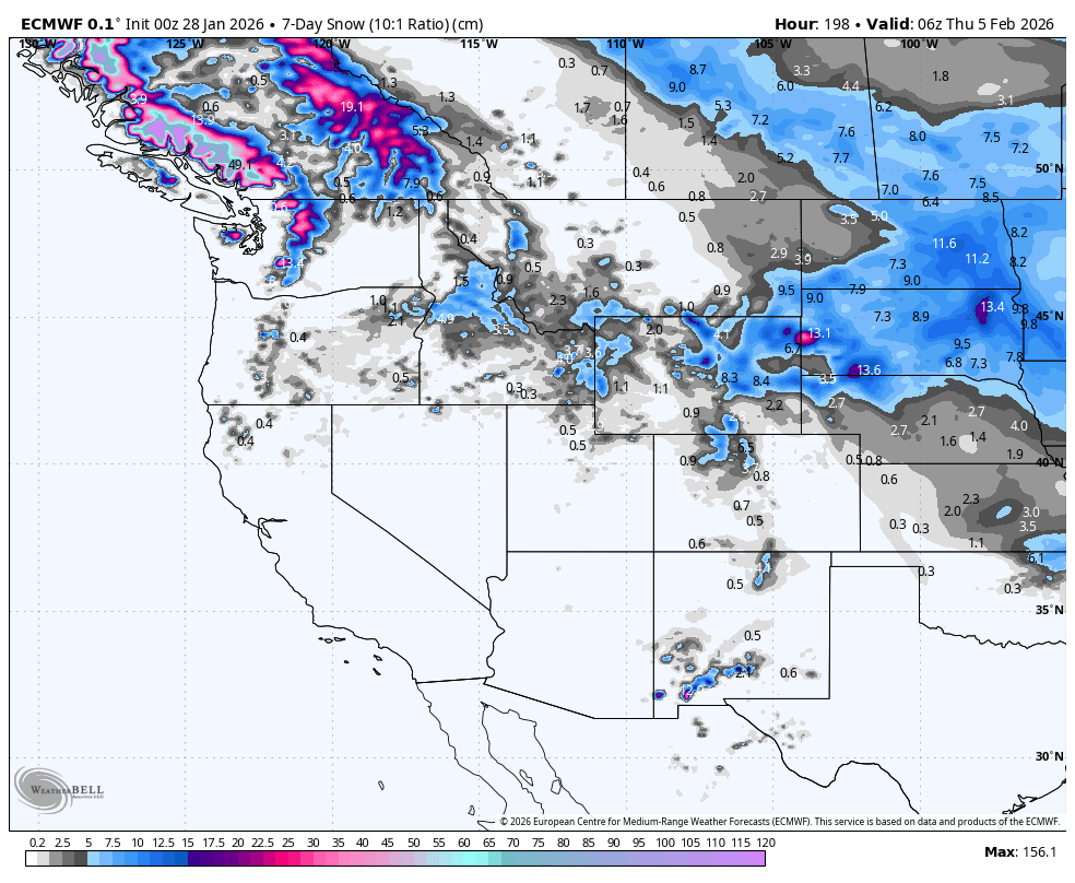
Weekly North America Forecast, Thursday January 29th – Teasing Amounts of Snow in Another Quiet Week
Mountainwatch | The Grasshopper
Written Wednesday, 21st January (Pacific Standard Time)
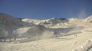
In what was a relatively quiet week in western North America, Colorado, New Mexico and Arizona received a solid top-up from Friday and Saturday’s storm. Most resorts received around 15-30cm, with 50+ cm in the most favoured spots. In what has been a lean winter so far, the new snow was desperately needed. Alberta, Montana and Wyoming also received a high-quality 5-15cm as icy Arctic air plunged southwards.
Quiet conditions will continue for another week as high pressure dominates much of our synoptic charts. Most of the action will be in the north as warm storms landing in the northwest on Wednesday will continue to bring high-level snow to BC and the northern Cascades during Thursday and Friday.
A weak storm will give these same areas another dusting of snow on Sunday. The storm then gains a little momentum as it tracks southeast across the US from Monday through Wednesday, giving much of the Rockies another top-up of powder.
Thursday January 29th & Friday January 30th
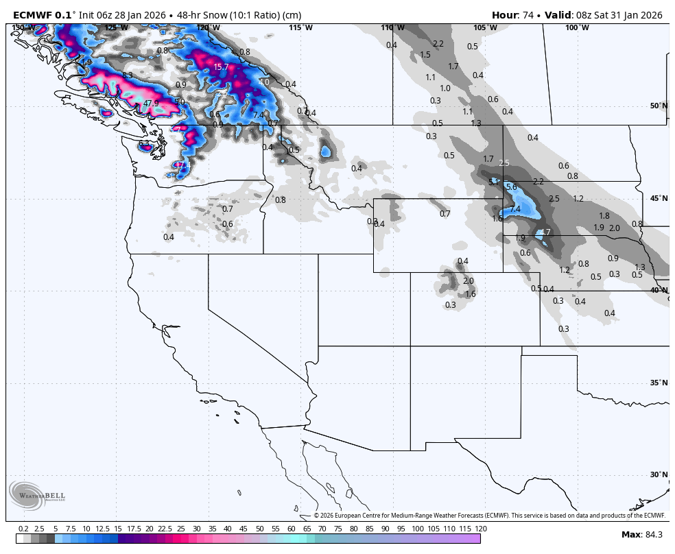
The Canadian Coast Mountains will be in the firing line as a strong, stormy south-to-southwest flow continues in the north. Whistler will be sitting right in the middle of the action and will receive heavy snowfall on its upper slopes, where 20-40cm is likely. However, snow levels will mostly sit around mid-mountain, so rain will be in the mix for the lower slopes.
The northern Cascades will also cop its fair share of precipitation, but as we look further south along the mountain range, precipitation will taper off, and snow levels will sit even higher. Interior BC should receive around 5-15cm, with the heaviest falls coming Friday as snow levels also creep up to near the 1500m mark at most resorts.
Further south, temperatures will also rise as high pressure continues to dominate. Most of the new snow, little as it may be, will fall early Thursday as a weak storm from Wednesday exits to the east. Any additional snowfall will be limited to a light dusting on the northern and eastern edges of the high, centred around southern Idaho and northern Utah.
Saturday January 31st January & Sunday February 1st
High pressure will also spread into the north on Saturday, keeping the entire western North America dry, except for a few showers of rain and high-level snow clipping the southern Coast Mountains as a new storm arrives further north into the Alaska panhandle.
Then on Sunday, a weak front, aligned north to south, will push eastward over the northwest before reaching interior BC Sunday night. Only light showers are on the cards, but the front will bring colder air, dropping snow levels to more reasonable altitudes below 1500m.
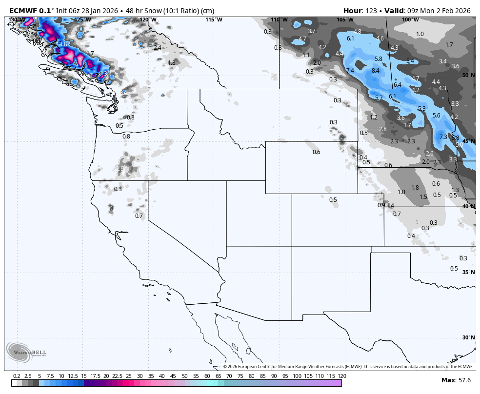
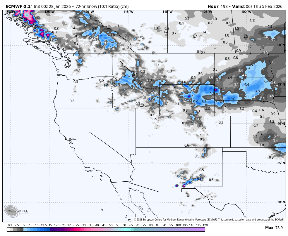
Monday February 2nd to Wednesday February 4th
Sunday’s weak storm will gain some momentum as it tracks southeast across the US from Monday through Wednesday. Models are dicey on the details at this point, but we should be looking at a wee top-up of fresh powder throughout much of the US Rockies in the neighbourhood of 5-25cm.
Barring more storms in the northern Coast Mountains and Alaska panhandle, high pressure moving in behind the weak storm will bring dry conditions and warming temperatures back to western North America.
That’s all from me today, folks. Have a great week, and I’ll see you back here next Thursday for another weekly rundown of North America’s highlights and snowlights.
Grasshopper