All Eyes on the Prize – Japan Snow Wrap
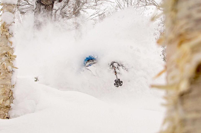
Niseko last week. Deep, epic pow and looking at the forecast there will be a lot more of this over the next seven days. Photo: Niseko Photography.
Mountainwatch | Reggae Elliss
It is that time of year again when Japan become the focus for many Australian skiers and snowboarders and now that school holidays have started a lot of Australian families are heading to there in the hope of enjoying some of that famously reliable snow. It has been a typical December with a few early storms, but now that winter has established itself, hopefully we’ll see a pattern of regular snow-bearing storms.
While Niseko and the other resorts in Hokkaido have turned on some great powder days during the past couple of weeks, milder temps in Hakuba and Myoko have seen the cover deteriorate over the past week. No doubt many people have been nervously watching the forecasts for the Honshu resort, but don’t panic as the next week is looking pretty good.
After some early rain in Hakuba today, a plummeting freezing level should see good snowfalls throughout December 24. That could result in a nice Christmas present of 25-30cms of fresh snow across the Hakuba Valley on Christmas Day.
In Niseko things have been good with consistent December snowfalls setting up a good base, currently 200cms at the top and 100cms at the base at Niseko Village. The forecast is looking really good for the Christmas/ New Year period, Niseko topping the Mountainwatch 7-day forecast with 90cms expected over the next week. Plenty of powder on the way.
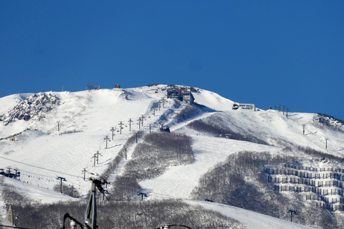
Hakuba Dec 18. The base is looking good on upper terrain in the Hakuba resorts and is about to get a good top up over the next few days. Photo: hakubapowdertours.com
TODAY ON THE HILL
There was around 5cms of snow yesterday before the air warmed up and the snow turned to rain. Unfortunately, it is still warm this morning at 5°C and raining at the base. However, that is due to change later today as moderate cold northerly winds move in and the freezing level drops with strong snowfalls forecast later today. Night skiing and riding is now underway and as our Niseko snow report said today, “the late afternoon and night program could hold some fun, fresh snow turns.”
Steve Lee reported mild and wet conditions in Hakuba this morning but, “the good news is temps are set to drop through the day with good snow in the forecast from today right through the new year period, just in the nick of time for all the Christmas guests crew. It looks like game on.”
There were good snowfalls in Furano and Central Hokkaido mountains yesterday with 30cms of fresh snow reported by Lucy Morrell, our Furano snow reporter. The wind was around 30ks this morning blowing in some nice drifts. Originally the forecast was for milder temps and rain at the start of this storm, but luckily the freezing level dropped quickly and the result is plenty of light and dry fresh snow. After this storm Furano should have all lifts open.
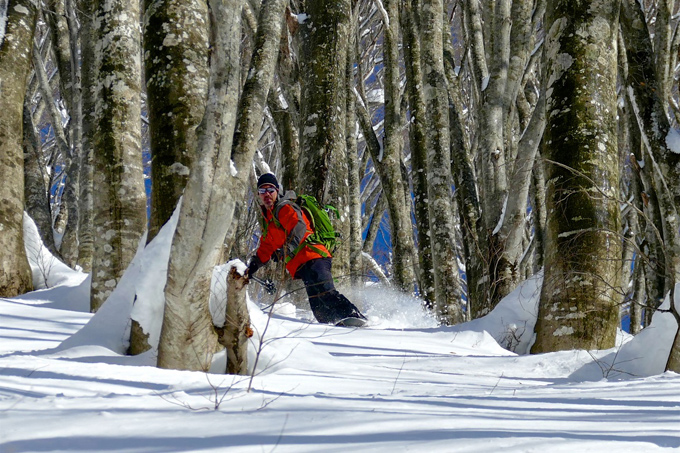
The sun came out in Hakuba last weekend and there were some fun freshies to be had in the trees. There won’t be any sunshine in the next week with snow in the forecast each day. Photo: hakubapowdertours.com
IN THE FORECAST
Consistent snowfalls tonight and tomorrow should result in some powder turns for Christmas with 35-40cms in the forecast. The freezing levels are expected to rise on Monday night which could see some rain at lower elevations in the early hours on Tuesday morning. However, that shouldn’t do much damage as another wave of cold air will move in pretty quickly with 25-30cms expected by Thursday.
The snow is expected to start falling this afternoon with another 45cms in the forecast over the next 36 hours. freezing level is flat-lining at zero metres from Monday which is great news, as another 50cms of cold, dry, smoky powder is due over a four-day period the next 7-days which is great news. Winds look set to be around 30km/h before easing later in the week.
Rain should turn to snow this afternoon with 35-40cms by tomorrow night, so it is shaping up as powder day for Christmas. Freezing levels will climb briefly on Monday afternoon before the next burst of snow moves in next Tuesday. Next week is looking great with cold temps and another 25-30cms due Tuesday to Thursday.
Furano forecasts,
snow reports and
live snow cams.
Hakuba forecasts,
snow reports and
live snow cams.
Niseko forecasts,
snow reports and
live snow cams.


