Australian Forecast, June 6th – Opening Weekend Storm Looking a Little Juicier

Mountainwatch | The Grasshopper
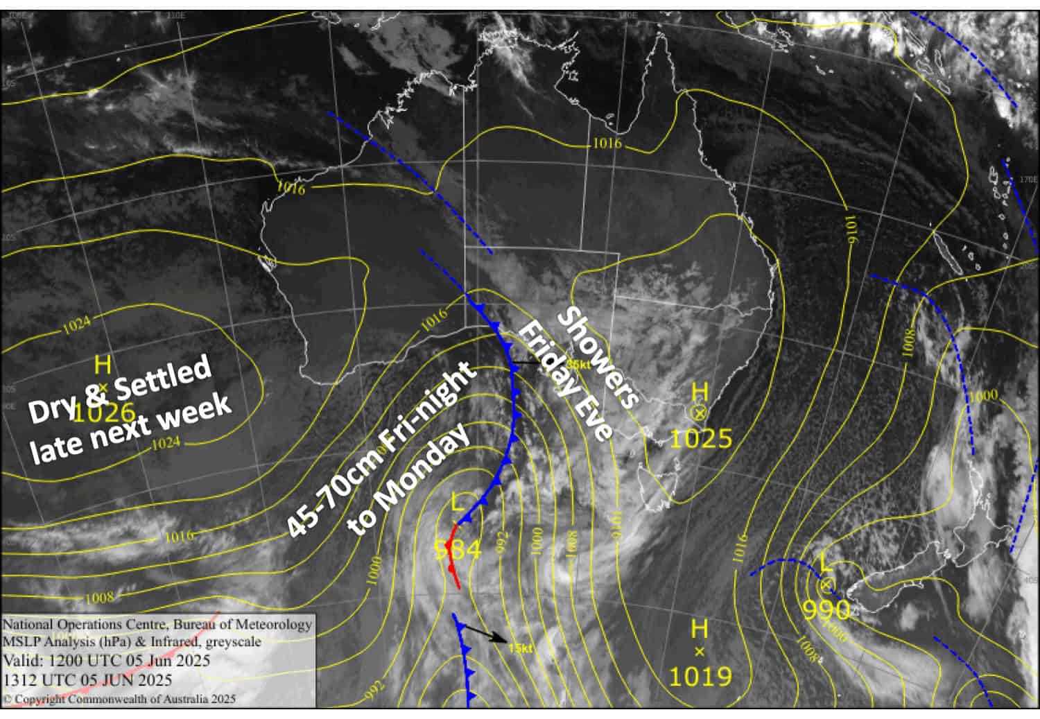
Published early Friday, 6th June 2025
The first proper snowstorm of the Australian season will kick off late Friday, the very evening of Opening Weekend Eve. Talk about timing!
The forecast is looking a little juicier than the last, with a slight increase in snow accumulations from Friday through Monday likely to sit between 45-70cm for the resorts. However, conditions will be challenging, with strong winds and heavy snowfall creating blizzard conditions. The bulk of the snow will fall over the weekend, with decent falls also expected on Monday. Tuesday and Wednesday will bring a little more leftovers as the storm departs.
Friday 6th June
Northwesterly winds strengthen, especially over Victoria, where it’ll blow a gale in exposed areas. Showers also spread over Victoria in the afternoon, becoming heavier and turning to snow above about 1400m late evening before spreading to New South Wales at night.
Saturday 7th June
Blizzard conditions with heavy snowfall and strong northwest winds will continue through the morning, then back off a touch during the afternoon before becoming heavy/strong again after dark. A lot of extra snow will also blow in from the windward side, filling in the gaps up high. Snow levels are tricky, but should at least get down to around 1300-1400m.
Sunday 8th June
Heavy snowfall, strong northwest winds and blizzard conditions are likely to ease over Victoria during the morning and then New South Wales much later. However, there is considerable uncertainty regarding these timings, so they could easily change. Snow levels will continue to creep down, approaching the 1000m mark by the end of the day.
Monday 9th June
The snowstorm continues, with heavy falls possible as southwest winds bend around to the south. Snow levels may lift above base levels late in the day, but by then the bulk of snow should have fallen.
Extended Forecast
Tuesday and Wednesday will bring leftover showers as the storm departs for New Zealand. Snow levels may sit above base levels for much of Tuesday, but they should lower again for Wednesday.
The back half of next week should stay mostly dry as high pressure gradually builds for a fine, settled weekend.
That’s all from me today, folks. The next forecast is on Monday. Have a great couple of days and see you back here then.
Grasshopper


