Australian Forecast Monday July 5 – Clear and Cold, A Change Late in The Week
Mountainwatch | The Grasshopper
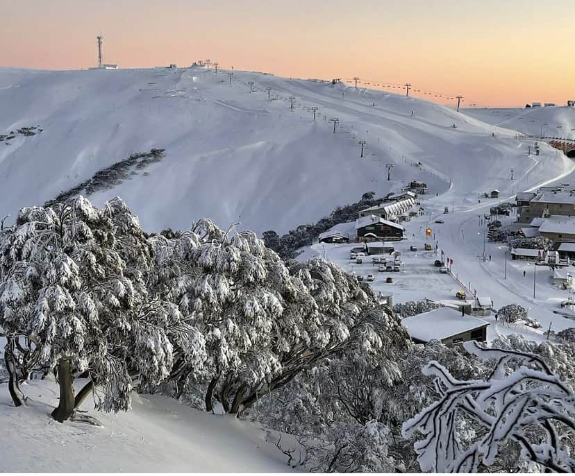
Cold temperatures were the theme of last weekend, a welcome break from the marginal temps that have been plaguing Australian resorts this winter. Resorts did well on Saturday with 10-15cm and over 20cm from the entire weekend.
The cold temps are not yet finished and while there won’t be more snow until around the weekend, the silver lining is that the resorts will be able to have the snowguns pumping, targeting new and almost-ready terrain.
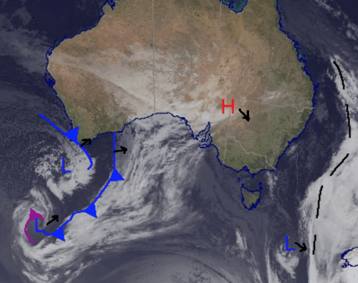
The weather from the weekend has all but passed with some isolated cloud hanging around today and tomorrow but ultimately a high-pressure system currently over the South with take control of the Alps.
Monday July 5
Cold temps with a partly cloudy day all over. There is a little chance for flurries all over the Alps bringing a dusting above 1000 metres, but they won’t leave anything significant. Northwesterly winds in Victoria and Westerlies in NSW becoming southwesterly and easing later on.
Tuesday July 6
Frost in the morning and possibly foggy early. Partly cloudy day with light winds mild temperatures.
Wednesday July 7
Repeat of Tuesday with morning frost and light winds throughout a partly cloudy day.
Extended Outlook
Nice and cold today, so get out and enjoy some of the fresh stuff that the weekend delivered. Snowguns should be firing and helping us to get some new terrain open soon. More of the same is expected for this week partly cloudy with nothing really to show for it until Friday. We may see some snow over the weekend, but it is looking like modest snowfalls. Also, I am back to filing the forecasts every day, so check in tomorrow for the latest update.


