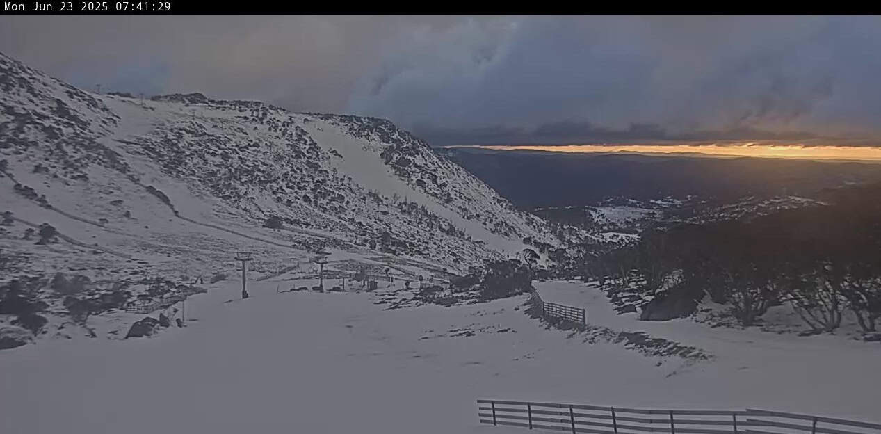
Australian Forecast, Monday June 23rd – Rain turns to Snow Tuesday as Punchy Storm Delivers the Goods
Mountainwatch | The Grasshopper
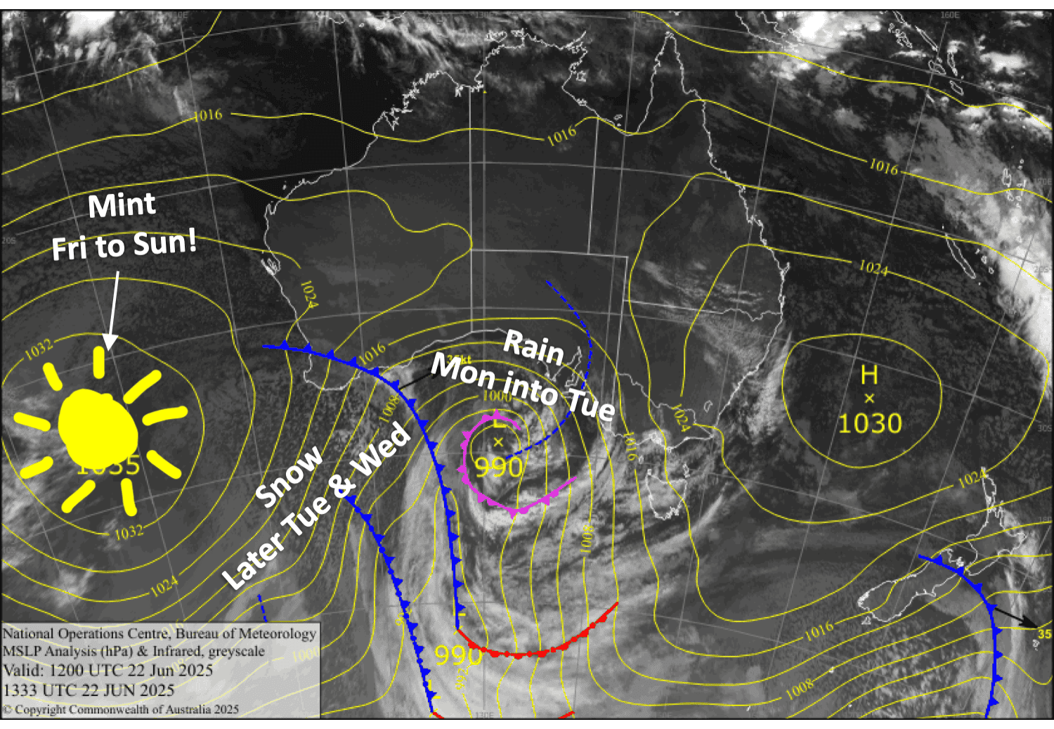
Well, the long run of mint weather has come to an end. A punchy storm from the west leads in with horrendously strong, warm and wet northwest winds today (Monday) and Tuesday, giving our lovely early snow cover a thorough drenching of rain. Fortunately, cold air will arrive during the latter half of Tuesday, bringing heavy snowfall and blizzard conditions through Wednesday.
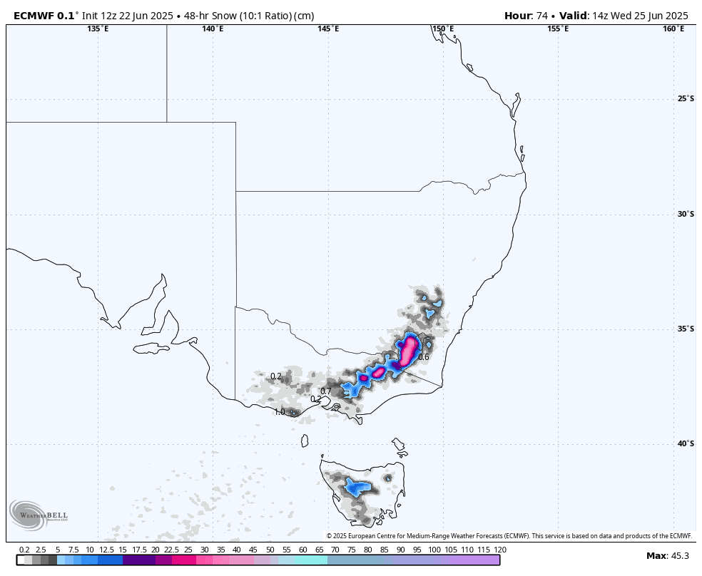
By Thursday morning, we should be looking at totals of 25 to 40 cm throughout the resorts, with 50+ cm possible in the more exposed terrain, although Mt Baw Baw is expected to get about 15 to 25 cm. Not only that, the weather on Friday and the weekend is looking mint again, so clear your schedule.
Monday 23rd June
Light rain or drizzle develops in the morning, then builds a little during the day, before heavy rain buckets down at night. Strong northwest winds will blow a gale in exposed areas, possibly affecting lift operations.
Tuesday 24th June
Heavy rain backs off during the morning, before turning to snow in Victoria in the afternoon and in New South Wales in the evening, then heavier snowfall at night. Northwest winds will go gangbusters, likely limiting lift operations.
Wednesday 25th June
Heavy snowfall will gradually pin back to snow showers during the day, then clear in the evening, as gale-force northwest winds turn west then southwest. Snow will reach low levels, and blizzard conditions will likely limit lift operations again.
Thursday 26th June
A mostly cloudy day, especially for Mt Baw Baw, where there’ll be some leftover snow flurries in the morning. Brisk, cold southerly winds gradually ease.
Extended Forecast
Friday and the weekend will be the days to hit it, as high pressure will bring calm, sunny skies on top of all that fresh snow. The slopes will be humming, and there should be a lot of terrain to shred. It’ll be one of the best June weekends in years, I reckon.
At this stage, high pressure looks to contain any incoming weather systems for much of next week too. It’s still early days, mind you, so wait till closer to the time before making any big calls.
That’s all from me today, folks. I’m sending out these forecasts every Monday, Wednesday and Friday throughout the season. Have a great couple of days, and I’ll see you back here on Wednesday.
Grasshopper