Australian Forecast Wednesday June 16 – Cold Front Arrives Today
Mountainwatch | The Grasshopper
Valid Wednesday June 16 – Friday June 18
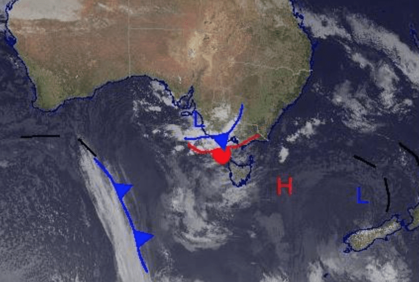
Welcome back, we are still on track for snow throughout the rest of the week until Sunday as a warm front clear and a cold front takes its place over the alps late today/early tomorrow. This will bring colder weather and a possible 5-15cm of snow before another decaying front hits, which should see more snow Friday/Saturday (another 3-10cm). So, overall it should be a pretty productive week; not much sunshine but a little bit of the good stuff.
Wednesday June 16
Very high chance of snow above 1200m in Victoria and high chance above 1300m in NSW. Gusty northerly winds picking up later in Victoria with the chance of a thunderstorm later on for both Vic and NSW. Totals in the order of 5-15cm.
Thursday June 17
Snow above 1200m for Victoria and very high chance of snow above 1100m for NSW. Around 2-5cm expected. Moderate northwesterly winds in NSW.
Friday June 18
More snow possible above 1500m for Victoria and 1400m for NSW with 3-10cm expected to fall. Winds increasing from westerly and swinging southerly later on.
Extended Outlook
There is a bit left in this system on Saturday before a high-pressure system approaches and settles things down on Sunday. We should have a mainly sunny start to next week and temperatures look cold enough for snowmaking. At this stage there looks to be some snow coming later next week and I’ll keep you updated on Friday how that system is tracking.


