Australian Weekend Forecast, Friday August 22nd – Skies clear this Weekend Before the Next Storm Approaches

Mountainwatch | The Grasshopper
After a top-up of fresh powder, and then a run of stunning, clear, calm and cold days to start the week, winds from the northeast quarter arrived on Wednesday and Thursday, bringing warmer temps and some cloud and light showers to the Aussie Alps, especially in New South Wales, creating more spring-like snow conditions.
It’ll be a similar story for today, Friday, as the weakest of fronts brushes past, followed by slightly cooler temps on Saturday, which should allow the snow guns to fire up the following couple of nights as high pressure clears out the muck for clear skies on Sunday and Monday. Northwesterlies then strengthen on Tuesday ahead of the next big storm cycle, which is picked to be a doozy – all the deets on that are in the extended forecast.
Friday 22nd August
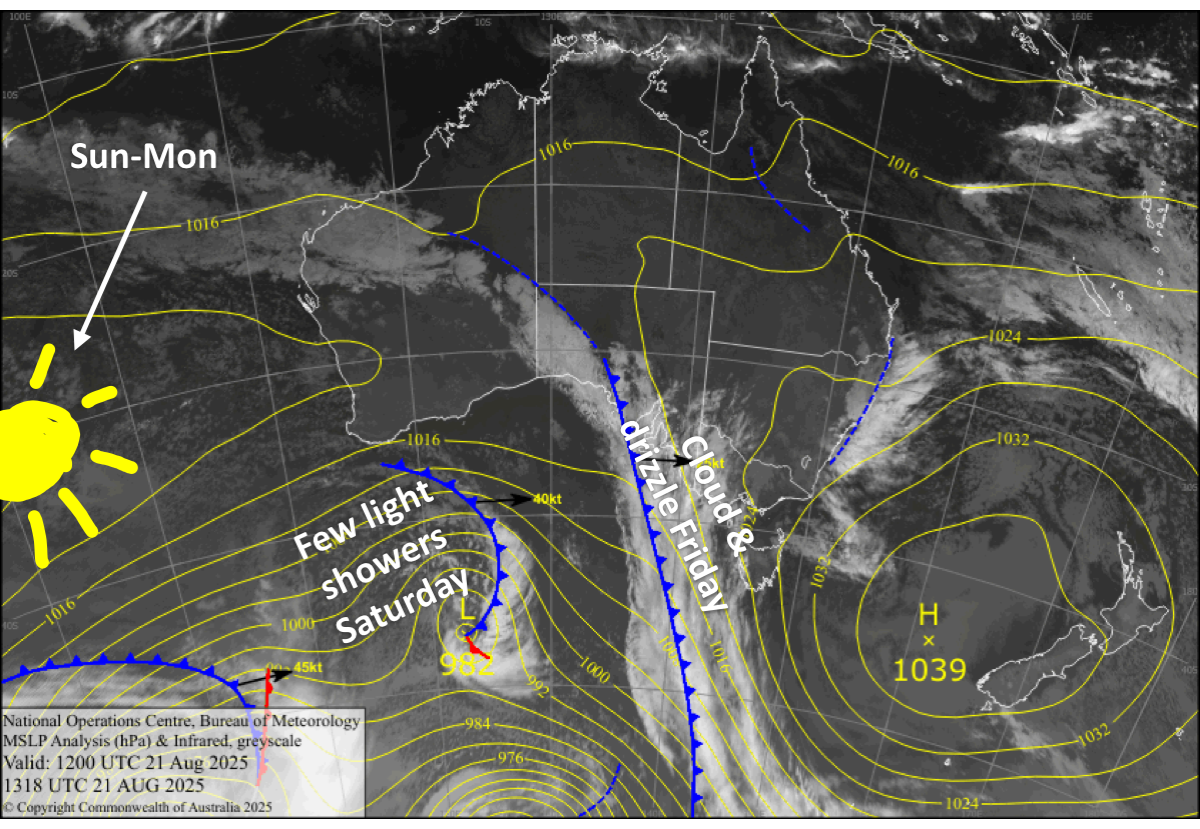
A mostly cloudy day in Victoria and a fine start in NSW, with patchy light drizzle developing and northerly winds.
Saturday 23rd August
Mt Baw Baw will see some rain showers, but elsewhere it’ll be a partly sunny, partly cloudy day, with only a light shower or two possible. Southwest winds ease.
Sunday 24th August
Any cloud about the resorts clears early for a mint, sunny day, while southerly breezes die out.
Monday 25th August
Nice and sunny again, with a light northwest breeze developing.
Tuesday 26th August
Clouds build over the Aussie Alps as northwest winds strengthen, reaching gale force in exposed areas. Rain spreads east over western Victoria from late afternoon, then elsewhere after dark.
Extended Forecast
Stormy conditions are expected to persist for the remainder of next week into early the following week, as a series of low-pressure systems passing by in the Southern Ocean extend up into the Aussie Alps.
Models are fairly well aligned, and expect rain will gradually turn to snow during Wednesday and Thursday, the 27th and 28th of August, as a few cold fronts hit, with snowfall continuing until around Monday the 1st, or Tuesday the 2nd of September. It’s still early days, but if the current forecast holds, we’ll enter spring with a nice thick layer of fresh powder.
That’s all from me today, folks. I’m sending out these forecasts every Monday, Wednesday and Friday throughout the season. Have a great weekend, and I’ll see you back here on Monday.
Grasshopper


