Australian Weekend Forecast, Friday June 13th – A Quiet Spell, Then a Wee Top-Up Early Next Week

Mountainwatch | The Grasshopper
Published early Friday, 13th June 2025
Snow accumulations from the Opening Weekend Storm saw Aussie resorts score a healthy load of snow, ranging from 35cm at Mt Buller to around 70m at Hotham and Perisher, with the other resorts sitting somewhere in between. It was a timely dump that has allowed us to kick off the season with a good amount of terrain open, with even more opening up this weekend.
A ridge of high pressure will keep skies clear Friday and Saturday, before northwest winds and some light showers kick up on Sunday ahead of a front early next week. The front will bring a nice wee top-up of snow Monday and Tuesday, although temperatures are looking marginal at first.
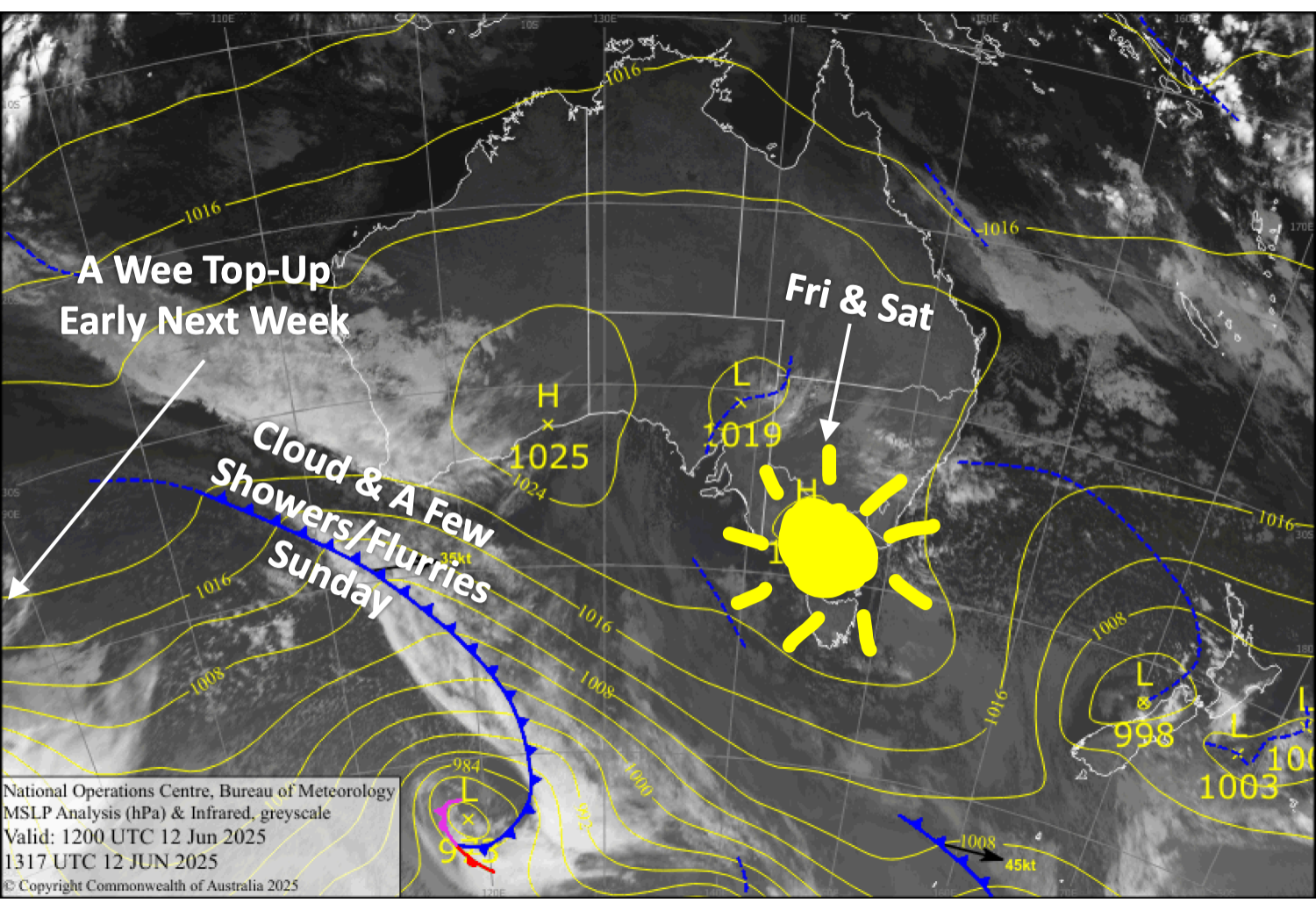
Friday 13th June
Any cloud cover clears first thing to a fine, sunny day, with light southeasterly breezes.
Saturday 14th June
Another fine day, with increasing northerly winds.
Sunday 15th June
Partially cloudy, with a few snow showers or flurries likely, and north-to-northwest winds.
Monday 16th June
Patchy drizzle or snow flurries throughout the day, turning to heavier snowfall after dark. Strong, gusty north-to-northwest winds.
Extended Forecast
Snow showers will likely continue through Tuesday, the 17th, adding to what should be a nice wee top-up, with some light leftovers possible on Wednesday, the 18th of June.
High pressure will then keep things dry and settled until next weekend, when on Sunday, the 22nd June, a fast-moving front passes over, possibly bringing a mix of rain and snow.
That’s all from me today, folks. I’m sending out these forecasts every Monday, Wednesday and Friday throughout the season. Have a great weekend, and I’ll see you back here on Monday.
Grasshopper


