COUNTDOWN TO WINTER – 5 Days and Counting
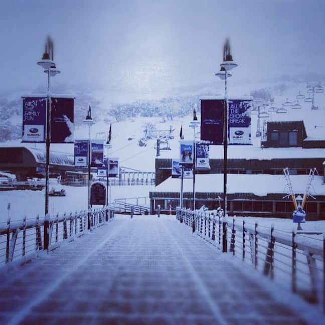
Perisher, early Sunday morning image::Courtesy of Rip Curl Thredbo
Countdown to Winter | Alex Horvath
It is now only 5 days until opening and the Aussie resorts are primed, ready for those lifts to start spinning this Saturday. With the models showing more snowfall over the next few days the weather gods really are smiling and delivering perfect conditions to usher in 2012.
Conditions on the Weekend
Anyone lucky enough to be in Perisher at the weekend celebrated the late-may snowfall in style with Saturday morning marking the first chairlifts of the season. Resort management has decided that conditions are so good that they will remain open making them the first resort to get things started for the season.
Saturday saw mostly cloudy conditions with a nice firm cover topped up by the snowmakers providing groomed perfection for those out there getting the legs back. The weather really turned it on early Sunday morning with 15 cm of natural snow falling right down to the National Park entry gates. Unfortunately the Victorian resorts didn’t manage to receive quite as much as their northern counterparts. Slightly warmer temperatures throughout the day meant that conditions became soft and heavy through the afternoon.
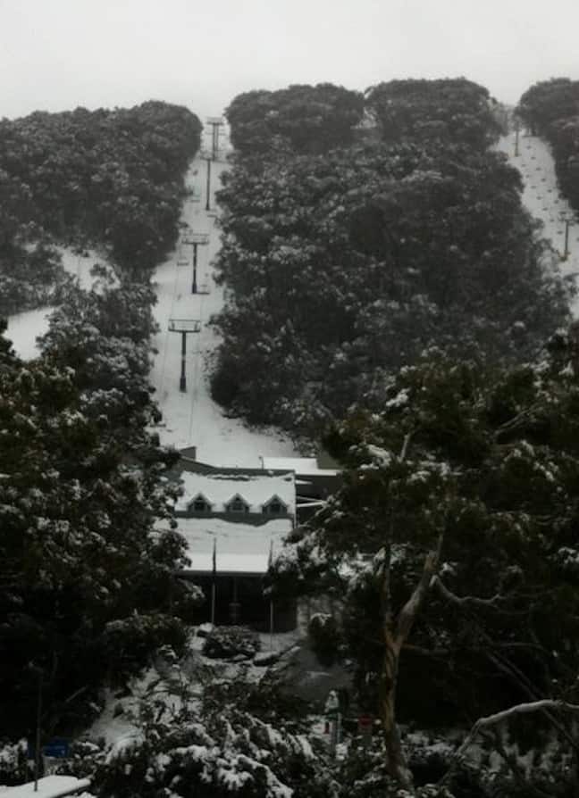
Thredbo village awoke to a snow day on Sunday Image::Courtesy of Rip Curl Thredbo
What to expect this week
Right now all eyes are on the weather system sitting off the south coast of NSW that is currently en route to the alps. Now, this system is likely to be a bit of a mixed bag consisting of some damaging winds, significant snowfalls as well as the possibility of some rain. In his latest forecast The Grasshopper says, “Of course with the winds comes the rain and snow, and the precipitation is going to start this evening and continue through till Tuesday lunchtime. Totals are looking like 80 mm/cm for NSW resort and about 45 mm/cm for Falls/Hotham/Baw Baw (with Buller less still because it is furthest from the low).”
The determining factor for exactly how our net balance (Snow – Rain) finishes after this system passes is going to be the freezing levels, “Freezing level is still the critical factor in all of this. It is tantalisingly sitting on a knife edge. Our model is holding it above 2000m across the Alps until midnight. Other models are just a little lower, around 1900m. Then it very gradually falls to about 1600m by Tuesday lunchtime” said The Grasshopper.
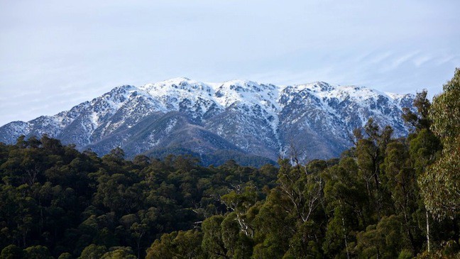
The ranges of Falls Creek starting to look alot whiter Image::Courtesy of Falls Creek
The best news for opening weekend is that once the cold air moves in, it is going to hang around. Resorts will be able to make significant amounts of snow adding to the pre-season base. Conditions on the weekend look like a mixture of sun and cloud, mild temperatures during the day with cool nights.
Lift Status for Long Weekend:
Perisher – OPEN
Thredbo – Scheduled to open Saturday 9 June
Charlotte Pass – Scheduled to open Friday 22 June
Mt Buller – Scheduled to open Saturday 9 June
Falls Creek – Scheduled to open Saturday 9 June
Mt Hotham – Scheduled to open Saturday 9 June
Mt Baw Baw – DECISION PENDING
For more updates stay tuned to The Grasshopper’s detailed daily forecasts, in the meantime the countdown is on!
Perisher forecasts,
snow reports and
live snow cams.
Falls Creek forecasts,
snow reports and
live snow cams.
Mount Buller forecasts,
snow reports and
live snow cams.
Charlotte Pass forecasts,
snow reports and
live snow cams.
Hotham forecasts,
snow reports and
live snow cams.
Thredbo forecasts,
snow reports and
live snow cams.


