Grasshopper’s Japan 2025-2026 Snow Season Outlook – December Update
Mountainwatch | The Grasshopper
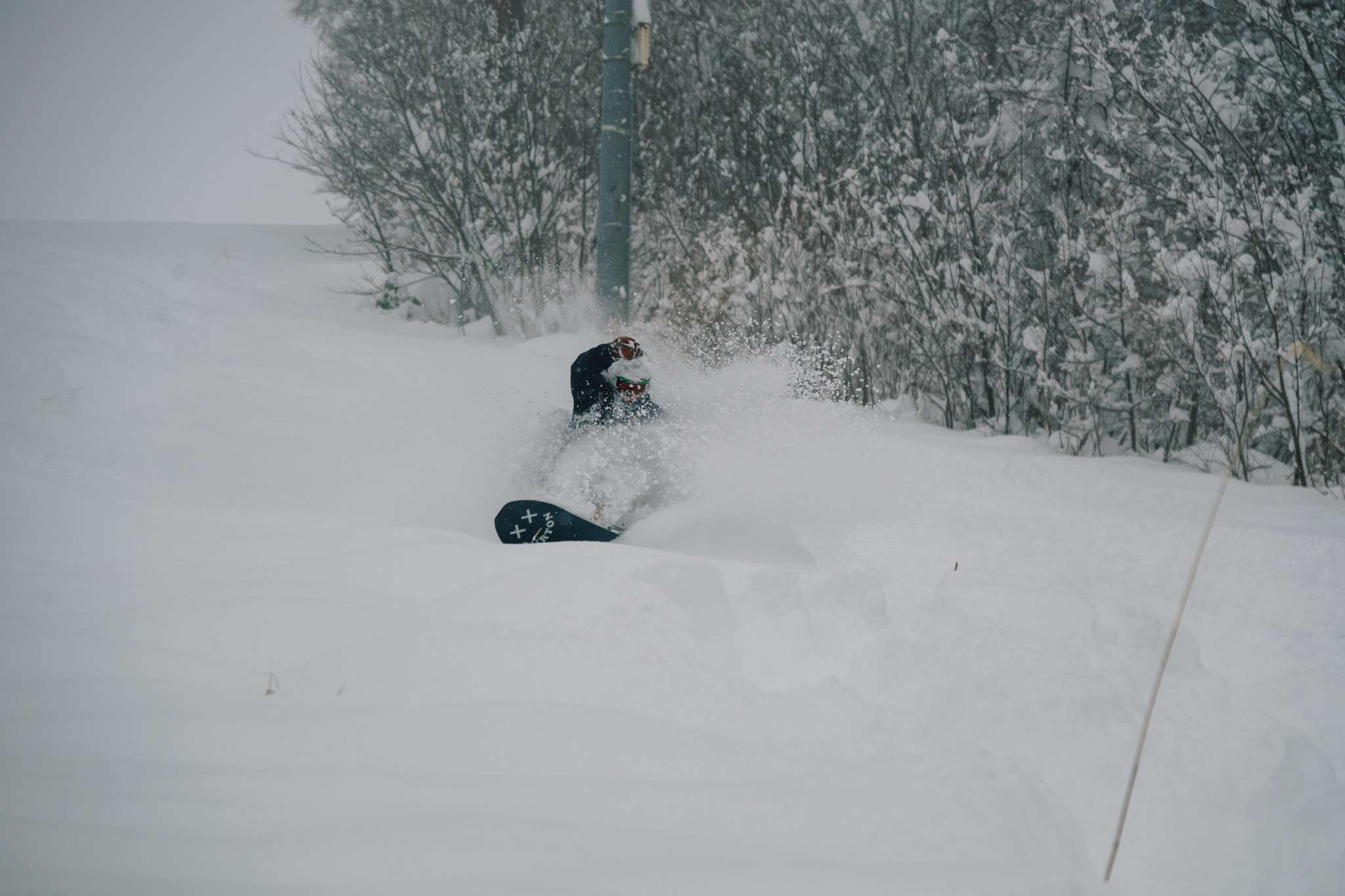
It’s time for the third instalment of our Japan Seasonal outlook series for the 25-26 season and over the past two weeks we have had some recent welcome snowfall kickstarting the early season. Let’s unpack what is to come with a review on the most likely outcome for the rest of the year and beyond.
Short Term Check in
A quick look at the short term and there is some consistent snow expected across both Hokkaido and Honshu across the weekend and into next week, the heaviest falls will be favouring Central Honshu. A low-pressure system is sitting off to the northeast driving strong northwesterlies across the country for the early weekend then another low will form off the east coast of South Korea overnight Saturday will move northeasterly and deepen as it crosses Japan.
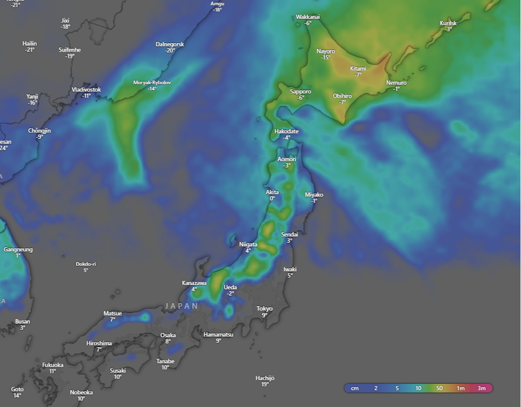
What does this mean in terms of numbers and areas? Below are the five-day forecasted snow accumulations from the ECMWF model showing decent falls across many areas. We should note with this map is that the model can underestimate heavy snowfalls in Japan specifically due to the dry, low moisture content snow that Japan is famous for. A slight cause for concern in some of the southern areas like Nagano/Niigata etc. is that as this low crosses the3 country on Sunday/Monday the temperatures are forecasted to be relatively warm, which may hinder getting all of mother nature’s best and wetter conditions at lower elevations.
Long Term
Okay now let’s look into the crystal ball past the next week. From our past updates the most likely scenario has been neutral-to-above average snowfalls due to a weak La Niña, which is most likely going to peak in the first half of winter then return to neutral conditions by winter’s end. Let’s see if anything has changed.
ENSO Update
Right now, conditions are indicative of a La Niña event with cool eastern equatorial Pacific sea surface temperatures (SST) and stronger trade winds. But the consensus from the major agencies is for these conditions to weaken considerably into neutral during the second half of winter. Below we can see the developed La Niña signature in the daily SST anomaly map.
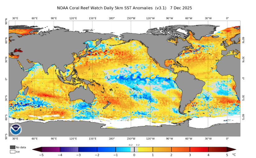
Daily global SST anomaly for 7 December showing that cooler eastern equatorial Pacific and the warmer western Pacific. Source: NOAA
Bouncing Back
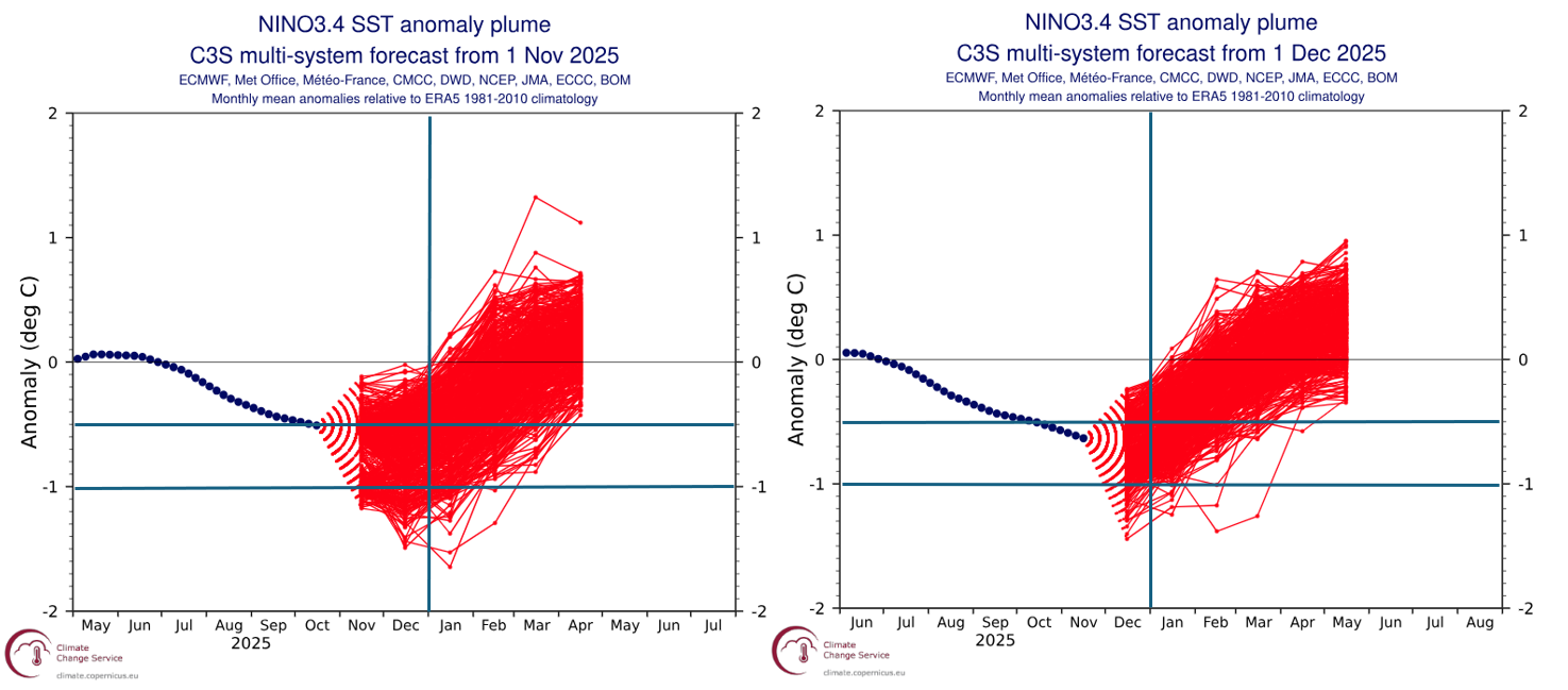
Looking at the projected evolution of the current La Niña conditions I’ve made a comparison between last month’s forecasted evolution of the SST in the central equatorial Pacific and this month’s forecast in the Nino3.4 region (from the region used for ENSO thresholds). Using my own creative license I have added a couple lines for ease of reading; the vertical lines are both at the beginning of January and the horizontal lines are at -0.5°C and -1.0°C.
From the comparison we see that the spread of the ensemble members is less, indicating more confidence in the forecast (expected as we are a month closer) and slightly less ensemble members below the -0.5°C threshold after January into the second half of winter in the December update than November. In a nutshell, more confidence in a quick return to neutral values, most likely transiting well into the neutral range through the spring.
JMA Update
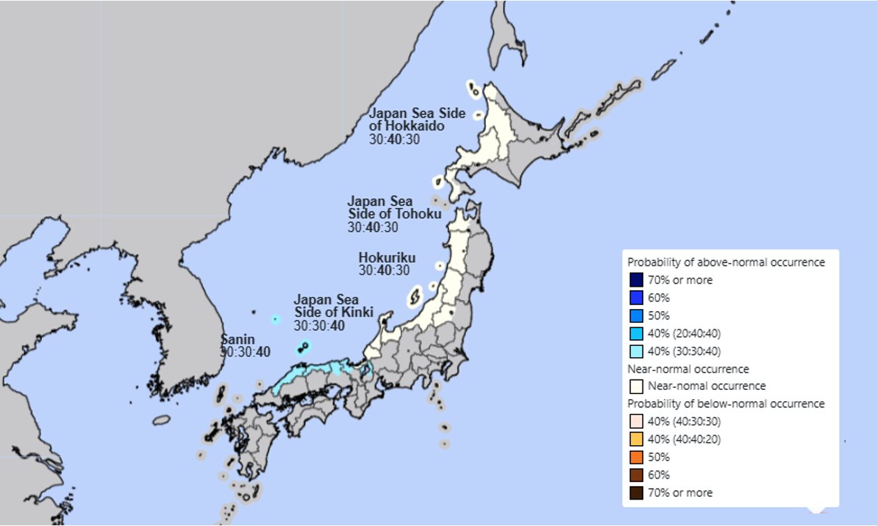
The Japan Meteorological Agency has released its updated seasonal snowfall outlook for winter, and it is a slight downgrade from the JMA’s initial outlook. The updated outlook below shows most likely neutral snowfall for the central and northern regions and above average for the further southern regions. The chance of neutral conditions is now more likely than it was in the initial outlook which was slightly skewed to above average conditions for those regions. Although it pushes the outlook for these areas from blue to white it is a subtle change. With our outlook already being neutral-to-above average this not a huge surprise. The most likely outcome is a quick return to neutral ENSO conditions in the second half of the season driving normal conditions rather than being amplified by a persistent strong La Niña.
Wrap Up
In the short term there is some welcome snow in the forecast this week with consistent falls heading into next week. Be wary of some milder temperatures through Sunday/Monday but overall, there should be some solid days to be had.
In the long term the story remains relatively like the previous outlook. From last month’s update the potential for a weaker polar vortex in the first half of the winter remains, potentially acting to “spruce up” some storms and lead to heavier snowfalls over the next couple of months. However, an increased consensus on a quick weakening of La Niña conditions in the second half of winter may lead to a slight reduction in the confidence in higher-than-average snowfalls. Overall, the season still looks in shape for neutral to average snowfalls with things just getting going now in the first half of December – we will keep our eyes peeled for what mother nature has in store for 2025-26.
I’ll have another update on the season outlook next month, but you won’t have to wait that long for short term forecasts with my weekly Japan and North America forecasts forecast starting this coming Thursday. See you then.


