Grasshopper’s Japan 2025-2026 Snow Season Outlook – February Update.
Mountainwatch | The Grasshopper
We are halfway through February, the Winter Olympics are in full swing, and it has been a big month across Japan for snowfall. While the past couple of weeks have been up and down, with milder periods between storms there have been some all-time conditions across many areas of Honshu and Hokkaido thanks to a few unusually large storm systems that moved through in January. With healthy bases across many resorts its time again to dive into the longer-term forecast. What is expected to round out the season?
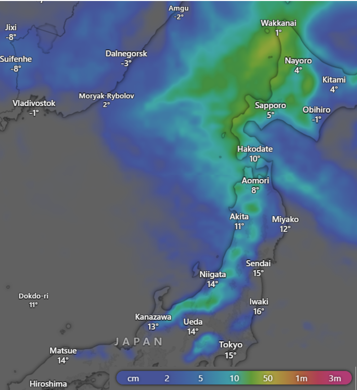
In the near future there is a little bit of snow in the forecast for the next seven days, but no major storm systems expected until the week after with some possible decent accumulations on the way. But for now, that’s a little bit too far away to put any numbers on. Below shows the 7-day accumulations from the European model, some fresh stuff across many areas, but after what we have seen this season nothing to blow us away.
Current Conditions
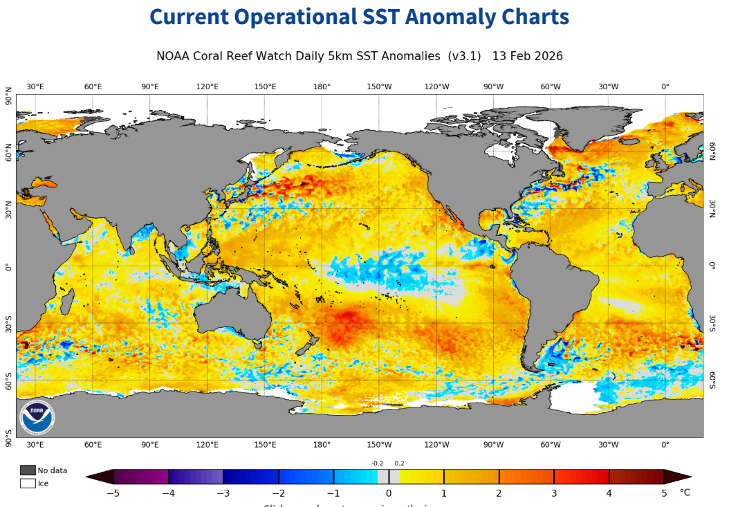
Now to analyse where we are at, let’s start with the oceans. The below graphic of the global SST anomaly shows a cooler anomaly in the central-eastern equatorial Pacific that is slightly more subdued than what we have seen earlier this season. If we cast our minds back to previous updates this was part of the plan, with a weakening La Nina over the February-March window the most likely scenario.
ENSO Recap
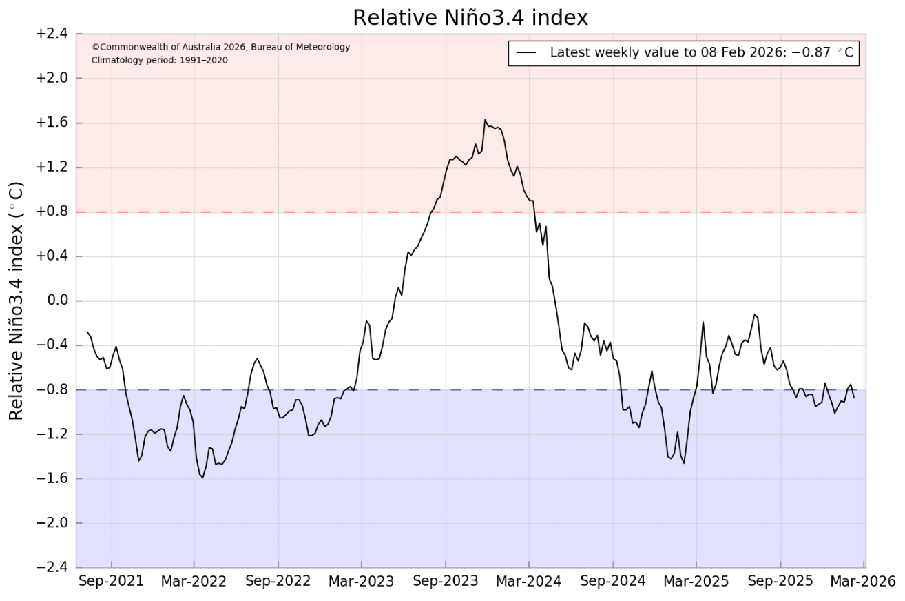
So, it looks like the La Nina event is weakening, but let’s have a better look. Below is a graph of the Nino3.4 index which shows its evolution over the past few years. Focusing on this year. the La Nina event this winter looks to be peaking or have just peaked at its most negative and returning towards neutral values.
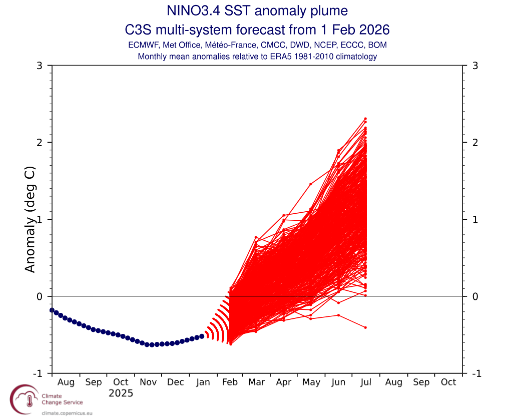
Supporting our idea of ENSO returning to neutral values we can look at the most recent forecast. Below is a product featured in past updates showing an ensemble spread of possible future paths of ENSO over the coming months based on model data from many of the leading met agencies worldwide. From February we can see the models are only really going in one direction, back to neutral and the potential for a strong swing into El Nino territory at the end of the year (which is not uncommon after a La Nina event). The focus here is on the next few months heading into spring with looking any further into the crystal ball on the other side of spring known to be particularly difficult to predict.
End of season three-monthly products
So, we’re on a pretty similar path to what was expected from the last update, what does that mean exactly? The most likely outcome through the remainder of the winter is for a quick return to neutral conditions, this is usually accompanied by less active periods of the EAWM compared to what we have had in the past month especially. Plus heading into the end of the season warming will become a factor with conditions in between storm cycles becoming warmer naturally as we head into spring.
Below is the JMA snowfall forecast for February through April. Important to note the JMA does not do this product for all areas only the two shaded in the image. We can see they’re prediction for slightly below average snowfall for the remainder of the season, but only slightly with average to below average a better description.
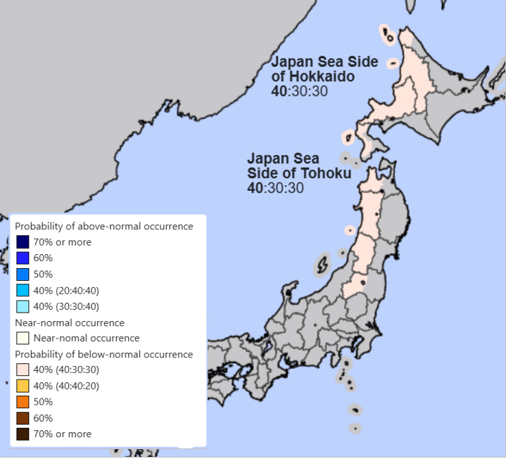
The three-monthly snowfall outlook for February through April from JMA showing a slight leaning towards below average snowfalls across the Sea of Japan side of Tohoku and Hokkaido. Source: JMA.
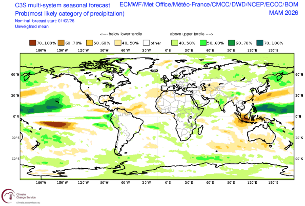
Investigating this signal further, below is the latest three-monthly product showing precipitation. Important to note the three-month period of this chart begins at the start of March so they cover March through May. Also, another note is these plots take into consideration models from numerous different agencies so they should a middle ground which can be very helpful. We can see Japan as a whole sits in a neutral zone, bordered by some above average precipitation areas to the north and conversely below average to the south.
Wrap it Up
So overall our plan for the back end of the winter looks to be playing out with a weakening ENSO event possibly becoming quickly neutral and in the absence of a real large mode of variability forcing mother nature’s hand things look to remain neutral. As we are nearing the back end of the season things begin to heat up in between storm cycles.
In the short term there is some light top ups over the next week and possibly something bigger brewing for the week after to keep an eye on. I’ll have a clearer idea on that in my Japan weekly forecast this Thursday