Grasshopper’s Weekly Japan Forecast, Thursday Jan 25th – A Deep Week Ahead as Conditions go from Snow Storm to Sunny
Mountainwatch | The Grasshopper
Written Thursday morning 25th January (Japan Standard Time)
This week’s forecast is a fairly straight forward one that will neatly take us from one end of the weather spectrum to the other. First, today, we start with an all-out snowstorm, featuring freezing temps, strong winds, and heavy snowfall of the higher Japanese quality. This will slowly wind down over the next several days before culminating in mild temperatures, light winds and sunshine by Wednesday next week.
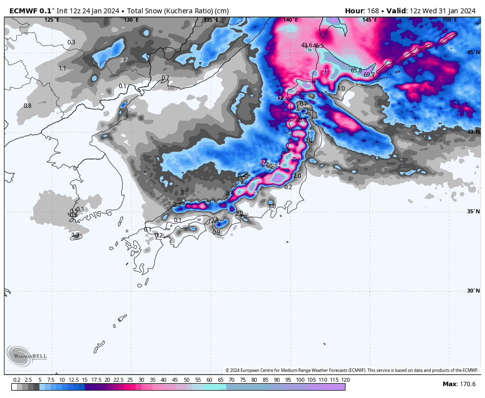
Overall, it’s going to be a deep week with 7-day totals up and over the metre mark in many areas. And if you don’t like the look of conditions on one day, just wait till the next, as they should have slightly improved.
Thursday Jan 25th & Friday Jan 26th
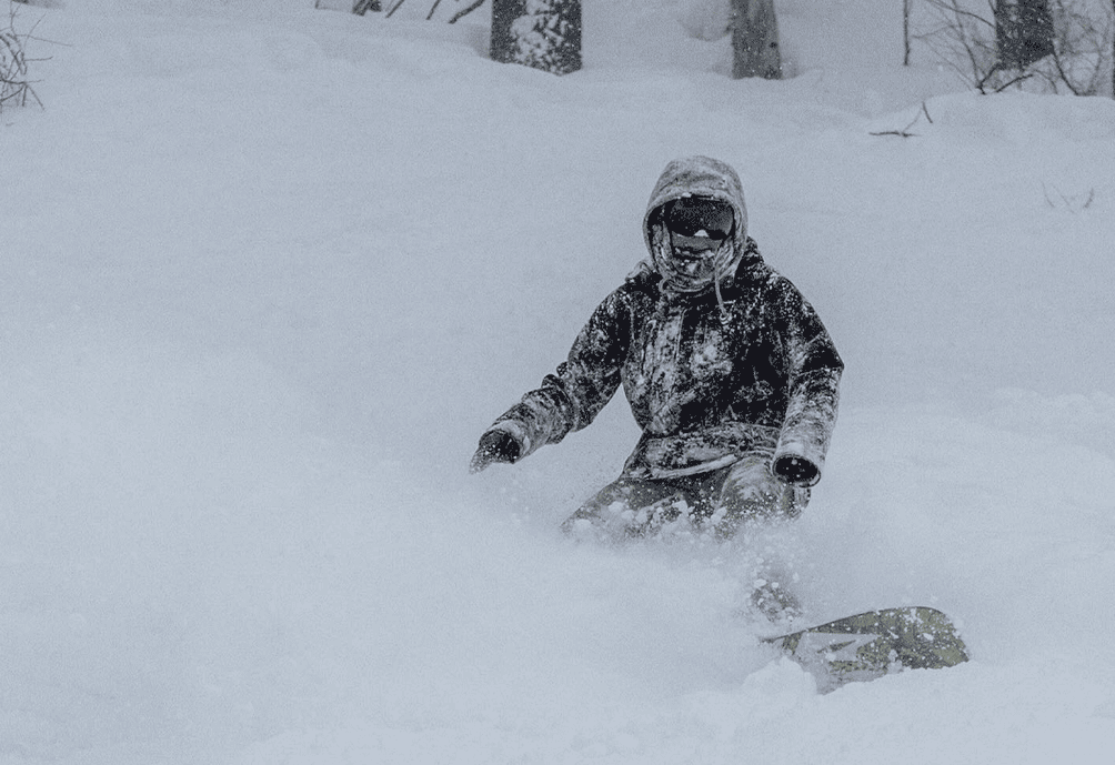
Well, folks, we’ve got one heck of a snowstorm out there today. It’s cold, its windy, and I can see cells of 35-40dBZ on the radar across the length of the country, which confirms we’ve got moderate to heavy snowfalls.
For most, today will see the most snow falling for at least the next 7-days, as the storm starts on an easing trend from tonight, with predominantly light to moderate falls continuing through Friday. However, heavy falls are still expected in areas that continue to hit the wind head on, such as those in the Echigo Mountains of eastern Central Honshu (e.g. Hakkaisan) and around Sapporo to Niseko on Hokkaido.
Saturday Jan 27th & Sunday Jan 28th
Light to moderate snowfall will continue throughout Japan this weekend. The biggest totals on Saturday will again likely be in the Echigo Mountains, which are favoured when winds are more westerly, and Sapporo to Niseko with winds from the north on Hokkaido. On the other hand, significant sheltering in some areas, such as in the Nagano region and Central Hokkaido, may see some resorts receiving little, if any, new snow.
Sunday, snowfall will become more isolated, and often go missing in action for long periods at some resorts, with sunshine even breaking out. This will particularly be the case for Central Honshu before a wobble in the isobars brings a period of snowfall from afternoon.
Monday Jan 29th to Wednesday Jan 31st
Monday, light snow showers will continue mostly about and north of the Echigo Mountains, but will start to dry up Tuesday as a ridge of high pressure brings more settled, sunny skies to Japan.
Wednesday, high pressure continues to dominate while a milder airmass pushes on from the west, likely making this the sunniest and warmest day of the 7-day period.
Extended Outlook
The ridge of high-pressure may exit the scene next Thursday (1st Feb) allowing the next snowstorm to blow in from the NW late in the day or during Friday. This one looks to be on the weaker side and will likely peter out during the weekend.
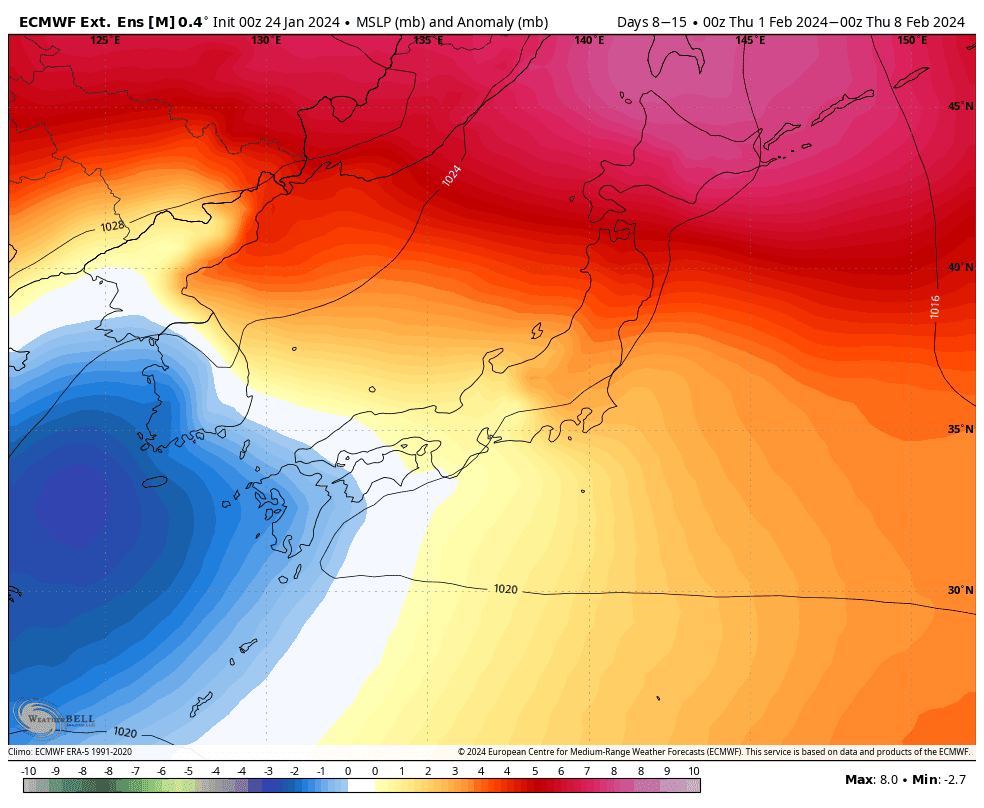
We could see the next storm roll in shortly afterwards from the west during Sunday 4th or Monday 5th, likely bringing a period of mild temps and low-level rain, before colder temps arrive around the middle of that week with higher quality snowfall.
That’s all from me today. Have a great week, see you next Thursday.
Grasshopper


