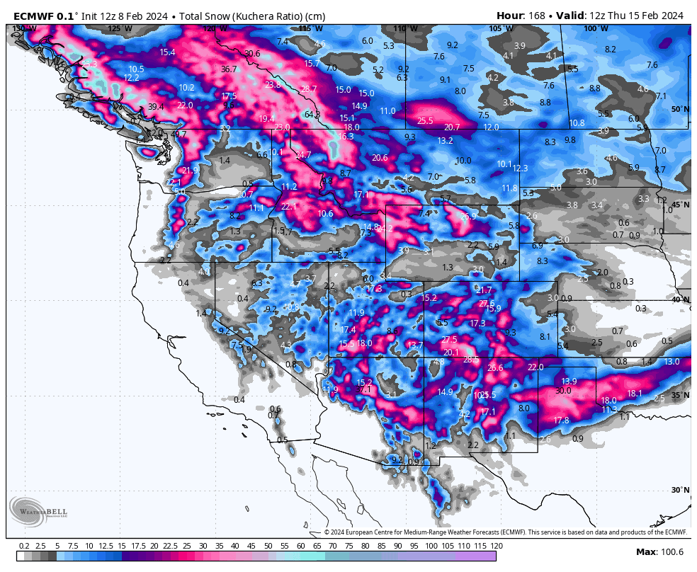
Grasshopper’s Weekly North America Forecast, February 8th – A Deep Week for the Rockies while the Sierras take a Break
Mountainwatch | The Grasshopper
Written Thursday morning 8th February (Pacific Time)
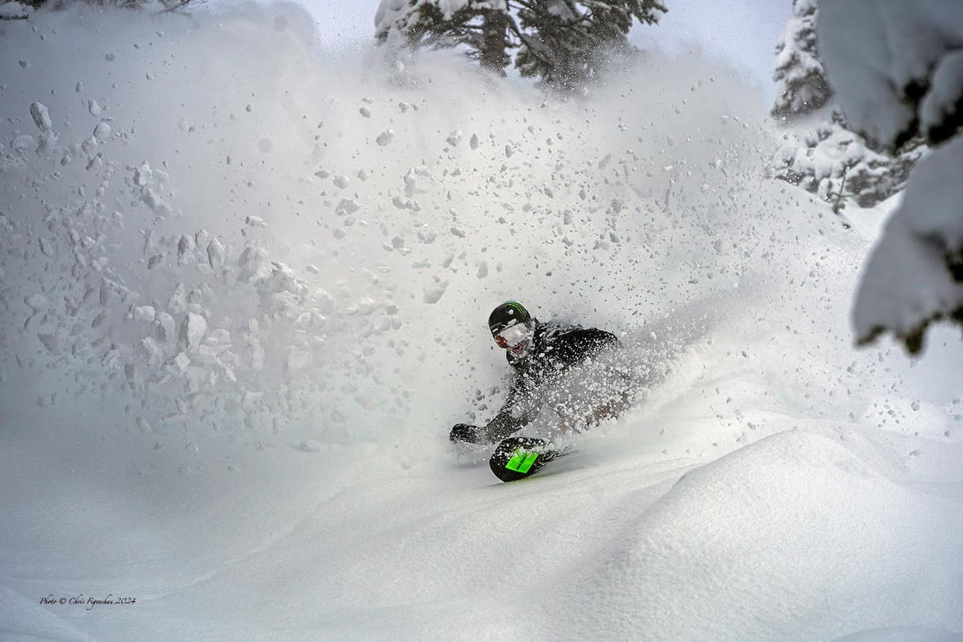
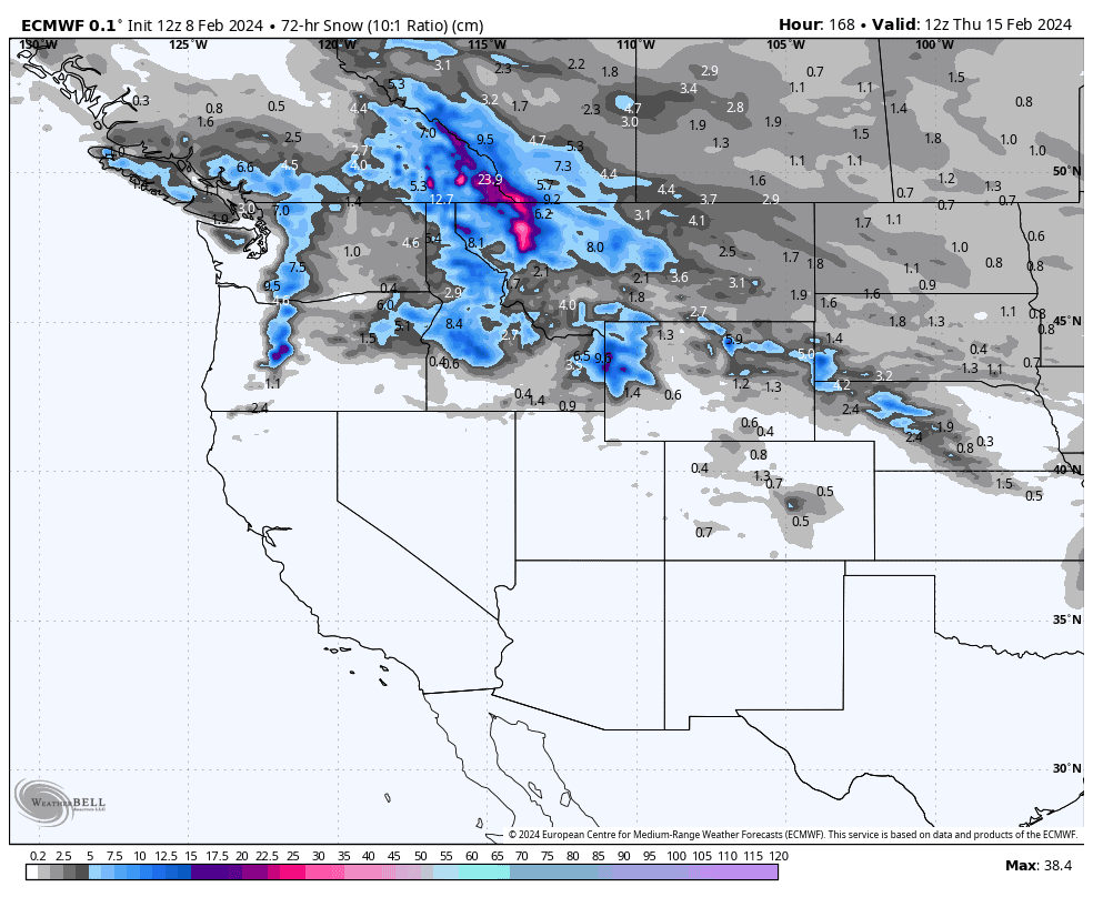
Well, the Sierras have had their fill after two monstrous storms dumped between 130-250cm of new snow in the past seven days. The central and southern Rockies also did well, and they’ll do well again over the next few days as a couple of weak-ish storm systems linger in the area on their way out of the West.
However, it’ll be the north which perhaps takes the cake this time around, as regular light-moderate snowfalls will add up quite nicely with totals getting up around the 30-60cm+ mark in southern BC/Alberta and northern Montana, with slightly lesser amounts in Idaho and Wyoming. The Coast Mountains and Cascades will also see similar totals, but temperatures will trend warmer and we’ll see some wet stuff appearing down low.
Thursday Feb 8th & Friday Feb 9th
A chilly airmass has spread south over Western North America, and we have a weak-ish storm system trekking eastwards across the south, which exits the scene Friday, while an even weaker system in the north (currently centred over the Canadian Rockies) slides southwards into the southern Rockies.
As a result, over this two-day period, virtually every resort in the West will see good quality snow of varying amounts, ranging from just a skiff in the BC Coastal Ranges, up to a moderate load of 20-40cm+ in the Southern Rockies (Southern Utah & Colorado, Arizona & New Mexico).
The bulk of snow has already fallen in the Sierras, where a nice 23-25cm was reported at Mammoth earlier this morning (although something like 130-250cm has fallen in the Sierras over the last seven days!). A few more light snow showers today and tomorrow will see an additional dusting there. Light snowfalls will be more persistent in the Cascades with around 5-15cm likely there, with similar amounts expected throughout the central and northern Rockies before they mostly peter out during Friday.
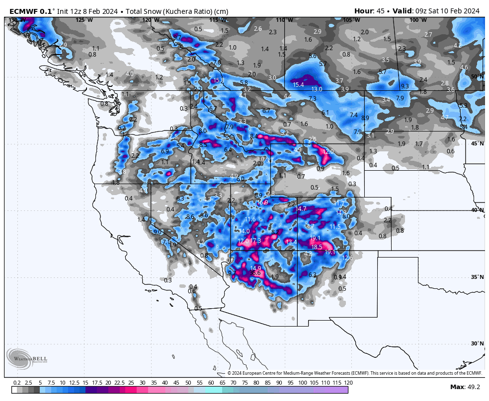
Saturday Feb 10th & Sunday Feb 11th
The weak storm system that is expected to slide into the south will intensify this weekend as it exits the West. Remaining light snowfalls in the central Rockies, as well as those in Utah and Arizona, will gradually clear during Saturday. At the same time they’ll ramp up to moderate, possibly even heavy, for a time in New Mexico and parts of Colorado before also easing here during the first half of Sunday, leaving up to 20-30cm of powder at some lucky resorts.
Meanwhile, a new storm will roll down from the north, spreading mostly moderate snowfall over Canadian resorts during Saturday, and into the Cascades, northern Idaho and Montana during Sunday. BC should do well out of this one although some wet stuff will be mixed in at low elevations in the Coast Mountains due to slightly milder temps.
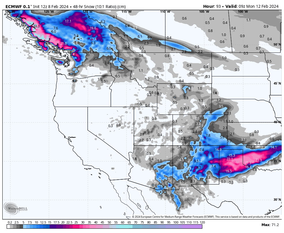
Monday Feb 12th to Wednesday Feb 14th
The storm system in the north will leave the Coastal Mountains and Cascades during Monday while weakening and spreading southwards down the Rockies through the south of Idaho and Wyoming. Snowfalls will mostly be light, and will clear up during Tuesday, but they’ll be a little heavier and persist about the southern portion of the Canadian Rockies and northern Montana where two-day accumulations could get up to around 20-40cm.
Another weak-ish storm is expected to push into the north from the Pacific during Wednesday bringing light-moderate snowfall to Southern BC, the Cascades, Idaho, Montana and Wyoming.
Extended Outlook
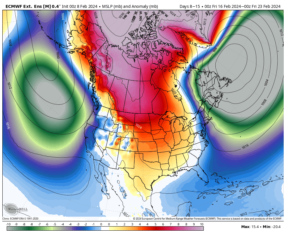
Snowfall is expected to continue across the north into next weekend (17th-18th Feb), before we enter a pattern that looks to benefit most of the West the following week, with the southern-central U.S. looking particularly well placed for some big totals.
That’s all from me today. Have a great week, see you next Thursday.
Grasshopper


