New Zealand Weekend Forecast, Friday August 15th – Another Boost of Powder and Icy Temps Coming Up
Mountainwatch | The Grasshopper
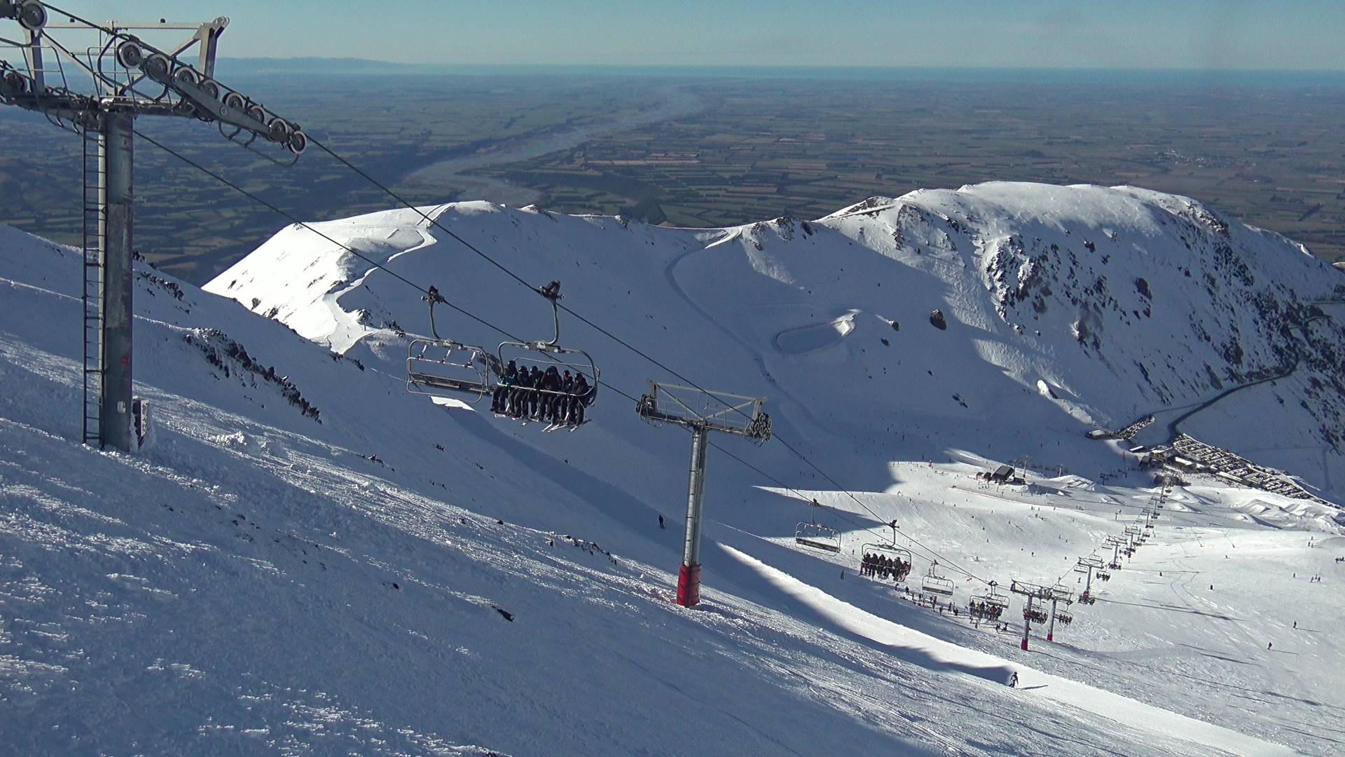
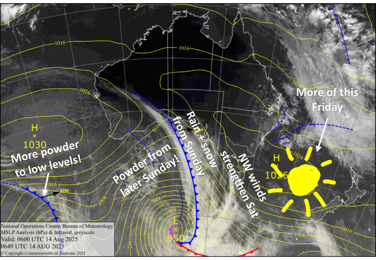
It’ll be another stellar day across the country today, Friday, as high pressure continues to dominate NZ weather charts. The high moves out east during the weekend, allowing northwesterlies to strengthen on Saturday ahead of an approaching front.
The front will slowly move up the country during the following few days, bringing heavy snowfall to the Southern Lakes on Sunday, Canterbury on Monday, and then Mt Ruapehu on Tuesday, where rain and high-level snow would have already kicked off on Sunday. An additional, stronger, icy-cold southerly pulse follows close behind, and will keep snow falling over the South Island until Tuesday and Mt Ruapehu till Wednesday.
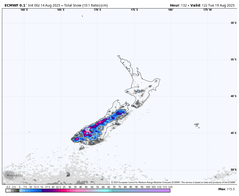
Snowfall accumulations for this storm cycle will likely be in the ball park of 15-40+ cm across the country. This will give us another timey boost for the tail end of the season, which has been rather slow on the whole for the Southern Lakes and Mt Ruapehu.
Friday 15th August
Any cloud affecting the ski fields will clear early for another gorgeous, sunny day, while brisk southwest winds ease, and then turn northwest over the South Island.
Saturday 16th August
A fine start for South Island ski fields, but clouds eventually move in as northwest winds strengthen, potentially reaching gale force in exposed areas of Canterbury. Snow showers spilling over the Main Divide will likely reach Treble Cone and Temple Basin from afternoon.
Sunday 17th August
A front moves onto the lower South Island and becomes slow moving. This will see rain and mid-to-upper level snow spread across the Southern Lakes during the morning, with heavier falls during the second half of the day while snow lowers to base levels as northwest winds ease and turn a colder, lighter southwest.
Canterbury will have a partly cloudy day, with mid-to-upper level snow showers likely reaching ski fields closest to the Main Divide. Strong northwest winds ease.
Monday 18th August
Snow clears the Southern Lakes in the morning while spreading up Canterbury, as the front moves northwards, bringing cold southerly winds with it. Snow returns to the Southern Lakes later in the day, as a stronger pulse of icy-cold southerly winds blast up the South Island.
Tuesday 19th August
Remaining snowfall over the South Island gradually clears as the icy-cold southerly winds abate.
Extended Forecast
Later next week, snowfall eventually clears Mt Ruapehu and skies clear over the South Island on Wednesday, the 20th of August, as high pressure starts to build over the country, bringing mostly sunny, settled weather through to at least Friday. It’ll be the best days of the season, with fresh powder to be had. The next storm looks to roll in later during the weekend or early the following week, but details on this are still very much sketchy.
That’s all from me today, folks. I’m sending out these forecasts every Monday, Wednesday and Friday throughout the season. Have a great weekend, and I’ll see you back here on Monday.
Grasshopper


