New Zealand Weekend Forecast, Friday June 13th – More Snow for Mt Hutt Opening Day, Settled & Sunny this Weekend
Mountainwatch | The Grasshopper
Published early Friday, 13th June 2024
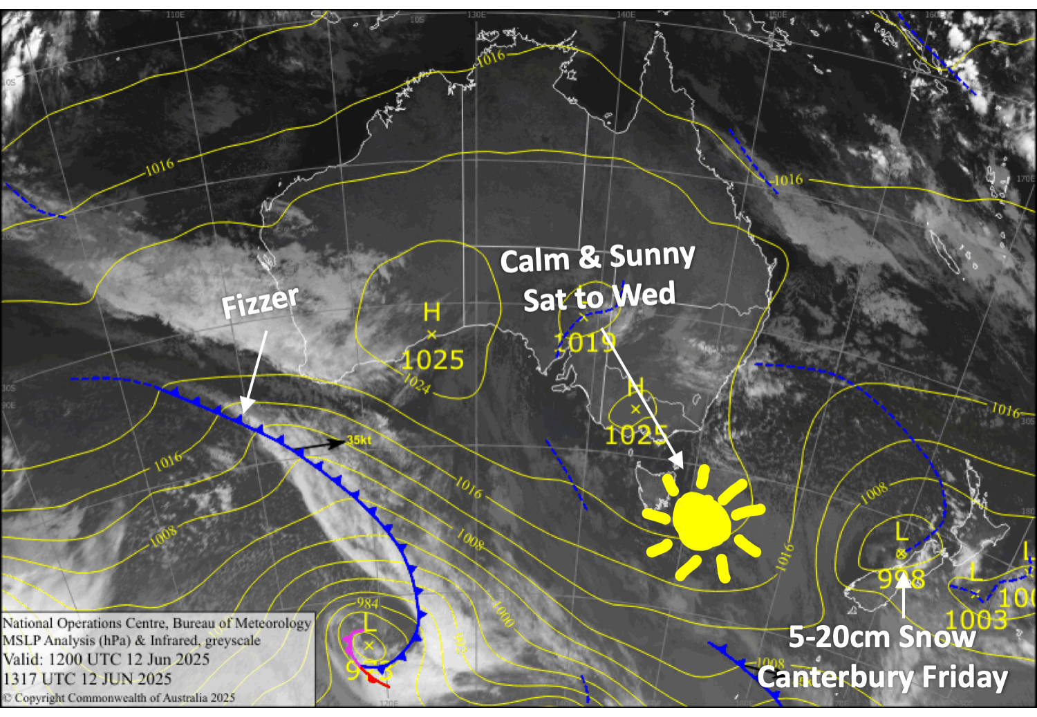
Kia ora te whanau! This coming weekend is Opening Weekend for a lot of major ski fields in Aotearoa, New Zealand, so it’s time to stay glued to the weather forecast. A timely dip in the Southern Annular Mode has led to a prolonged storm cycle, resulting in widespread snow and cold temperatures across the South Island.
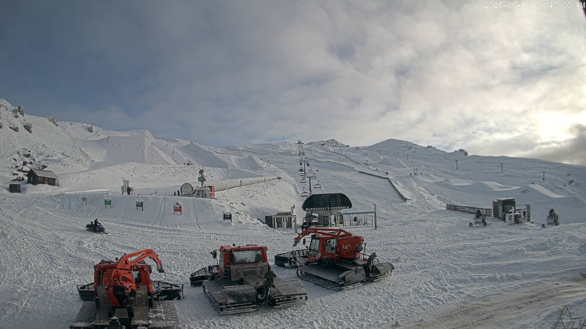
Canterbury in particular has scored big-time, with Mt Hutt receiving about 112cm over the last week, including a fresh 15cm of snow reported Thursday morning. Snow continued falling on Thursday, even though it turned wet on the lower slopes, and will continue to fall today (Friday) for Opening Day, with snow levels eventually lowering later. With a base of 75-121cm, it’ll be the best start to a season here in years.
The Southern Lakes have also had a couple of shots of powder recently, bringing in around 15-25cm, with another skiff of snow falling Wednesday night. A long run of cold temps has allowed ski fields to further bulk up the groomed runs with man-made snow, so there’ll be plenty of terrain ready to roll for Opening Day Saturday.
High pressure will set in over the South Island this weekend, giving us several days of sunshine and light winds. Just perfect!
Friday 13th June
For Southern Lakes, the Queenstown ski fields may see some light flurries in the morning before cloud covering the region gradually breaks up through the second half of the day. Just light southerly breezes, and temps will be nice and chilly at night for making snow.
From midnight till midday, Canterbury will receive a solid 10-15cm of snow on the upper slopes of the Frontal Range (Mt Hutt, Porters Pass), with around 5cm farther inland, but it’ll be wet on the lower slopes. Lighter snowfall will predominantly continue about the Frontal Range through the afternoon as snow levels lower to base altitudes, before finally clearing up at night, leaving up to another 5cm. Best to stick to the high ground if you can for opening day at Mt Hutt.
Saturday 14th June
A nice, calm, sunny day across the South Island, perfect for Opening Day in the Southern Lakes. Any cloud cover in Canterbury will clear early. Chilly temps for snow making.
Sunday 15th June
Another stunning day for South Island ski fields, with mostly calm, sunny skies for the first Sunday session of the season. There’ll just be a little cloud over the Southern Lakes in the morning. Cold temps morning and night for the snow guns.
Monday 16th June
Sunny and calm for the Southern Lakes.
It’ll be sunny for Canterbury too, except for some snow showers in the north, likely hitting Mt Lyford. Southeast breezes.
Extended Forecast
High pressure will likely keep skies clear for Tuesday, 17th, and Wednesday, 18th, June.
A couple of fronts will then bring brisk northwest winds and a few showers of rain and snow on Thursday and Friday, the 19th and 20th of June, before a mostly fine weekend dominated by high pressure.
That’s all from me today, folks. I’m sending out these forecasts every Monday, Wednesday and Friday throughout the season. So, see you back here Monday.
Grasshopper


