New Zealand Weekend Forecast, Friday June 27th – Storm Now Favouring Southern Lakes, Milder Temps in Canterbury
Mountainwatch | The Grasshopper
New Zealand ski fields have had a couple of rough days. Heavy rain saturated the snowpack, and strong winds closed or limited lift operations.
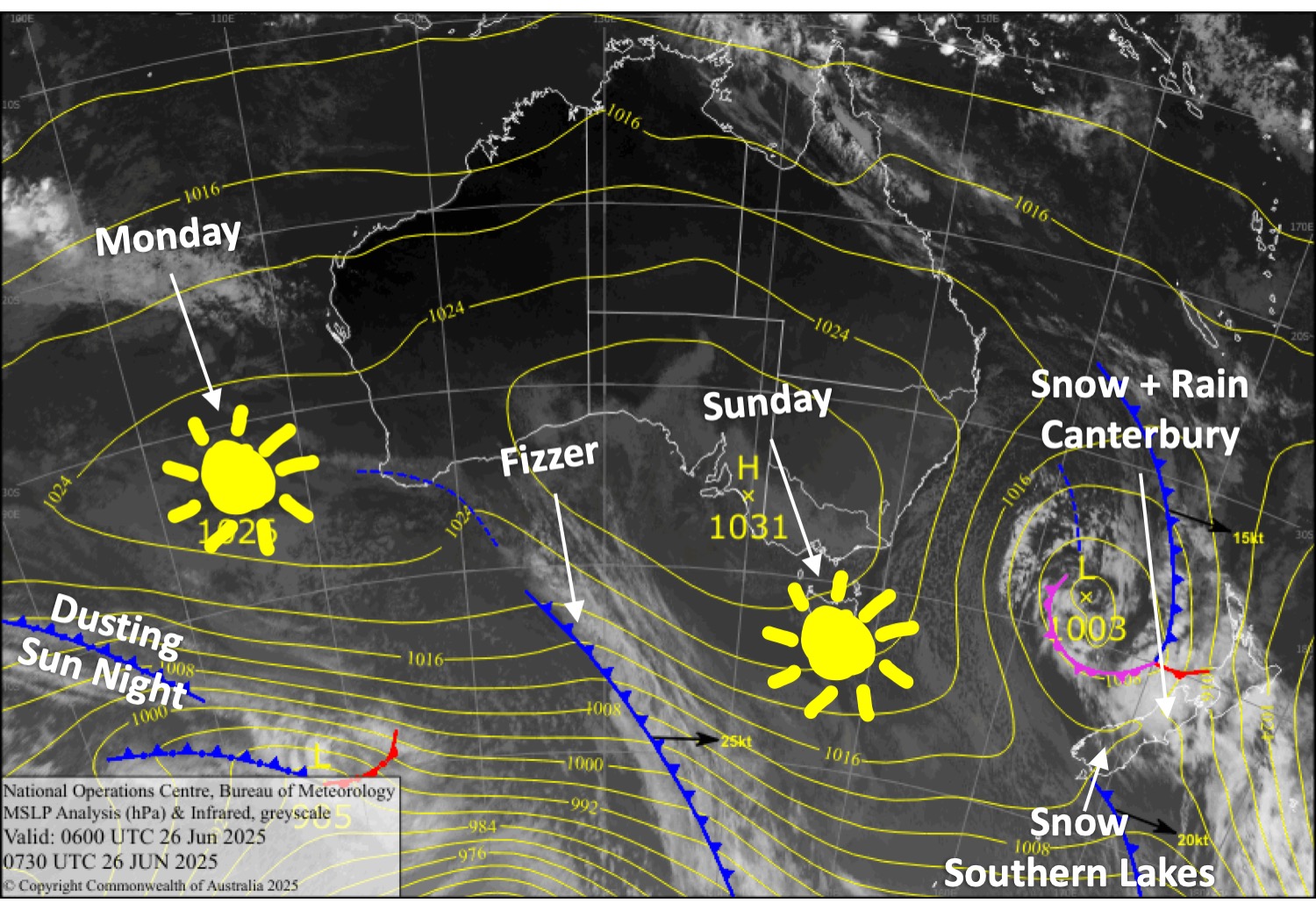
We’re now entering the second half of this Tasman storm, which will bring cooler winds from the east-through-south on Friday and Saturday. A band of heavy precipitation will nail Canterbury on Friday, but temperatures now look marginal north of the Mackenzie Basin, causing some of it to fall as rain, especially on lower slopes, from Mt Hutt northwards. The snow that does fall will be the dense variety, too. Snow accumulations will vary from 20-40cm on the upper slopes, reducing to 10-20cm lower down.
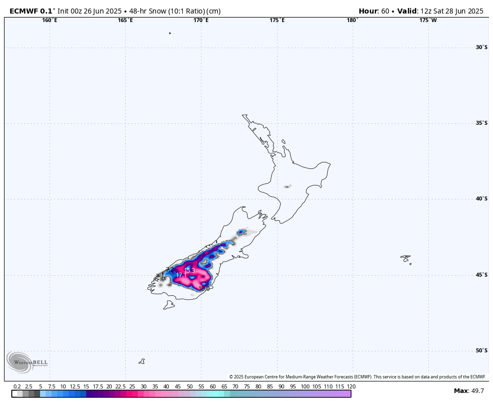
The band of precipitation will drift onto the Southern Lakes Friday night. Temperatures will be a little chillier here, so we should have good snowfall to low levels through to Saturday night. Around 20-30cm is expected, which will be massively appreciated, as things looked a little grim after the rain.
Barring some wind, Sunday and Monday will be nice days to head up to get amongst the fresh snow, and the Southern Lakes will score an extra dusting of snow from a weak cold front Sunday night.
School holidays start this weekend, and for all the North Island kids, Whakapapa and Turoa will also ramp up their operations from this weekend onwards, depending on conditions. Strong northerly winds and heavy rain will put a limit on things for Friday. Saturday through Monday will be wet too, but snow should fall about the tops and then gradually lower to about mid slopes, and winds will be a bit lighter.
Friday 27th June
Heavy rain in Canterbury will gradually turn to dense, soggy snow during the morning as cooler south-to-southeast winds push in, but it may not reach base level at some ski fields. It’ll all clear about and north of Mt Hutt at night, but it’ll continue in the Mackenzie Basin. Best stick to the high ground, but visibility will be limited.
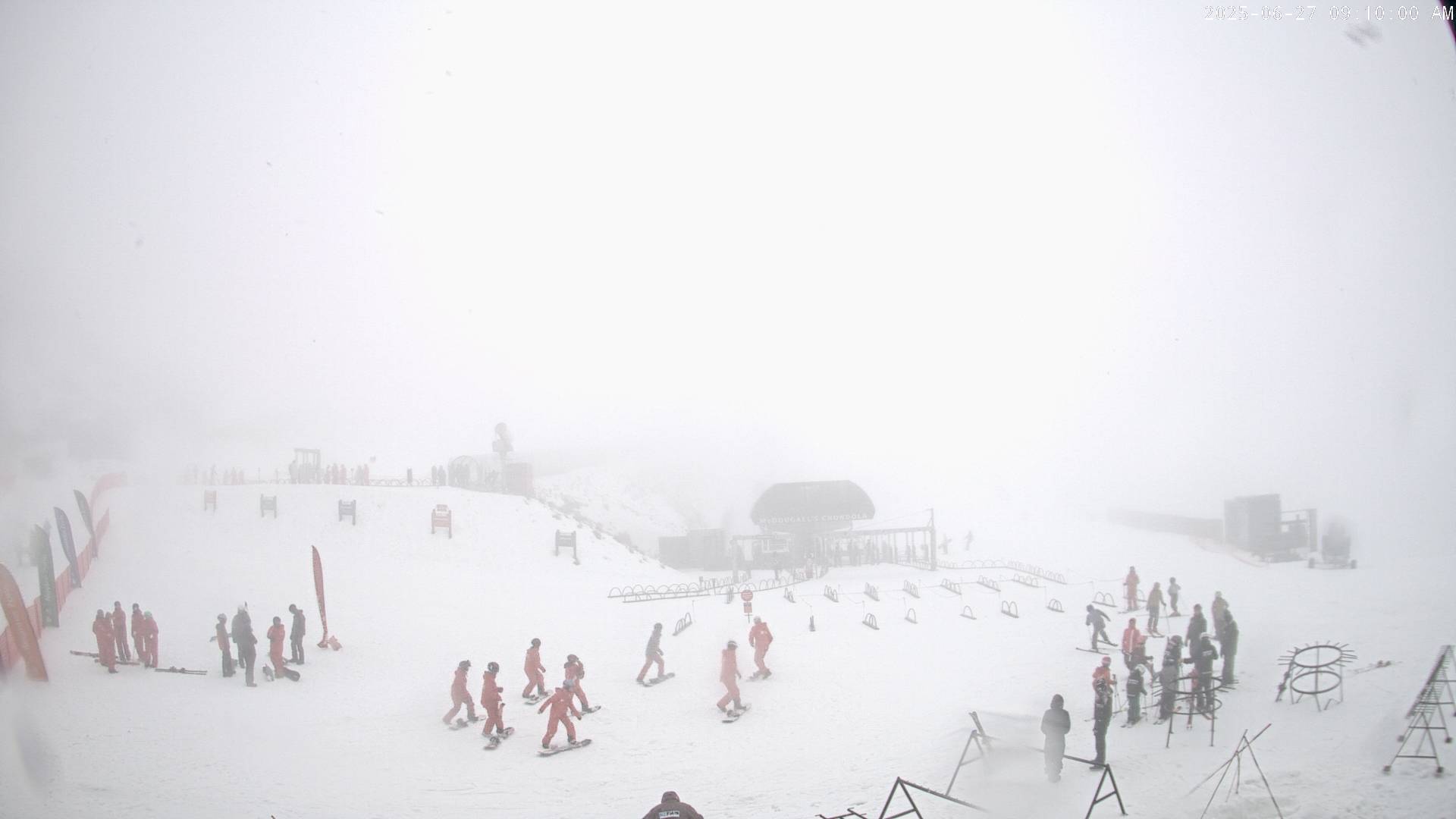
The Southern Lakes will also be fairly clagged-in with limited visibility from cloud pushing hard up against the slopes by an easterly breeze. There could also be some light flurries during the day before heavier snowfall sets in at night.
Saturday 28th June
Heavy snowfall over the Southern Lakes and Mackenzie Basin gradually backs off throughout the day and finally clears at night/overnight, as southerly winds turn southwest.
Elsewhere in Canterbury, it’ll be cloudy, and snow showers will spread north during the latter half of the day as southwest winds develop.
Sunday 29th June
Any remaining snowfall over the South Island clears before opening time, leaving sunny skies. Southwest winds gradually clock around to the northwest.
A weak cold front will give the Southern Lakes a light dusting of snow at night.
Monday 30th June
Partly cloudy, partly sunny skies and westerly winds across South Island ski fields.
Extended Forecast
Next week, Tuesday and Wednesday will remain nice and settled as a high drifts over the country. Another Tasman low is then expected to pass over the country sometime during the latter half of the week, from Thursday onwards. Earlier forecasts were picking a decent amount of snow, but now just a bit of rain is looking more likely. We’ll wait for Monday’s forecast before making any big calls.
That’s all from me today, folks. I’m sending out these forecasts every Monday, Wednesday and Friday throughout the season. Have a great weekend, and I’ll see you back here on Monday.
Grasshopper


