New Zealand Weekend Forecast, June 20th – Cold Change Brings Another Dusting, A Little Rain & High-Level Snow Sunday
Mountainwatch | The Grasshopper
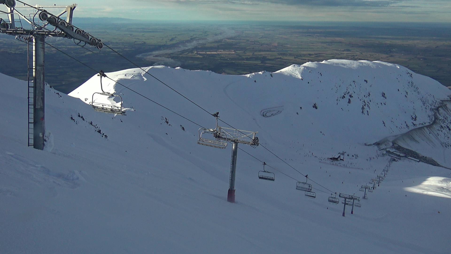
The Southern Lakes received a dusting of 2-7cm in the early hours of Thursday. Snow showers returned late Thursday and will persist into Friday afternoon, giving ski fields another dusting ahead of a mint day on Saturday, as a ridge of high pressure passes over the South Island.
Mt Hutt missed out on the dusting on Thursday and was affected by strong northwest winds, which limited operations and hardened the snowpack to a crisp. Northwest winds will persist through Friday, but cooler winds from the south later in the day will bring light snowfall through into Saturday, giving some ski fields a light dusting and a chance to fire up the snow guns.
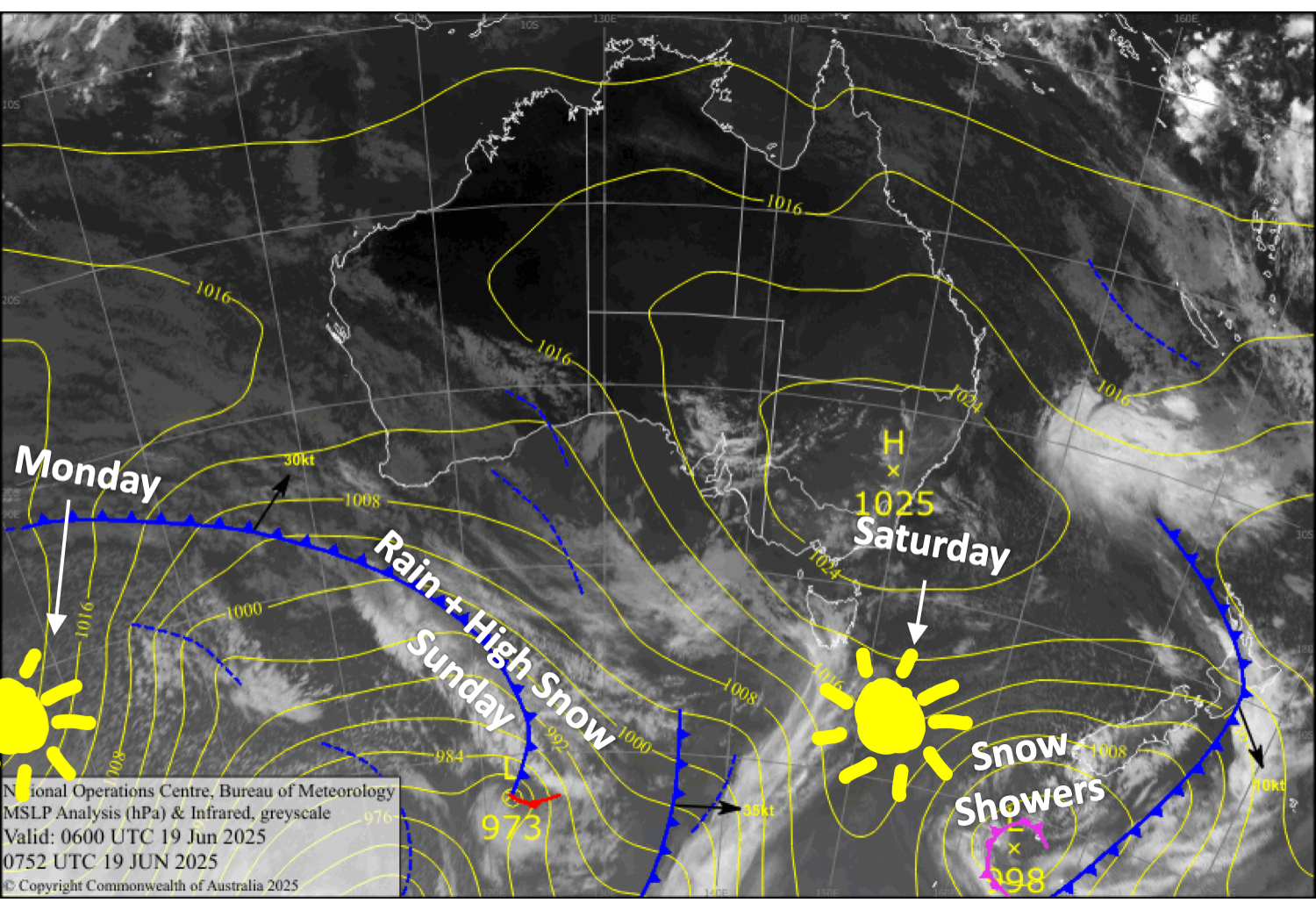
Westerly winds will become strong again on Sunday, while a front brings rain and high-level snow to the Southern Lakes during the second half of the day and a little bit to Canterbury that night. Things clear up again for a lovely day on Monday as another ridge of high pressure moves onto the South Island.
Porters Pass is scheduled to open on June 27th, but will sneak in a few early sessions Friday, Saturday and Sunday. Whakapapa and Turoa on Mt Ruapehu in the North Island will also open their learner slopes on Saturday.
Friday 20th June
Snow showers for the Southern Lakes clear this afternoon as gusty westerlies turn southwest, although the Queenstown ski fields could see a few extra flurries.
For the most part, Canterbury fields will have strong, gusty west-to-northwest winds and partly cloudy skies. Snow showers will then kick up from late afternoon as winds turn to a lighter southwest.
Saturday 21st June
Clear and sunny with light breezes for the Southern Lakes and the Mackenzie Basin.
Elsewhere in Canterbury, southerly winds will push a few light snow showers into the Frontal Range (Mt Hutt, Porters Pass) during the morning, while Mt Lyford further north will receive light snowfall until evening.
Sunday 22nd June
Westerly winds become strong in exposed areas of the Southern Lakes, then a front will bring rain and high-level snow during the afternoon and evening.
The day will start nicely in Canterbury, but cloud will build in the afternoon as strong west-to-northwest winds develop. There’ll also be some light showers overnight, possibly falling as snow up top.
Monday 23rd June
Any cloud about South Island ski fields clears early for a mint day, as southwest breezes turn westerly.
Extended Forecast
The middle of next week is looking rough. A storm from the west brings heavy rain on Wednesday and Thursday, along with horrendously strong northwest winds. A cold change will bring light snowfall from late Thursday into Friday, but it won’t be nearly enough to repair the damage.
However, cold temperatures throughout next weekend should have the snow guns cranking, and a weak cold front will likely bring an extra dusting of snow late Saturday into early Sunday.
That’s all from me today, folks. I’m sending out these forecasts every Monday, Wednesday and Friday throughout the season. Have a great weekend, and I’ll see you back here on Monday.
Grasshopper


