North America 2025-2026 Snow Season Outlook January Update – Still Looking Good for the North
Mountainwatch |The Grasshopper
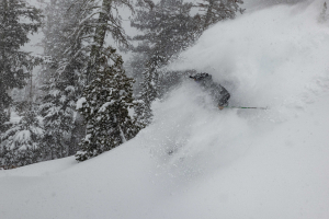
Happy new year to all, and with that we find ourselves nearing the peak of the 25/26 North American season. So far, the Canadian Rockies have taken the cake with the some of the best performing resorts like Lake Louise and Kicking Horse breaking December records and locals and visitors enjoying multiple powder days. However, it hasn’t been as pretty further south with dry spells and variable weather, not quite what the doctor ordered.
Around the grounds
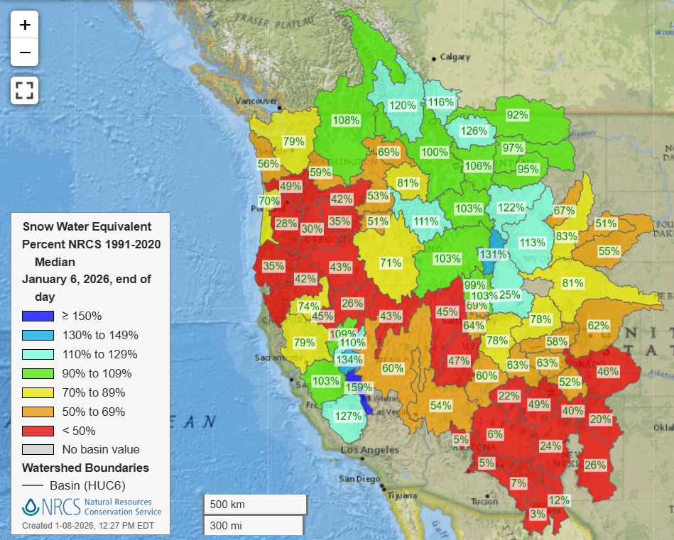
Below we have a well recognised map from previous outlooks, the snow water equivalent (SWE) plot which shows the percentage of the 1991-2020 median for that specific basin. A quick caveat for this map is that it is based on a few observations within that basin, so broad scale describes the different regions. The plot is also sensitive to recent storms. Looking at the trend, we can see broadly around average to above-average levels becoming lower as you move further southeast. Areas like the Canadian/northern and parts of the middle Rockies are doing the best so far. Californian areas are looking better thanks to some recent storm cycles which have improved the fortunes through areas like the Sierras and Tahoe.
Some good news is that over the next six days widespread areas will see some fresh snow thanks to some consistent northwesterlies through the weekend then a trough will move onshore to hit the northwestern USA/southwestern Canada. For more detail stay up to date with the weekly North American forecasts.
As mentioned earlier, Lake Louise and Kicking Horse in the Canadian Rockies have both recorded their deepest December on record with monthly totals of 307cm at Lake Louise and 340cm for Kicking Horse. Upper mountain snow totals above 2000 metres are more, both resorts reporting over five metres this season.
ENSO Recap
In the previous outlooks for this season, we saw that the most likely scenario was a La Nina developing through December, persisting through the first half of winter then easing. As of right now La Nina is continuing and is near its peak, the most up to date NOAA guidance predicting a 68% chance of a return to neutral conditions by March. So, no major change to our scenario but there is the potential for this easing to be quite quick through the next few months. However, for now we remain in the same position.
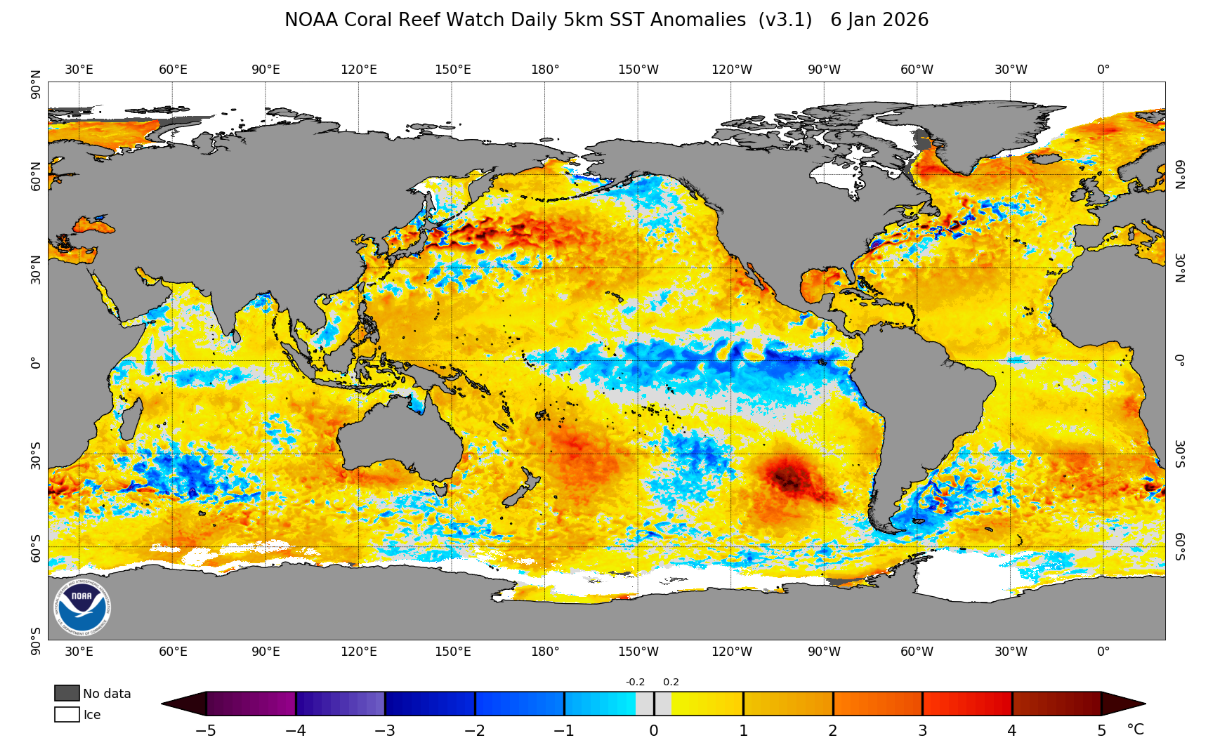
Below is an updated SST anomaly showing the global situation. It is a familiar La Nina pattern – developed cooler waters in the central-equatorial Pacific and the warmer waters of the western-equatorial Pacific.
Seasonal Products
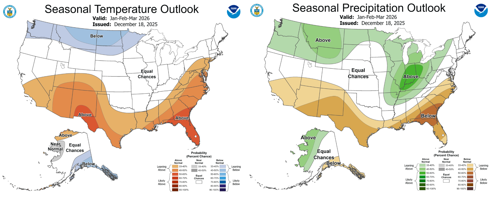
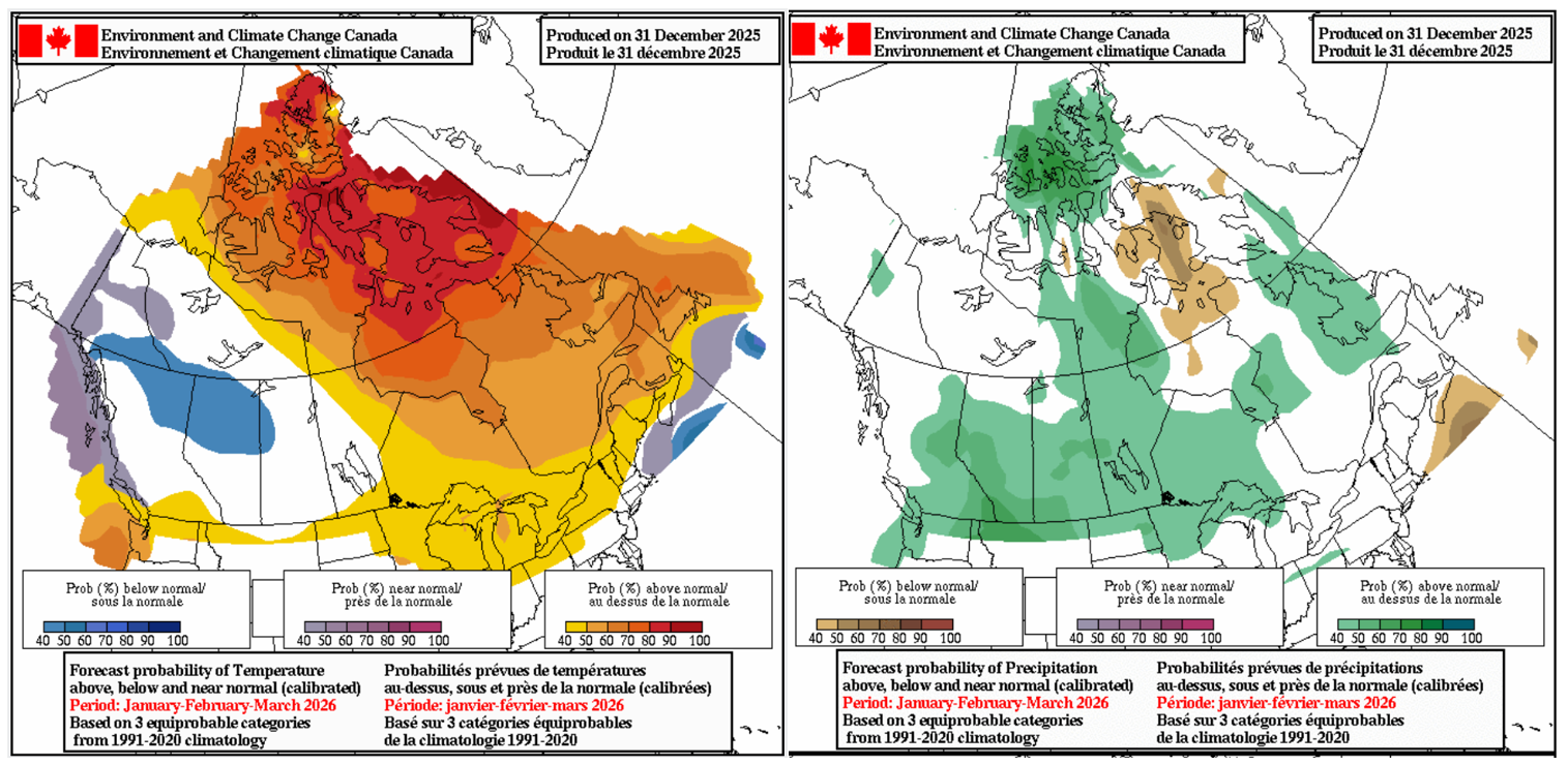
NOAA and Environment Canada’s latest three-monthly outlooks are shown below with again a similar story – the main driver being the current La Nina event easing through the second half of the season.
Focusing on the USA first, we see broadly neutral temperatures apart from the chance of below average temperatures further north and northwest. Moving to the precipitation outlook (and comparing that to the initial SWE map shown earlier) we can see a common theme, the prominent signal for the northern/middle Rockies particularly and the northwest as a whole. This was expected as we moved further into the season with perhaps a more-focused above-average signal further inland the more coastal areas of the Pacific Northwest.
Now moving north of the border, there is no major surprises with Environment Canada’s outlook for the next three months: Broadly neutral temperatures throughout the west of the country with the potential for cooler temperatures in the northern Canadian Rockies. Precipitation is broadly forecasted to be above average with specific higher probabilities around most of the Canadian Rockies.
What’s new?
The week ahead will continue an active trend which sees most places get some fresh stuff but again, no surprise, as it looks to favour areas which have been already doing well this season.
In the longer term the La Nina event is forecasted to be nearing its peak, with a return to neutral conditions expected in the next few months.
Other interesting players like the modelled weaker polar vortex we spoke about in the last update isn’t forecasted to be as much of a deviation from neutral conditions through the rest of the season. That is not to say there will not be any more events seeing the polar vortex weakened or destabilised as is generally promoted by a La Nina. But as ENSO returns to normal and no other significant climatic conditions take the floor, it sits at neutral.
Overall, the outlook remains promising for areas north of the border with much the same areas we have mentioned in the past outlooks – the Canadian Rockies and throughout northwestern USA in prime position.
To see how this scenario plays out over the next month, check out my weekly North America forecast every Thursday.