STORMWATCH – Blizzard Alert for Niseko
The weekend wet snow is building a solid base
Stormwatch | Blizzard alert
Friday 9 December update: After a slight reprive – and some blue skies (check out the video – nice) More snow will hit Niseko this weekend. A Siberian front is on the way and it’s bringing a metre or so of snow!
2011/12 Season Intro from Japan Ski Experience on Vimeo.
Wednesday 7 December update: Aproximately 30cm fell on the peaks overnight, adding to the 60cm or so yesterday. As expected, the snow has turned dry and the wind has subsided… all in all a lovey day in Niseko, with more snow to come!
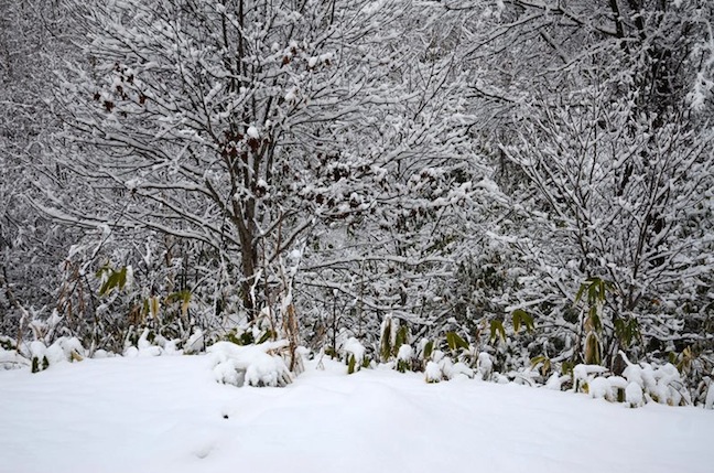
A serious blizzard is enveloping Niseko, 150cm of snow has fallen on the resort’s peaks since Sunday and the storm shows little sign of abating.
While the greater part of the Northern Hemisphere is limping into winter Niseko is welcoming the turn of the seasons with some season kick-starting weather. The heavy snowfalls, which began over the weekend, started wet – perfect for building a strong base on the recently opened slopes, but thanks to a very cold north west jet stream, which should hang around until Friday, that dense precipitation should get very dry, very soon.
Conditions, as of Monday afternoon, 5 December:
New Snow Past 24hrs: village: 25cm top station: 45cm
Current Snow Depth: village: 65cm top station: 170cm
Accumulated Snow: village: 190cm top station: 290cm
The blizzard played havoc with lift operations on Monday, but the wind is expected to ease, allowing access to the top – and the best conditions yet this season – on Tuesday.
The season-starting snowstorm sets Niseko apart from almost all the other Northern Hemisphere resorts. Conditions in Europe are so woeful many major resorts have delayed opening. British Columbia – particularly Whistler, pockets of Colorado and Utah have received decent snowfalls but conditions are still resolutely ‘early season’ across most of North America.
Niseko forecasts,
snow reports and
live snow cams.


