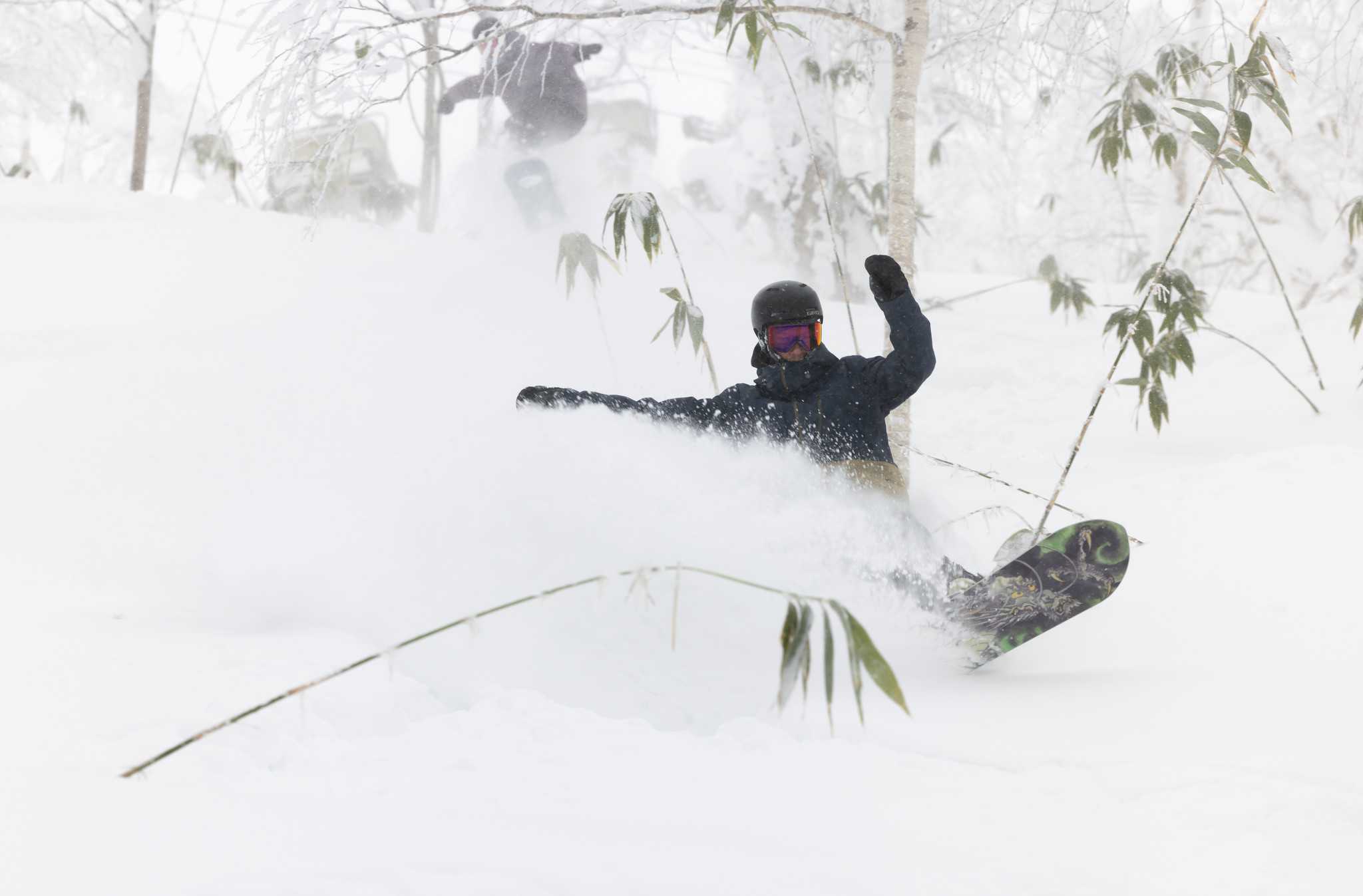
Weekly Japan Forecast, December 28th – New Year Coming with a Big Bang
Mountainwatch | The Grasshopper
Written Thursday morning 28th December (Japan Standard Time)
The lead up to New Year’s Eve will be relatively quiet here in Japan, where just light snow showers will frequent Hokkaido, and clear, calm skies over Central Honshu will be only briefly interrupted with a little snow early Friday.
However, New Year’s Eve itself will come with a bang. Featuring a fast-moving low, a snowstorm will kick off early on Hokkaido and reach central Honshu before the first Sake Bomb goes down the gullet. The storm will quickly clear out New Year’s Day, so after a quick nap, you should be getting deep and sunny that afternoon.
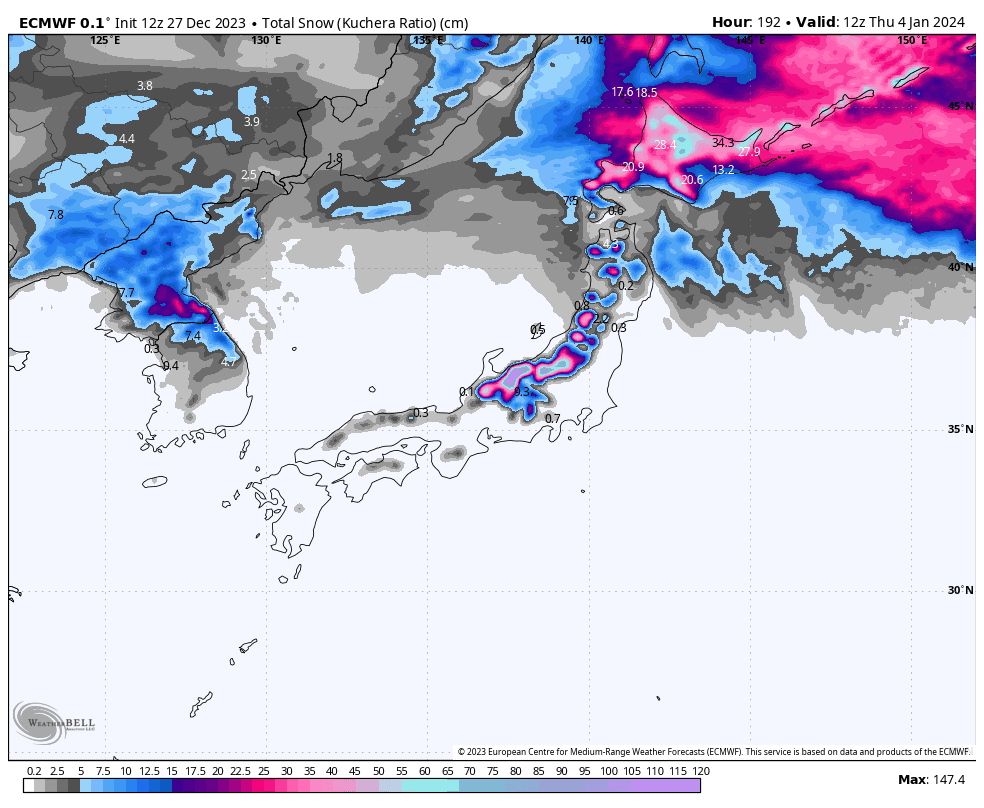
We’ll finish up this snowlight reel with another hefty dump, which will take the form of a cold front that slowly crosses the country during Wednesday. Central Honshu should make the most out of this one, with heavy snowfall into early Thursday.
Thursday 28th to Saturday 30th
Up on Hokkaido, persistent cold westerlies will keep skies mostly grey during this three-day period, with light snowfalls likely reaching a crescendo Friday night and keeping the slopes light’n fluffy.
Down on Honshu, high-pressure brings calm, sunny skies to central parts, and will also clear out any cloud or left-over snow showers in the north for a time this afternoon.
Friday, a weak low passes over Central Honshu during the early hours, bringing a brief period of light-moderate snowfall before skies gradually clear again. Temps aren’t super cold, so mixed precip (rain, sleet etc.) can be expected down low. Northern Honshu will also see light snowfall, mostly in the south, which clears Saturday.
Sunday Dec 31st & Monday Jan 1st
Sunday, a deepening and fast-moving low storms over the country. Things will happen first on Hokkaido, with snowfall becoming heavy as winds from the SE-E pick up. Snowfall will then gradually back off later Sunday and clear Monday as winds turn northwards and dry out.
On Honshu, the storm will arrive later on Sunday, but starting out as heavy rain with mild winds out of the southwest. However cold northwesterlies will start to arrive before the New Year’s countdown begins and snow will fall heavily to low levels through into Monday morning, before gradually clearing later in the day.
Tuesday Jan 2nd & Wednesday Jan 3rd
Snow showers will kick up on Hokkaido and in the north of Honshu during Tuesday as frontal system to the west takes shape. Temps will be relatively mild as winds will come from the SW, but the front will eventually start to cross southwards over the country from early Wednesday, bringing colder northwesterlies and a period of moderate-heavy snowfall with it.
The front should eventually reach central Honshu late Wednesday, with heavy snowfall expected at least into early Thursday before easing.
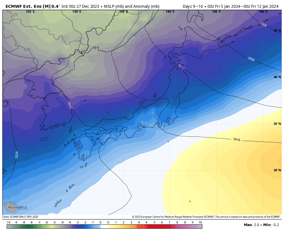
Extended Outlook
After sneaking a peek, next week’s snowlight reel is looking action packed. The 7-day period is likely to be dominated by low pressure, with cold temperatures and lots of precip likely. It’s all the ingredient we need for a deep week of Japow, which some models suggest will start to fall next weekend.
That’s all from me today. Have a great week, see you next Thursday.
Grasshopper


