Weekly Japan Forecast, Thursday, February 5th – Friday to Monday Storm to Deliver Another Slab of Powder
Mountainwatch |The Grasshopper
Written late Wednesday, 4th December (Japan Standard Time)
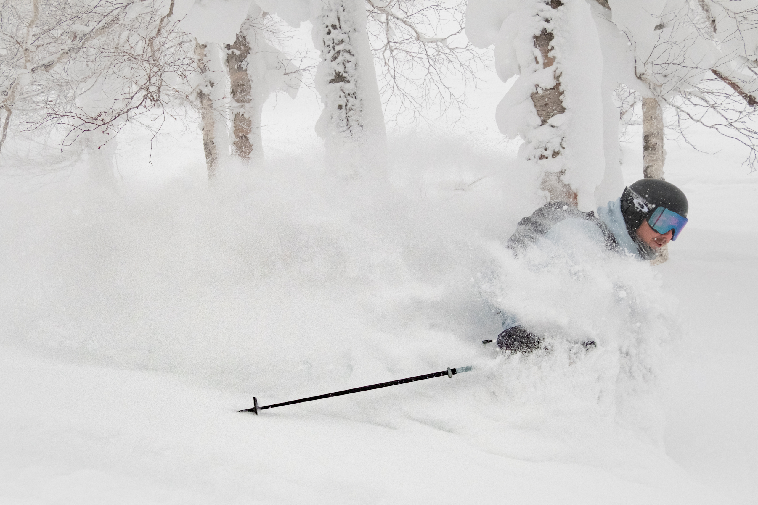
It’s been a beautiful, mild, sunny Wednesday across southwestern and central Honshu after the resorts here received a nice refresh to kick start the week. Myoko, as you would have rightly guessed, topped the charts with 40+ cm in Tuesday morning reports. Resorts here also chalked up big totals during a three-day storm that eased early Friday, leaving great conditions underfoot for the weekend, which saw lighter snowfall.
As usual, snowfall has been more consistent and steadier further north, with some large daily totals also appearing in Tohoku. Japanuary has really come through for the north and saved our bacon after one of the worst early seasons on record. Niseko has recorded the highest January snowfall in a dozen years, quickly bringing snowpack depths up to slightly above average. Typically, we can look forward to another third of the season’s snowfall still to come.
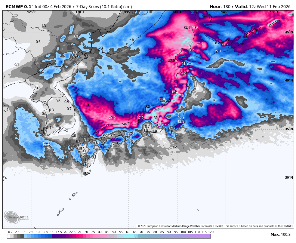
The next storm spreads down the country from the north starting late Thursday. After a wet and warm start, it’ll turn cold and powdery on Friday, and resorts across the country will pick up another decent slab of powder before the storm winds down during Monday and Tuesday.
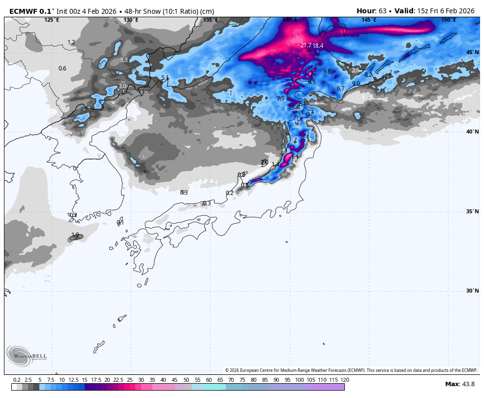
Thursday February 5th & Friday February 6th
Thursday starts off dry across most of the country, except for a frontal belt of showers of snow and low-level rain over northern Niigata and the southern half of Tohoku, marking the boundary between warm air to the south and colder air to the north.
This belt will be drawn up into northern Tohoku Thursday afternoon before a storm hits the area and Hokkaido that evening/night with heavy precipitation. The storm starts warm and wet down low, but a cold change arrives early Friday with a transition to high-quality powder to sea level.
The storm will push south into central and southwestern Honshu from later Friday morning, starting awfully warm, with wet conditions to mid and upper slopes, but turning nice and cold and powdery by the end of the day. The heaviest falls will be nearest the coast.
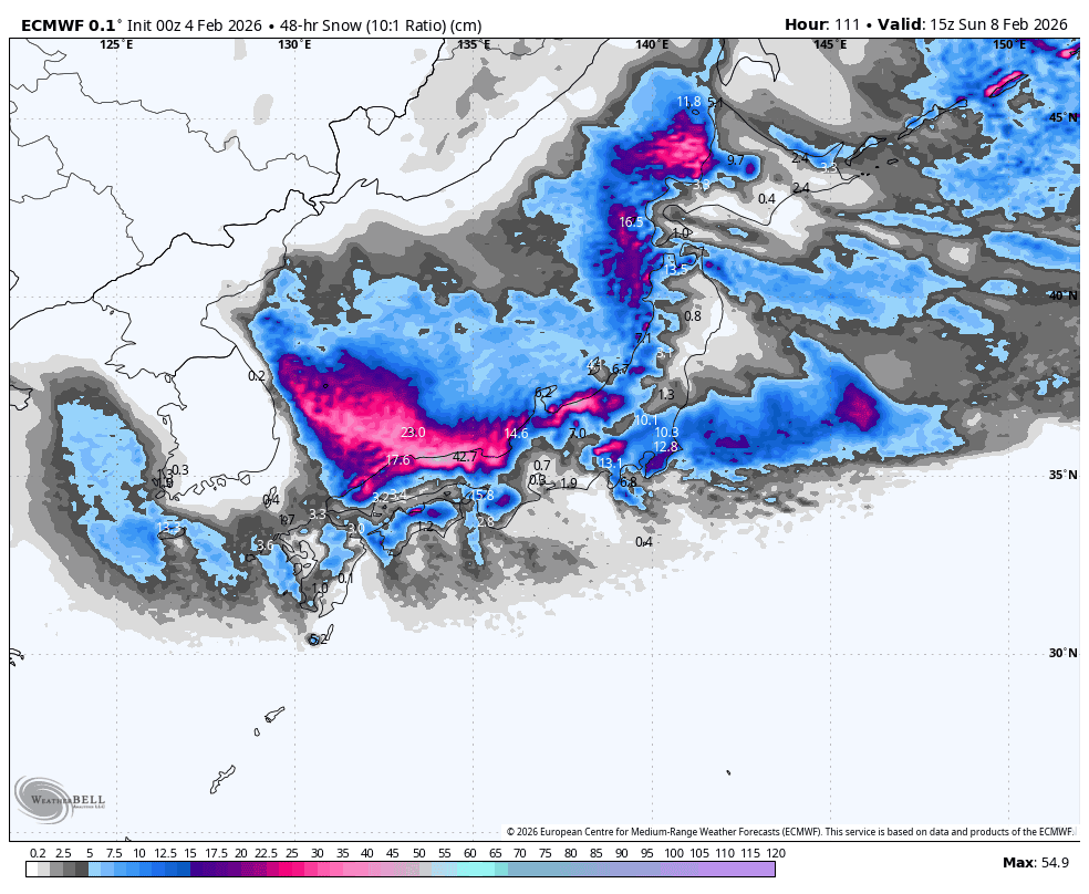
Saturday 7th & Sunday 8th February
The snowstorm continues this weekend, delivering heavy snowfall across the country. For much of Honshu, the heaviest snowfall will come Sunday after a low swings past on the Pacific side. And for Hokkaido, snowfall will wax and wane at some point, but models disagree on the timing, so I can’t tell you with any real certainty.
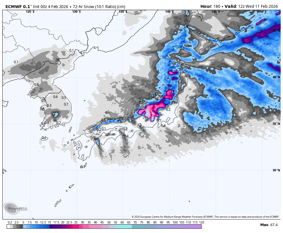
Monday February 9th to Wednesday February 11th
The snowstorm winds down early next week, with snowfall gradually clearing southwestern and central Honshu during Monday, then northern Honshu and Hokkaido early Tuesday. However, another frontal belt may build over northern Tohoku later on Tuesday.
On Wednesday, a weak low-pressure system in the north brings milder conditions and a little more snow to Hokkaido, while a stronger system from the southwest spreads heavy rain and high-altitude snow up Honshu. Thankfully, the tail end of the southern storm is expected to turn cold and powdery the following day, on Thursday the 12th.
That’s all from me today, folks. Have a great week, and I’ll see you here next Thursday for another weekly rundown of Japan’s highlights and snowlights.
Grasshopper


