Weekly Japan Forecast, Thursday Jan 22nd – Long & Strong Storm Underway
Mountainwatch | The Grasshopper
Written late Wednesday, 21st January (Japan Standard Time)
It was a rather warm and slushy weekend and start to the week for central Honshu, and the much-anticipated snowstorm that arrived on Tuesday didn’t materialise in Hakuba. However it will have by the time you read this, with the storm hitting that area as I write. Still, other resorts elsewhere in central Honshu reported decent numbers this Wednesday morning.
It’s been a different story up north, where it’s been cold with steady snowfall. Resorts in the north of Honshu and on Hokkaido have recorded 10-40cm of consecutive snowfall over the last five days.
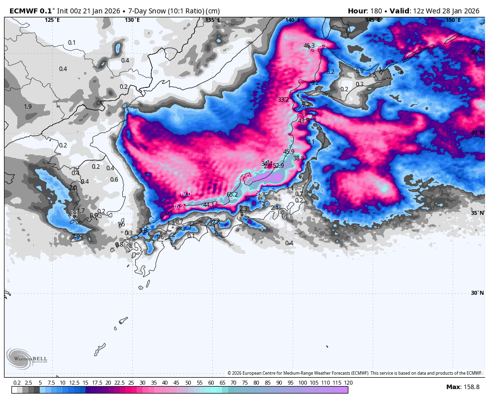
The storm cycle that kicked off on Tuesday will continue to rage over the country for much of the foreseeable future. It could be the biggest cycle of the season so far, and seven-day totals will be massive, especially in Central Honshu (Hakuba included), where snowfall will be heaviest this weekend and again from late Tuesday. Resorts further north will continue to pile on the powder too, with lighter, steadier snowfall.
For up to date on the ground conditions as this storm progresses, check out the daily snow reports for Niseko, Hakuba, Nozawa Onsen and Myoko.
Thursday January 22nd and Friday January23rd
At the time of writing, much of the Sea of Japan side of Japan has snow showers on the radar, except for the popular Nagano prefecture. Niigata, on the other hand, is under a band of moderate-to-heavy snowfall moving in thick and fast. This band of snow marks a slight shift in winds to the northwest and a touch colder airmass.
The band of snow will push down into Nagano this Wednesday evening with a solid top-up of powder overnight, setting up an excellent day on the slopes for Thursday. Nagano will then see limited lighter snowfall on Thursday as the band retreats back up into Niigata, but it‘ll build a little through the latter half of Friday.
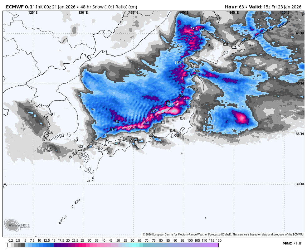
Fairly regular light-to-moderate snowfalls further north, along with isolated heavier falls, will see most resorts picking up a solid 20-50+ cm over this two-day period. Little can be said about the trend in snowfall, other than it becoming more widespread for a time on Thursday as winds tilt westward.
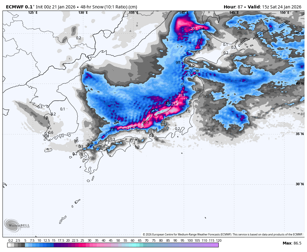
Saturday January 24th & Sunday January 25th
The storm cycle continues through the weekend, with heavy snowfall favouring central Honshu, where a whopping 50-100+ cm will pile up over a 48hr period.
Northern Honshu and Hokkaido will generally see lighter and less persistent snowfall, but we should still see around 10-40cm across most resorts. Those furthest from the Sea of Japan coastline, such as Furano, will be on the lower end of that range.
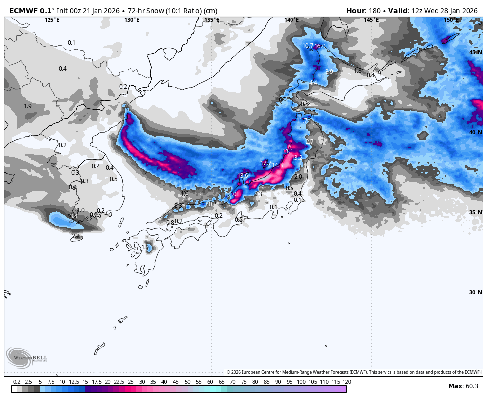
Monday January 26th to Wednesday January 27th
Snowfall over central Honshu eases and possibly clears during Monday before the next storm surge hits later on Tuesday, with heavy snowfall once again returning and persisting through Wednesday (and possibly the following few days).
Snowfall rates will taper downwards over northern Honshu and Hokkaido, but they’ll be more persistent throughout this three-day period. So, we should see a more even spread of snow throughout Honshu at least, with Hokkaido likely picking up a much lighter load.
That’s all from me today, folks. Have a great week, and I’ll see you here next Thursday for another weekly rundown of Japan’s highlights and snowlights.
Grasshopper