Weekly North America Forecast, January 7th – Storms Warm Up in The North & Dry Up Across The US

Written Wednesday afternoon, 7th January (Pacific Standard Time)
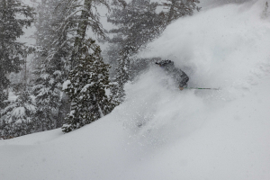
Storm activity over the past few days has delivered more powder days in BC, the Cascades, the Northern Rockies and Tetons. This storm also delivered some much-needed snow in Utah and Colorado while Canada is looking good for more snow next week.
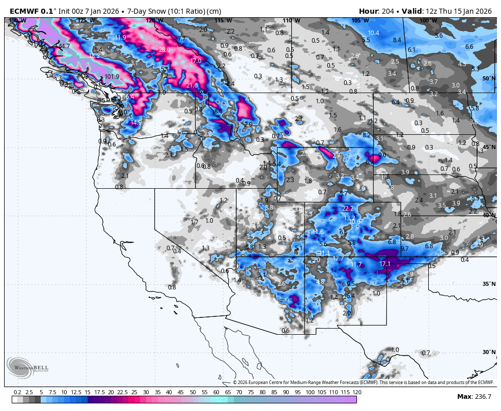
7-Day snowfall accumulation. Note that snow depths here are calculated using a 10:1 ratio, where 1mm of rain equals 1cm of snow. This can significantly underestimate things here in North America, where 1 mm of rain often equates to 1.5-2 cm of snow, especially in the Rockies, where it can be really light n’ fluffy. Source: ECMWF, WeatherBELL.com
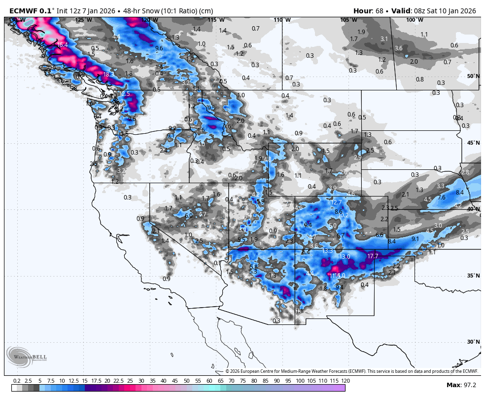
Thursday January 8th & Friday January 9th
A fairly modest storm that spread throughout much of Western North America during Wednesday has seen a cold airmass push down over the north, resulting in light, but high-quality powder falling across Canada and the Cascades.
The cold airmass will continue pushing south through the Sierras and US Rockies Wednesday night and during Thursday, where snow quality and snow levels will also improve. After a period of mostly light-to-moderate snowfall, high pressure will move in from the west and settle over the US, bringing clear, dry conditions.
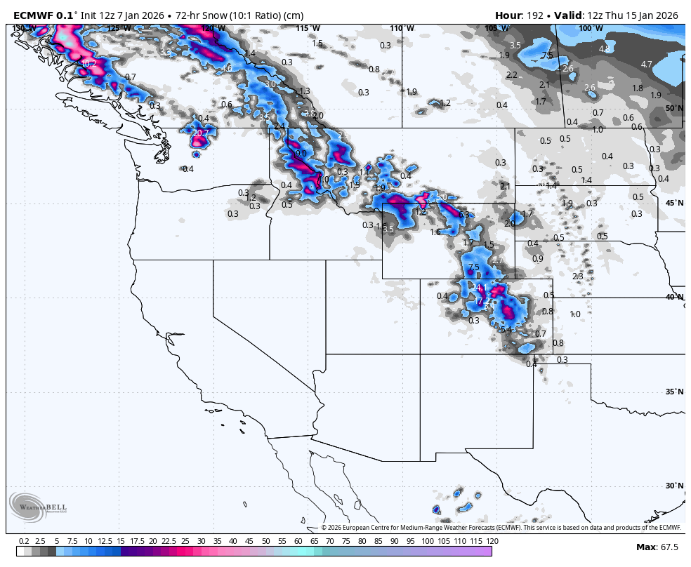
Colorado, Arizona and New Mexico will do well out of this storm, thanks to an extra couple of low-pressure systems passing nearby, with 25 to 50+cm expected on exposed terrain. Similar totals should also show up in the Cascades, northern Idaho and Montana.
Saturday January 10th & Sunday January 11th=
High pressure will remain firmly rooted over the western US this weekend, bringing dry and mostly sunny skies, and a warming airmass.
North of the high, strong, humid winds off the Pacific will rip over Canada and the northern Cascades, bringing heavy precip to the Coast Mountains, and light-to-moderate falls to the Canadian Rockies. However, snow levels will gradually creep up, exposing low and mid terrain to rain.
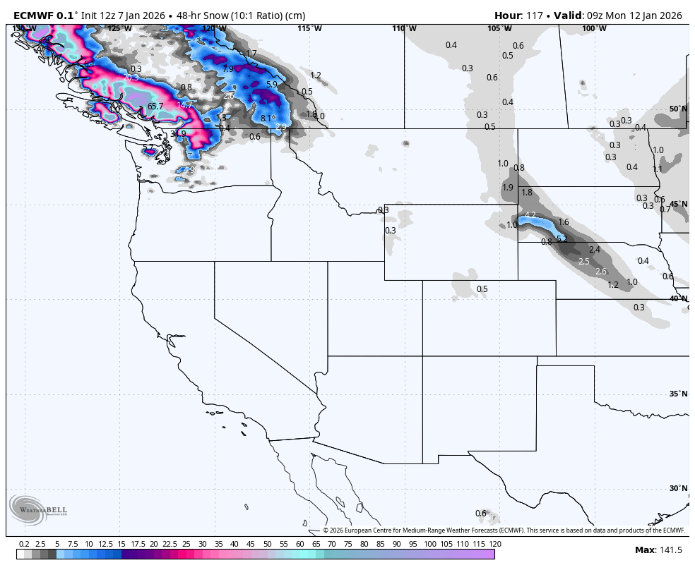
Monday January 12th to January Wednesday 14th
The stormy pattern north of the border persists through Monday, the storm even pushing into northern Idaho and Montana, before buttoning off and clearing during Tuesday and Wednesday. Again, warm temperatures and elevated snow levels will be an issue, with rain affecting mid and even upper terrain of most resorts.
While most of the US remains dry under the persistent high pressure, some of that moisture in the north scoots down its eastern flank during Tuesday and Wednesday, dumping a load of lower-quality snow over Montana, eastern Wyoming, and eastern Colorado. Rain and slush will also affect the lower terrain in these parts.
That’s all from me today, folks. Have a great week, and I’ll see you back here next Thursday for another weekly rundown of North America’s highlights and snowlights.
Grasshopper