SNOW ALERT NZ – Incoming storms for the North Island
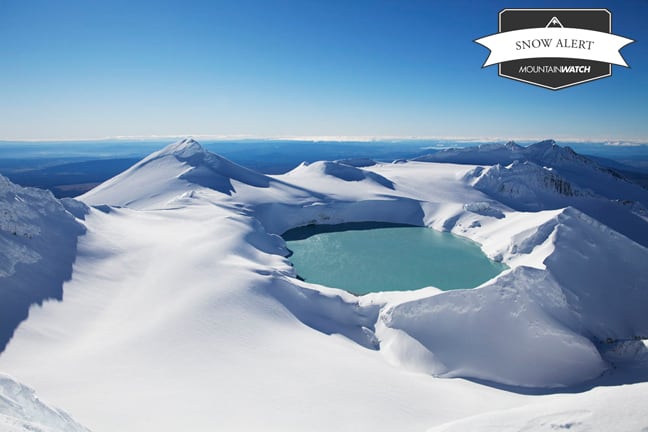
It’s a safe bet that it won’t be looking like that up there right now Image:: Krystle Wright
SNOW ALERT
Filed: August 12 2013
Snow Likelihood rating: On its way already…
It’s windy, it’s wild, the mountain is closed but it’s snowing. Some wild weather has descended upon the North Island and there is more on its way. At last report there has been about 5 to 15 cm depending on where you look.
In today’s update The Grasshopper said, “South-westerlies and snow showers today, with another 10 to 25cm of fresh snow possible. Tomorrow will see the snow showers clear by about midday, but then rain will return in the evening ahead of another cold front, with another 10cm above 2000m. On Wednesday that front will have moved through and the models suggest we’re going to get pounded by westerlies and snow showers. Right now our forecasts suggest 40cm. That might jump around a bit, but either way it’s going to be a lucrative few days.”
With wind and snow expected for the best part of this week the best strategy is probably best to sit it out and wait. Once that weather clears it will be on, if you’re around snap some Instagrams and add a #mountainwatch.
Read more: here
Turoa forecasts,
snow reports and
live snow cams.
Whakapapa forecasts,
snow reports and
live snow cams.


