Storm Journal June 22nd-26th – More Terrain Opens as Cold Fronts Deliver Regular Top-ups and Gusty Winds
Mountainwatch |Reggae Elliss
After the slow start to the season we’ve seen a good turnaround here in the mountains over the past week with more lifts and terrain in all resorts open thanks to a consistent run of windy and snowy weather since last Thursday.
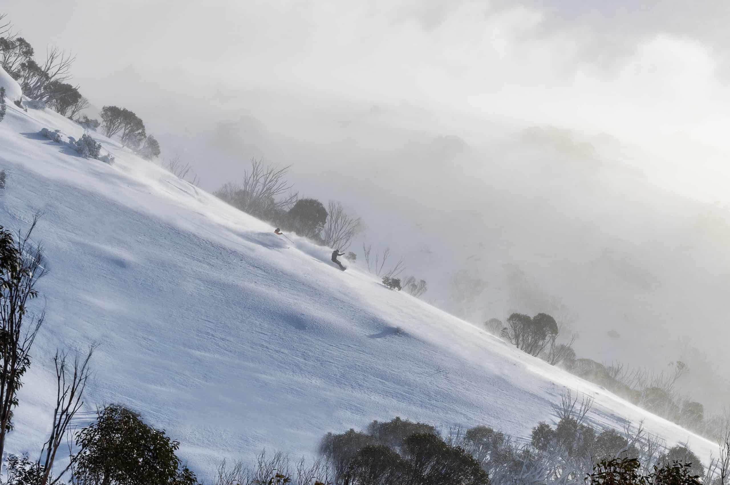
A series of weak cold fronts brought daily snow totals of around 10-15cms although Falls and Hotham received 20cms on Sunday night and Thredbo, Perisher and Charlotte Pass saw 20cms in the past 24 hours. While the accompanying strong and gusty northwest winds caused some wind-hold issues, they also blew in a lot of snow, filling in the terrain at higher elevations.

The NSW resorts, Falls Creek and Hotham picked up the most snow where the totals since Thursday range from 55-70cms. That was on top of the 25cms that fell on June 18-19. Buller missed out on the snow on a couple of days and has received 22cms since Thursday while Mt Baw Baw received 16cms. Selwyn Snow resort, which is further north also picked up 20+cms.
Selwyn re-opened last Friday for the first time in three years, after a rebuild following the damage caused by the bushfires in the 2019/220 summer.
The cold fronts weren’t particularly strong, and temps were marginal at lower elevations, but upper elevation saw some good totals. That was expected, the Grasshopper writing in his forecast on June 21 that, “It’s these marginal temps that have kept me on my toes, with snow levels bouncing around between 1300-1700m over the next several days, while gale NW winds whip over the Aussie Alps.”
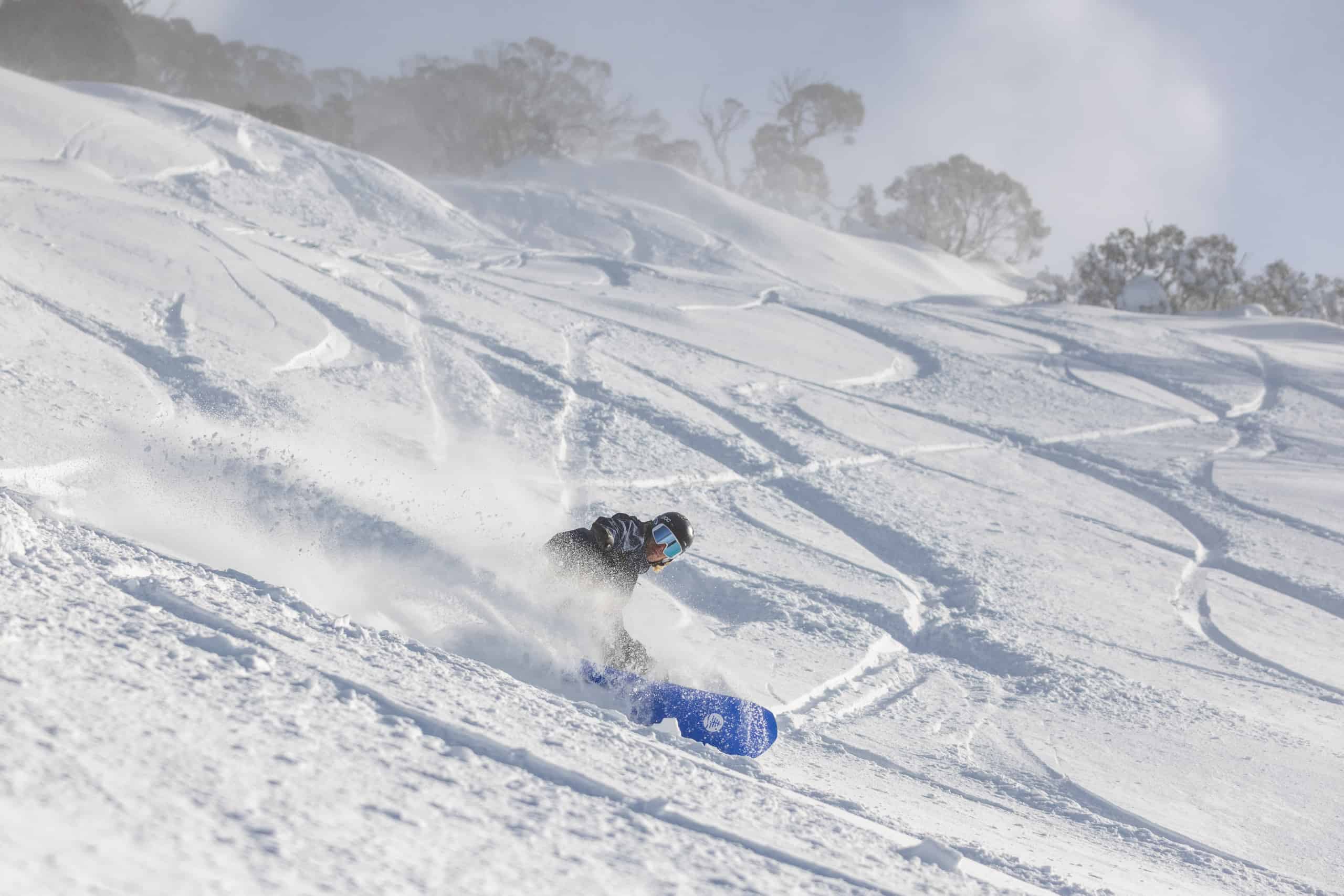
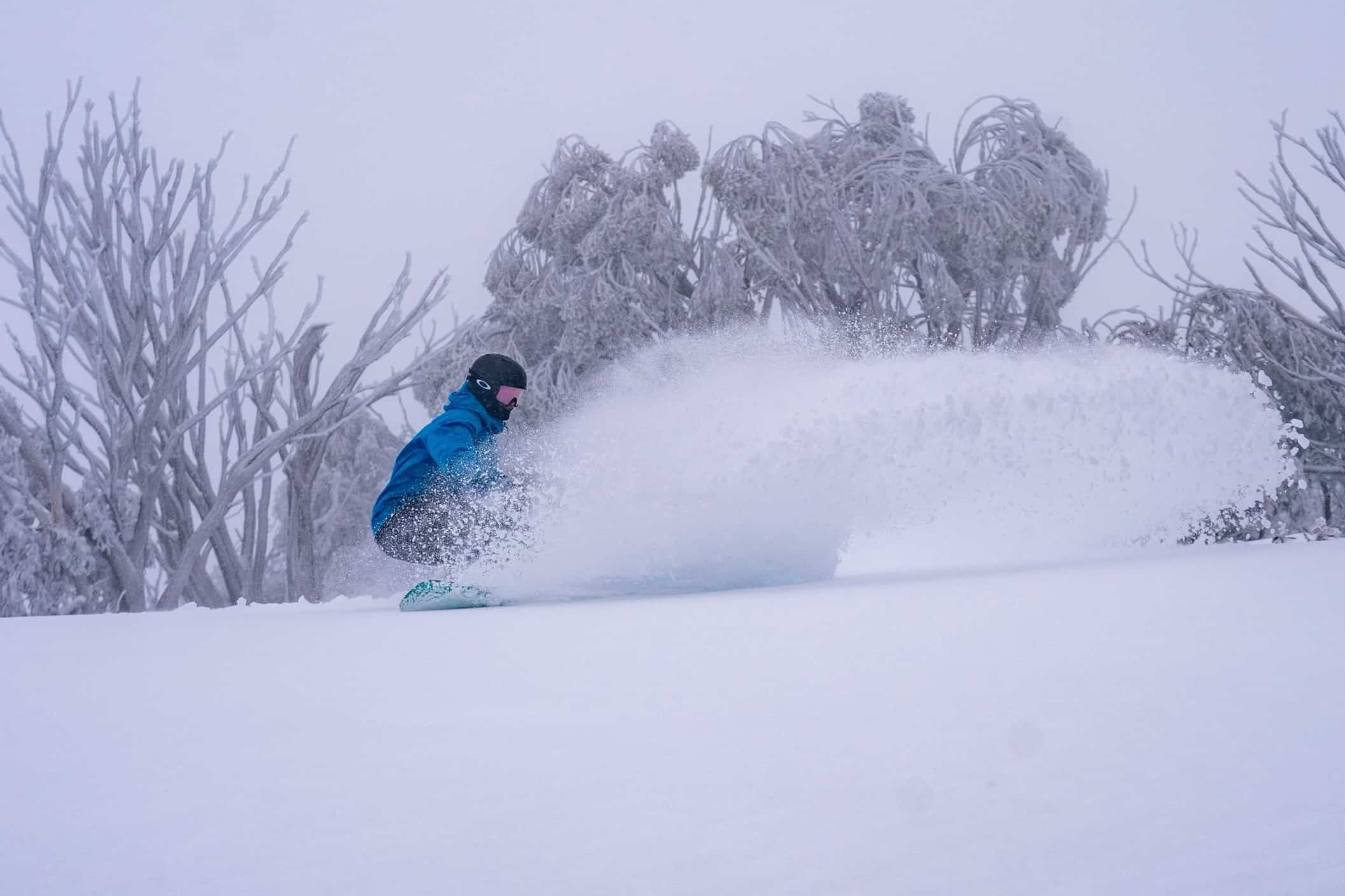
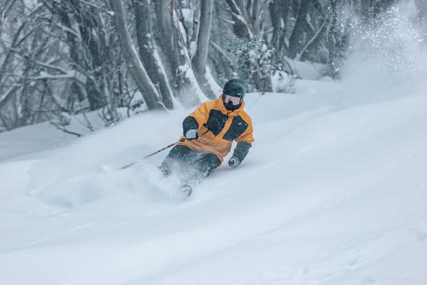
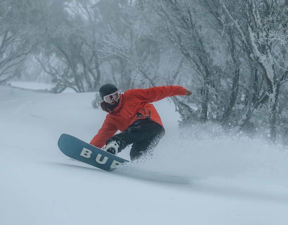
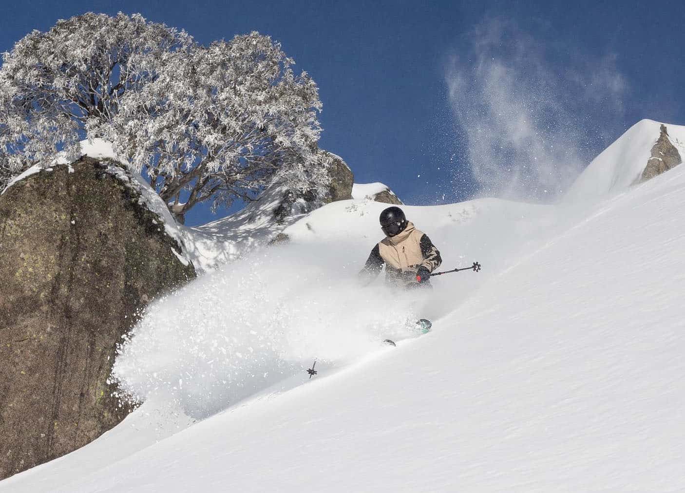
There was drizzle at times at lower elevations and it was wet in Thredbo village yesterday, but the snow quality above 1600 metres was pretty good. The wind and visibility made it hard going at times, but it was worth it to get some fresh turns. Sunday turned out to be a surprise blue-bird powder day, with a few hours of sunshine, colder temps, dry snow and easing winds.
After a delayed start due to wind, Thredbo opened the Kosi chair for the first time this season and the laps in the Bluff were among the best I’ve had, especially this early in the season. That was the story at the other resorts as you’ll see from the photos below.
The final front came through last night with Falls, Hotham, Perisher and Thredbo receiving another 5-10cm and this morning was also pretty good with a mix of fresh and wind-blown snow. The forecast is for a few snow flurries today and tomorrow followed by a pool of cold air tomorrow night and Thursday which will see the snowmakers fire up the guns.
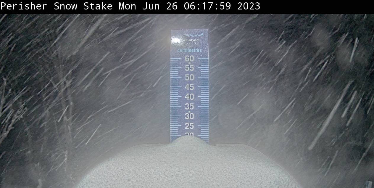
Falls Creek now has a base of 97cms, Hotham 82cms while Perisher and Thredbo, which equate their base with Snowy Hydro’s snow depth reading at Spencers Creek, are still saying a base of 57.7cms, the snow depth reading on June 21st. The base depth will change when Snowy Hydro do the next reading, but it should be up around 80cms.
The timing of the weather and snow could not have been better with school holidays underway, and I expect we’ll see more lifts open by the weekend. Check out our daily snow reports from our independent on-the-ground snow reporters for the latest updates on snow and weather conditions in your favourite resort.
And, of course, for the full analysis on the when the next snow is due the Grasshopper publishes his forecasts every Monday, Wednesday and Friday.