Australian Forecast, June 21 – Crisp and Clear Today, Light to Moderate Snowfall from Late Thursday
Mountainwatch | The Grasshopper
Valid Wednesday 21stJune to Friday 23rdJune
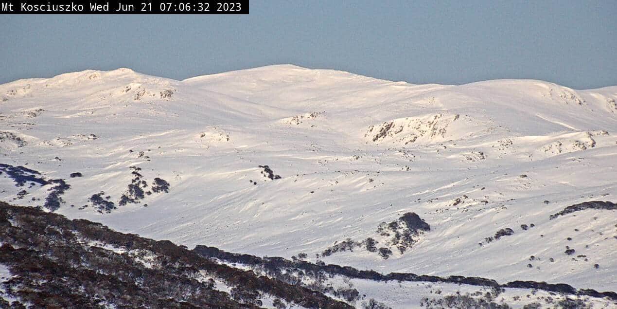
The slopes are wonderfully white after 20-25cm fell during Monday. Temps are positively freezing this morning, so they snow guns have been going hard piling it up on the groomed runs, and with clear blue skies, today is worth the effort.
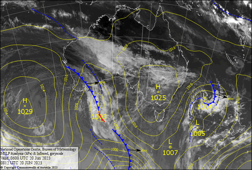
The clouds will build during Thursday ahead of an approaching low, which will bring yet another top up that night, with light to moderate snowfall persisting through Friday.
With even more snow expected this weekend and early next week, the slopes will be humming with a solid base, built up little by little after this long string of small to moderate snowfalls.
Wednesday 21st
A beautiful, winters day with a freezing, cold start, temps deep into the negatives. However, it’ll warm up as a light northerly breeze kicks in.
Thursday 22nd
During the morning, it’ll be partially cloudy due to mid & high level cloud, with a light shower or two possible first thing.
In the afternoon, the cloud will thicken with a few light showers/flurries returning, turning into widespread snowfall during the evening.
Snow levels are tricky; they’ll mostly be in the 1300-1500m range, but are likely to lift to 1500-1800m for a time at night. Vic resorts will be at the lower end of those ranges, while NSW will be at the higher end. Northerly winds gradually strengthening throughout the day.
Friday 23rd
Mostly light snowfalls throughout the day, then a period of more persistent, heavier falls during the evening and night. Snow levels around the 1400m mark, give or take 100m or so. NW winds rising to gale in exposed places with reduced visibility.
Extended Forecast
The flakes will continue to fall this weekend, especially Saturday night into the early hours of Sunday as a front passes over, bringing what should be at least a tidy 5-15cm. Freezing levels will be hovering around 1500m, so slopes below that may get a little wet and slushy at times.
Monday should bring yet another dump of snow, while a low ducks underneath, possibly followed by lighter snowfall during Tuesday and next Wednesday before high pressure settles in.
That’s all from me today, folks. See you again on Friday!


