Grasshopper’s Weekly North America Forecast, Thursday Jan 23rd – Light snowfall for Canada and Northern Rockies, Snow at last for Sierras and the South

Mountainwatch | The Grasshopper
Written Wednesday afternoon, 23rd January (Pacific Standard Time)
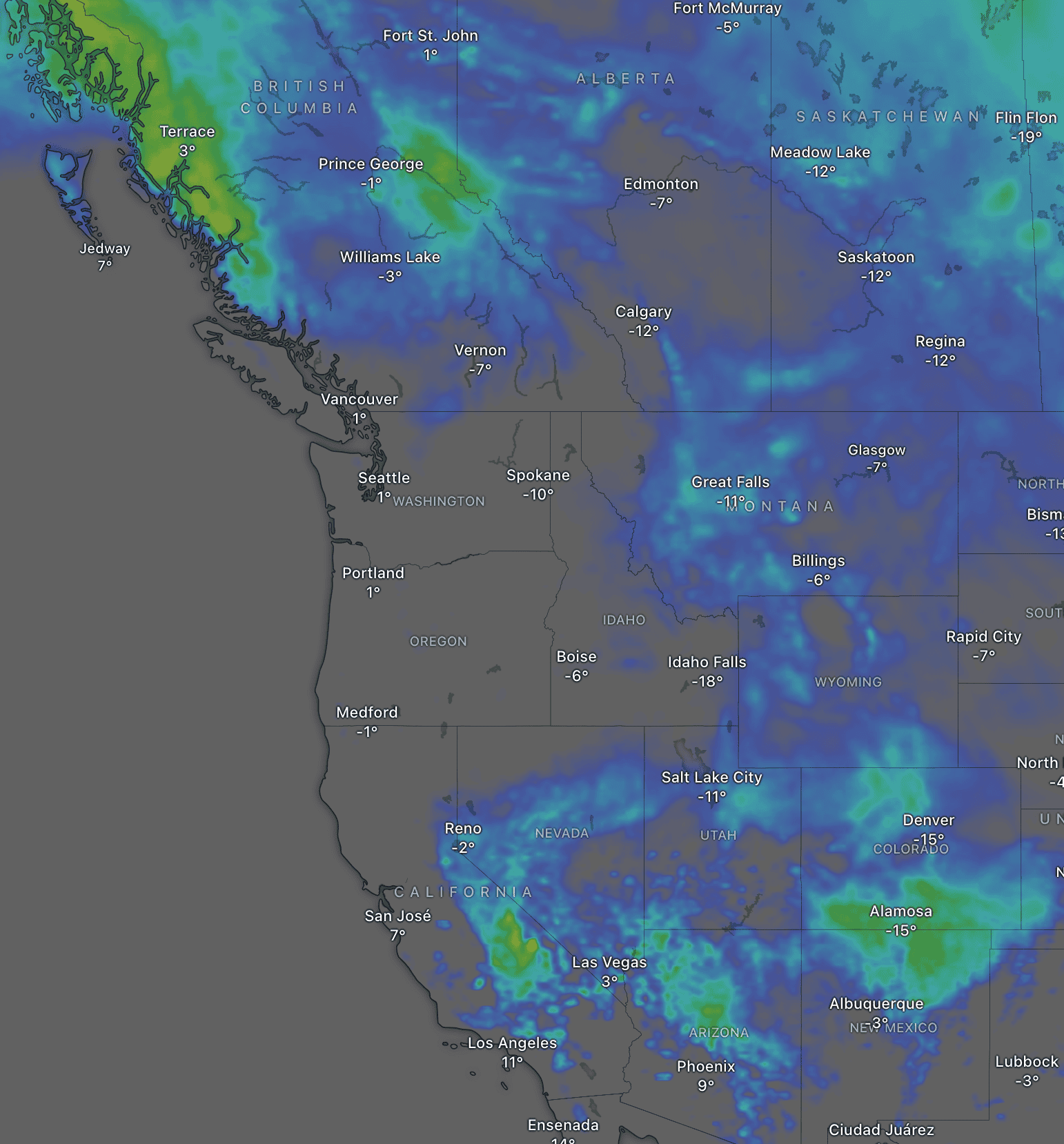
Temperatures have bounced back somewhat after a bitterly cold arctic airmass brought the coldest temperatures of the season to many parts of North America, reaching 10-20 degrees or more below zero. Despite the cold, it was a quiet week in terms of snowfall, with Canada and the eastern Rockies picking up just a light shot or two of powder between bouts of sunshine.
The next seven days won’t bring much more snow for the north, with only light snowfall adding up to trace amounts for many Canadian resorts and a wee top-up for areas east of the Continental Divide in the northern half of the U.S. during Thursday and Friday.
Further south, the Sierras, Arizona and New Mexico will at long last receive a more substantial top-up thanks to a storm system setting up over the area this weekend before tracking eastwards early next week. The storm will also clip southern parts of Colorado and Utah on Tuesday and Wednesday on its way out of the west.
Thursday January 23rd & Friday January 24th
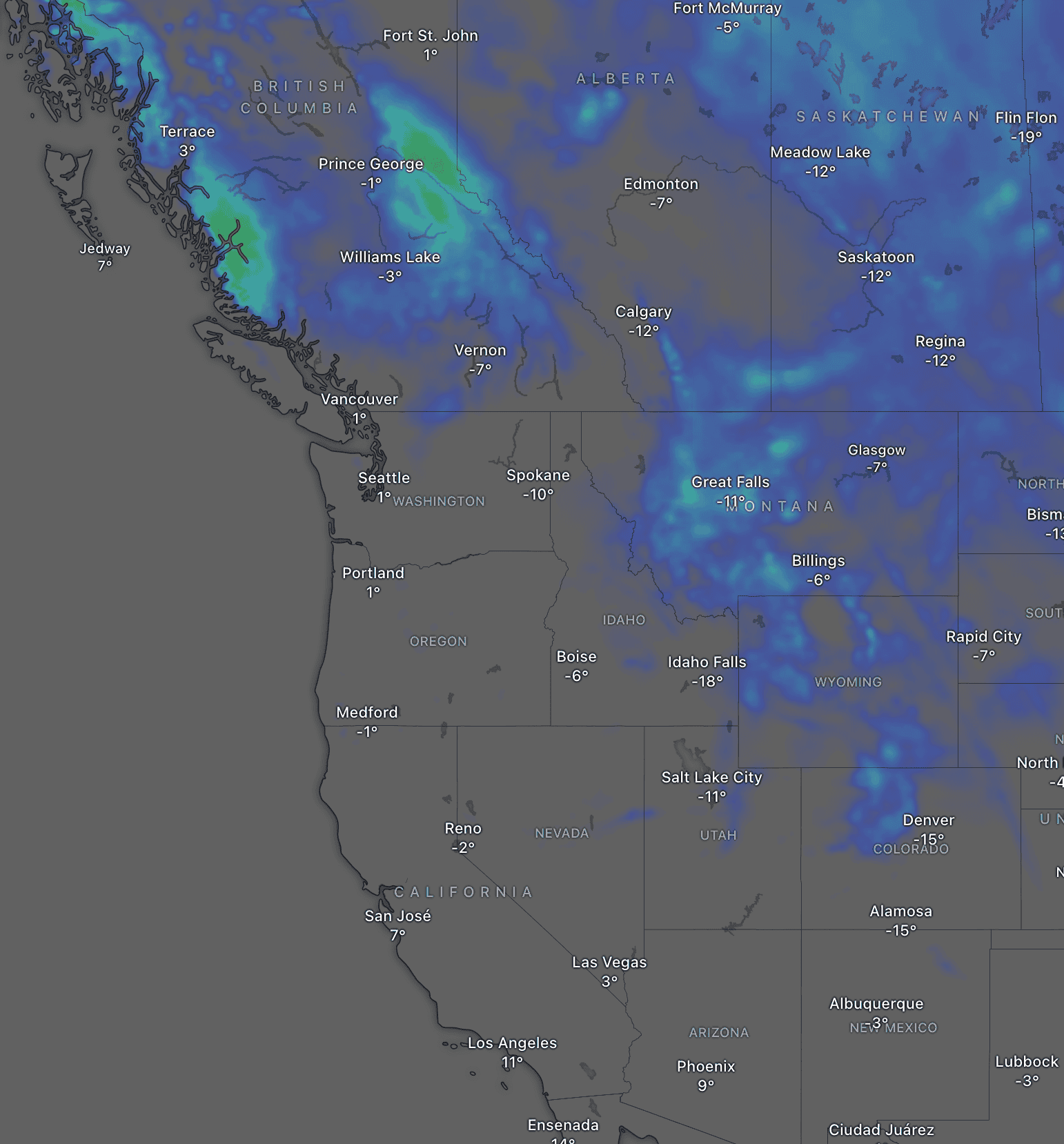
On Thursday, a front in the north will weaken as it moves southwards over western Canada, with moderate-heavy snowfall in northern B.C tapering to light-very light by the time it reaches the majority of resorts in the south, with only a dusting or trace amounts at best expected to accumulate. High pressure further south will bring clear, sunny skies.
On Friday, skies clear in Canada as the weak front continues to slide southwards down the Rockies into northern Colorado. Areas east of the divide will be favoured and will do better than their northern counterparts, with around 5-10cm in Montana, Wyoming, and northern Colorado. However, zero-to-trace amounts will fall west of the divide.
Saturday January 25th & Sunday January 26th
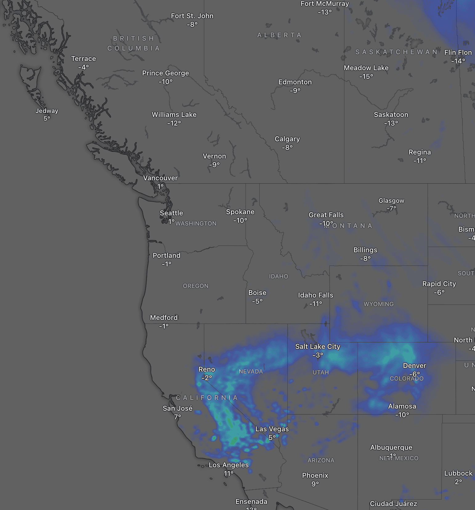
On Saturday, a low sets up over the south, allowing snowfall to expand westward from Colorado through Utah into the Sierras along a band of precipitation, marking the boundary between cold northern air and warmer, humid southern air. Snowfall will eventually spread to southern California and northwest Arizona on Sunday while drying up and becoming fine elsewhere. Areas affected will likely pick up a tidy 5-15cm, the first snowfall in the Sierras in weeks!
Meanwhile, resorts in Canada, the Cascades, and the northern U.S. Rockies will enjoy a settled, sunny weekend thanks to high pressure.
Monday January 27th 20th to Wednesday January 29th
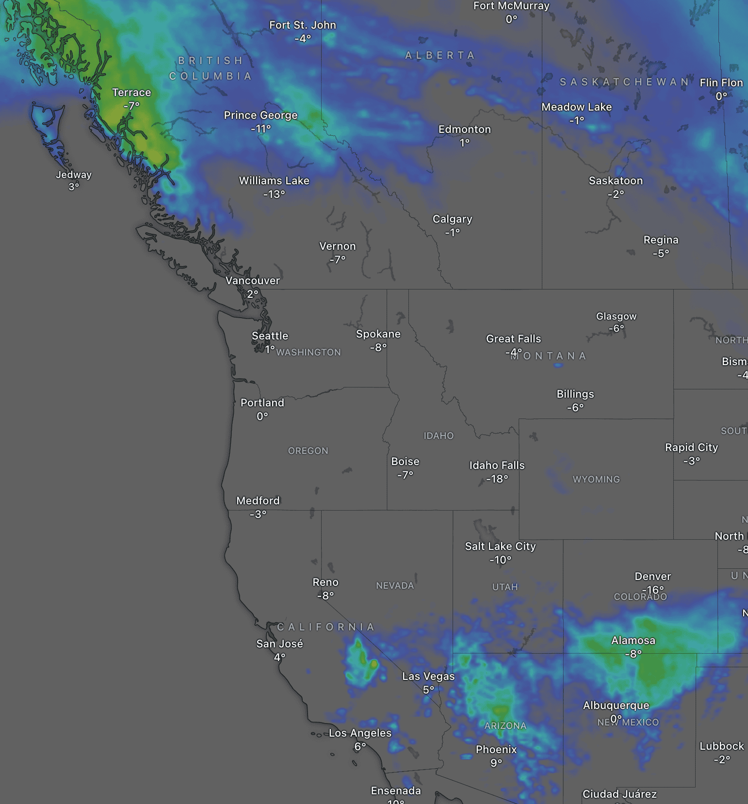
The low in the south will track eastwards during this time, dragging snowfall away from southern California Monday night and through Arizona, New Mexico and southern Utah/Colorado on Tuesday and Wednesday. The injection of moisture from the south into the storm system will likely lead to localised heavy falls where up to 35-45cm is possible, although most areas will receive around 10-25cm.
Skies will remain sunny further to the north as high pressure persists. However, at some point on Wednesday, we could see the next storm enter northern B.C.
That’s all from me today, folks. Have a great week, and I’ll see you back here next Thursday for another weekly rundown of North America’s highlights and snowlights.
Grasshopper