New Zealand Weekend Forecast, Friday September 26th – More Powder, Rain & Gales Ahead as Season Enters Final Stretch
Mountainwatch | The Grasshopper
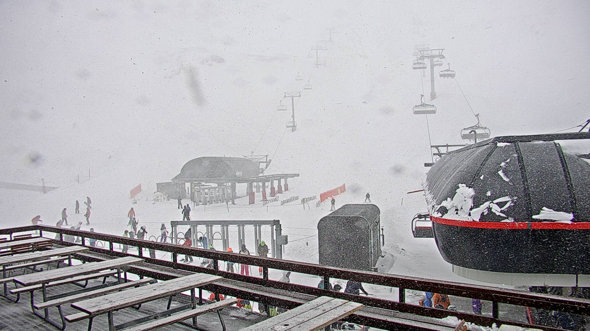
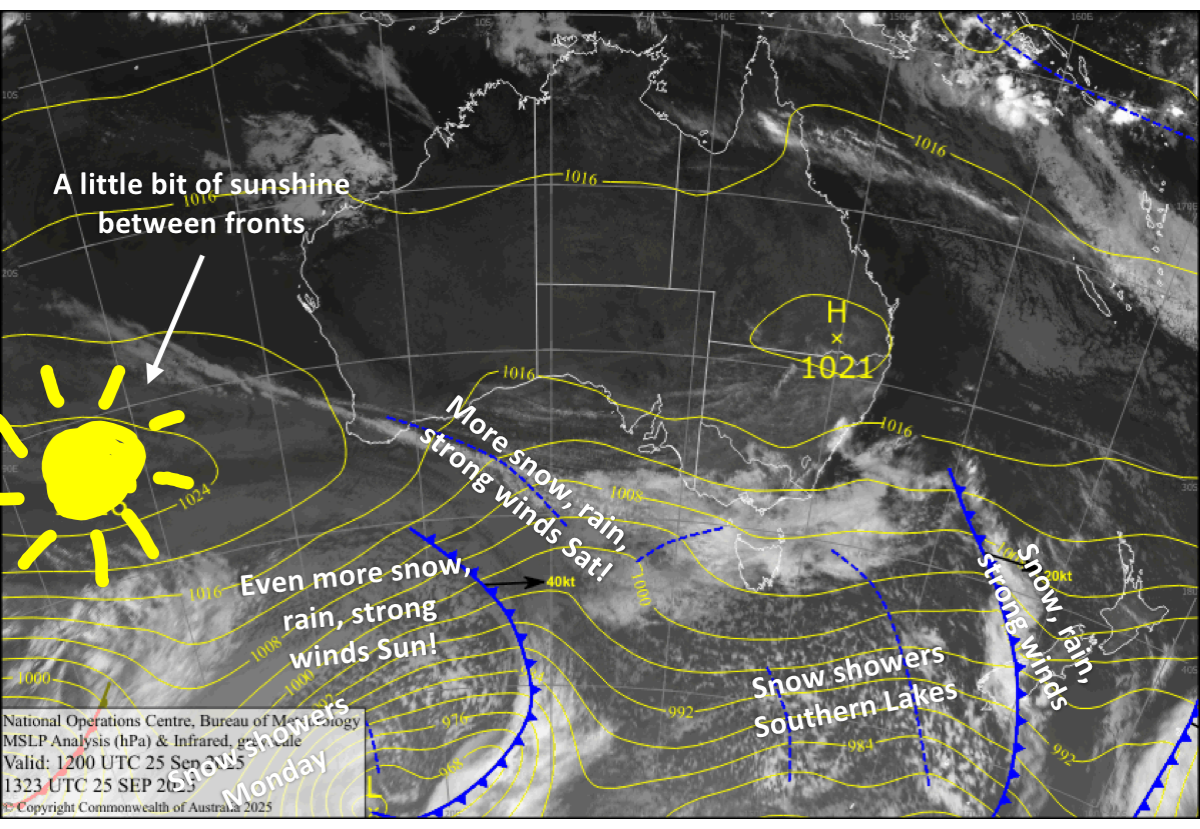
A front ripped through the Southern Lakes Wednesday night and Canterbury early Thursday, bringing a wee top-up and a dusting of powder respectively, though it was a little less than expected. Still, the snowpack is looking good as we head into the final stretch of the season, which will remain lively with fronts expected to roll through every day or two, dishing up a mix of powder, rain, and strong winds.
Make the most of it while you can as Treble Cone and Coronet Peak will have their closing days this Sunday, Cardrona closes next Sunday, the 5th October, and The Remarkables and Mt Hutt finish on the 12th October.
Friday September 26th
The Southern Lakes will wake up to a fresh dump of powder and a cold westerly wind from a front passing through overnight. Snow showers return later in the morning, then clear up late afternoon and early evening, bringing another few centimetres or so.
The front will also dump around 5-15cm over Canterbury ski fields as it crosses in the morning, accompanied by severe northwest gales. Mt Hutt will likely sit at the lower end of that range, with rain and sleet on the lower slopes. Behind the front, northwest winds ease a touch, but will continue to blow a gale in exposed areas. Mt Hutt clears to mostly sunny skies, while other ski fields may see an extra snow shower or two in the afternoon.
The front also passes over Mt Ruapehu later, bringing a period of rain and high-level snow late afternoon and evening. However, there’ll be some lighter snow showers beforehand as northwest winds strengthen.
Saturday September 27th
It’ll be a fine start for South Island ski fields, but cloud will build before the next front from the west passes over, bringing a mix of rain and 5cm or less of upper-level snow during the afternoon and evening. Northwesterlies gradually strengthen, reaching gale force in exposed areas late afternoon.
Light rain and high-level snow on Mt Ruapehu clears late afternoon as northwest winds ease.
Sunday September 28th
Partly cloudy skies for South Island ski fields before another front spreads rain and upper-level snow over the Southern Lakes in the afternoon, and then just plain old rain up Canterbury in the evening, with heavy falls on the cards. Gale northwesterlies rise to severe gale in Canterbury and will likely affect lift operations there once again. A cold westerly change at night brings lighter snowfall to low elevations for the Southern Lakes.
Brisk westerlies on Mt Ruapehu will push in some cloud and a spot of drizzle onto the lower slopes.
Monday September 29th
Snow showers clear the Southern Lakes during the morning, leaving a dusting of powder and mostly sunny skies as cold westerlies gradually ease.
In Canterbury, rain clears before dawn, leaving clear skies and easing westerly winds. However, a cold southerly change in the afternoon brings light snowfall, which clears at night, leaving a fresh dusting.
Rain builds and northwest winds strengthen on Mt Ruapehu as a front approaches. Conditions ease at night after the front passes over.
Tuesday September 30th
Northwest winds pick up over the South Island, pushing some cloud over the Southern Lakes, while Canterbury stays clear.
Mt Ruapehu will be mainly fine with westerly breezes.
Extended Forecast
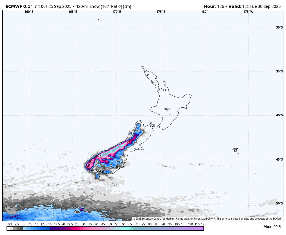
October will likely kick off with a dusting of snow as a cold change is expected to whip up the South Island on Wednesday, the 1st, and the North Island on Thursday, the 2nd. Skies clear only briefly before the spring westerly barrage of storms return later in the week. No major powder dump is expected in the foreseeable future, as each of these storm systems will primarily bring shots of rain and high-level snow accompanied by strong northwest winds at times.
That’s all from me today, folks. I’m sending out these forecasts every Monday, Wednesday and Friday throughout the season. Have a great weekend, and I’ll see you back here on Monday.
Grasshopper