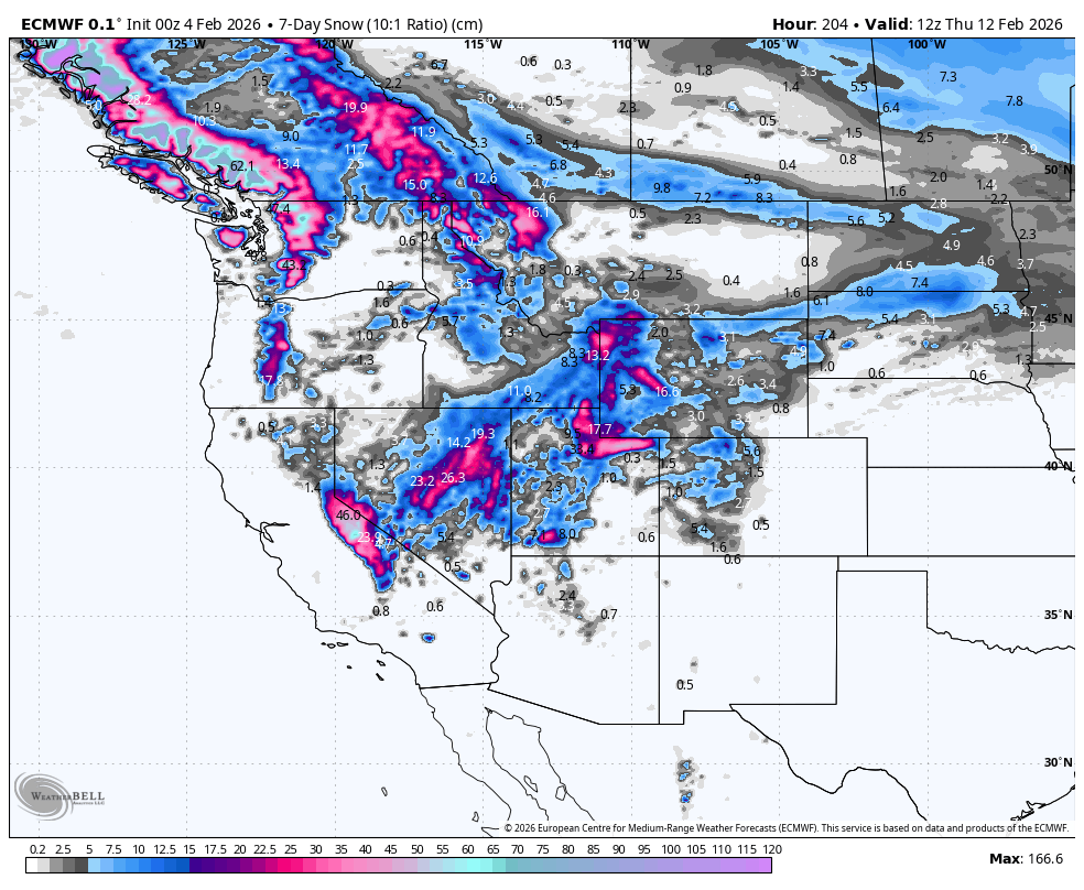
Weekly North America Forecast, Thursday, February 5th – Tide’s A-Changin’, Snow to Return to the West
Mountainwatch | The Grasshopper
Written Wednesday, 4th February (Pacific Standard Time)
High pressure has kept much of western North America warm and dry over the past couple of weeks, while low pressure and freezing Arctic temperatures have affected the east.
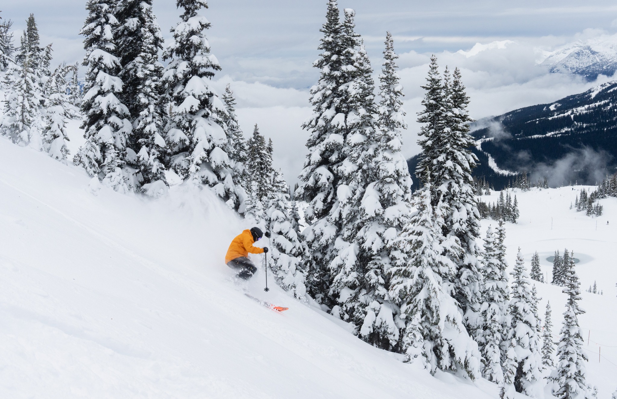
The tide will gradually turn during the next several days, with storms first returning to the north this weekend. Resorts in BC will benefit most from frequent snowfall and cooler temperatures, rebooting the season there.
A storm will also pass over the south Monday through Wednesday, bringing heavy snowfall and a solid dump to the Sierras, Utah, Wyoming and Colorado. However, warm temperatures will bring some rain to the lower terrain initially, especially in the Sierras.
Thursday February 5th & Friday February 6th
A strong ridge of high pressure will keep most of western North America dry and unseasonably warm during Thursday and Friday, a stark contrast to the freezing Arctic temperatures felt in the east.
A warm, moist southerly flow will bring heavy rain and high-level snow to the northern Coast Mountains of Canada and the Alaska Panhandle. A little moisture also sneaks in from the south, bringing showers to the southern Sierras as far north as Mammoth, where a sprinkling of snow is expected on the upper slopes on Friday.
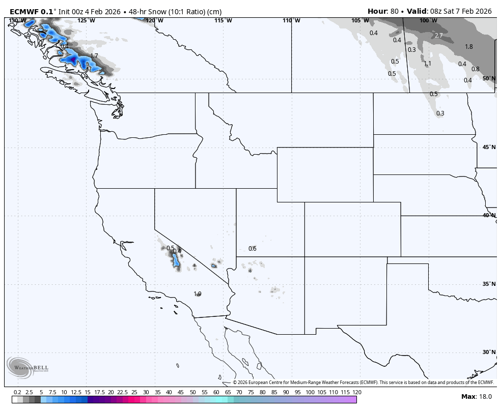
Saturday February 7th & Sunday February 9th
The warm, humid and stormy south-to-southwesterlies will push south this weekend, bringing rain and high-altitude snow as far south as Mt Shasta in Northern California, and into northern Idaho and Montana. Temperatures will trend cooler overall, especially at Canadian resorts, where snow is expected to eventually fall below mid-slopes by the end of the weekend.
It’ll remain high and dry elsewhere, apart from light showers springing up over the southern states of Utah, Colorado, Arizona and New Mexico Saturday afternoon. Some fortunate (or unfortunate, depending on how you look at it) resorts here will receive a sprinkling of snow.
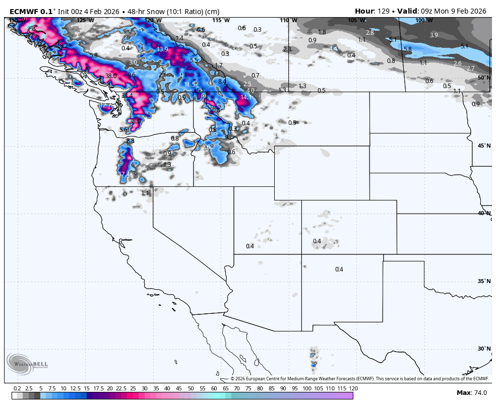
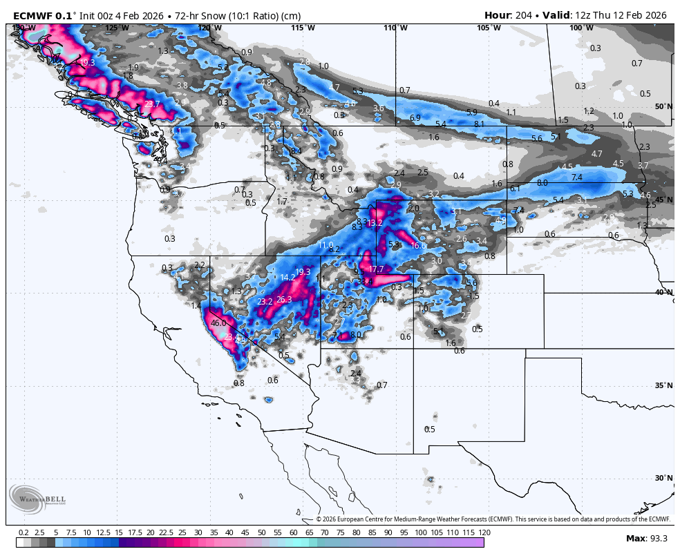
Monday February 10th to Wednesday February 12th
Over this three-day period, storms in the north will wane, as high pressure finally makes way for a storm passing over the South.
The likes of the Sierra Nevada, Utah, Wyoming and Colorado will receive heavy snowfall, with light falls in adjacent states. Again, temperatures will be mild, with rain particularly affecting the lower slopes of the Sierras. They’ll eventually trend cooler, but not until a fair chunk of the precipitation has fallen.
Snowfall in the north largely dries up during Monday, but it’ll linger in the Canadian Coast Mountains on Tuesday. Another storm front rolls down the Alaska Panhandle and Coast Mountains on Wednesday, with light-moderate snowfall also spreading down the Canadian Rockies later in the day. Temperatures will be cold enough for snowfall to reach base levels, or close to, at most resorts.
That’s all from me today, folks. Have a great week, and I’ll see you back here next Thursday for another weekly rundown of North America’s highlights and snowlights.
Grasshopper


