Weekly Japan Forecast, Thursday Feb 19th – Powder Day Thursday, Then Spring-Like

Mountainwatch | The Grasshopper
Written late Wednesday, 18th February (Japan Standard Time)
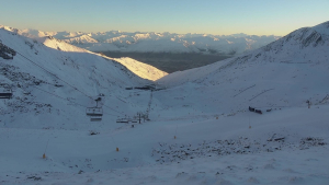
After a week of low snowfall and warm temperatures, we’ll wake up Thursday morning to a brand-spanking new layer of powder, fresh off the lot after a storm rolled in late Wednesday. It’ll be a great powder day as the storm gradually clears throughout the day.
You’ll want to make the most of it as it’ll be the last decent dump in a while as warm, dry weather takes hold Friday and through the weekend. The next storm will only give northern Honshu and Hokkaido a wee top-up of snow on Monday after some initial wet, warm conditions. The next storm after that will then likely bring heavy rain to Honshu next week Wednesday.
Has spring arrived early this season?
Thursday February 19th & Friday February 20th
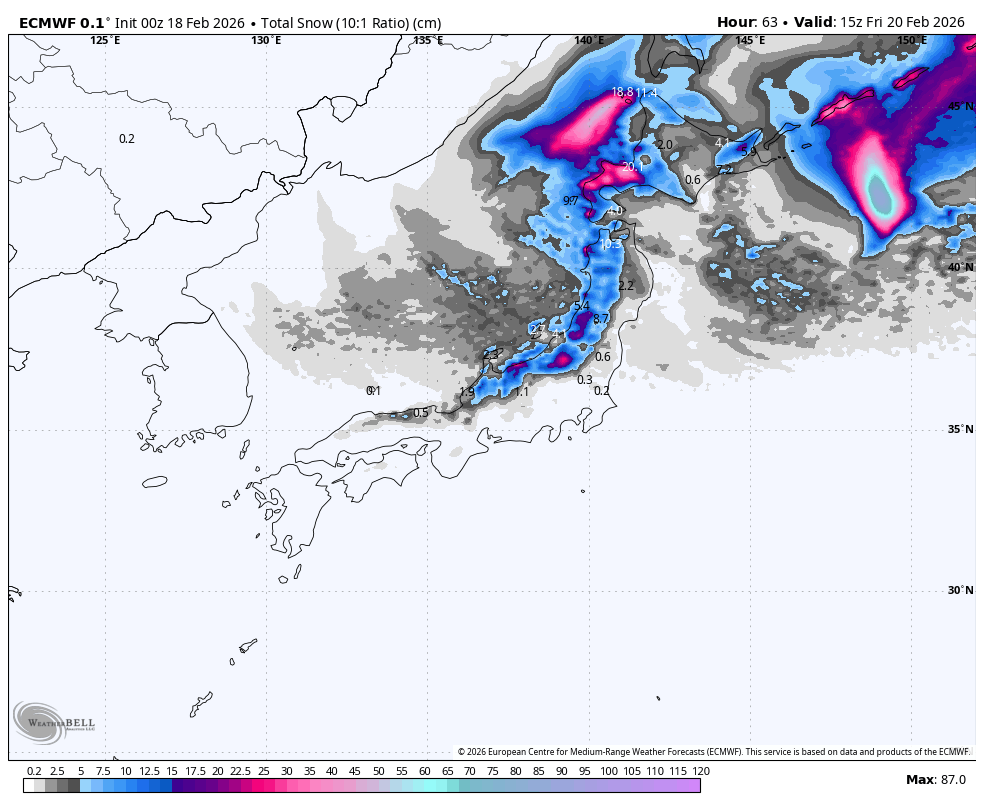
Thursday will be a great powder day after a storm arrived Wednesday afternoon. Things started a bit warm and damp, but cold air arrived from the northwest shortly after, dumping high-quality powder through the night.
Snow showers will gradually peter out during Thursday as the storm winds down – first in the Nagano Prefecture and areas to the west during the morning, then other areas to the north throughout the second half of the day and overnight. Storm totals could reach 30-45cm in parts of southwestern Hokkaido and Central Honshu, and 10-30cm elsewhere.
Friday will be another great day up the hill, with dry, sunny conditions for most, as high pressure drifts over the country. However, mild southwesterlies will push in a few light snow showers over southwest Hokkaido and northern Tohoku during the latter half of the day.
Saturday February 21st & Sunday February 22nd
The weather will remain warm, dry, and mostly sunny this weekend as high pressure departs, giving us another early taste of spring. Warm southwesterlies will turn southerly and strengthen late Sunday as the next storm approaches from the west.
Monday February 23rd to Wednesday February 25th
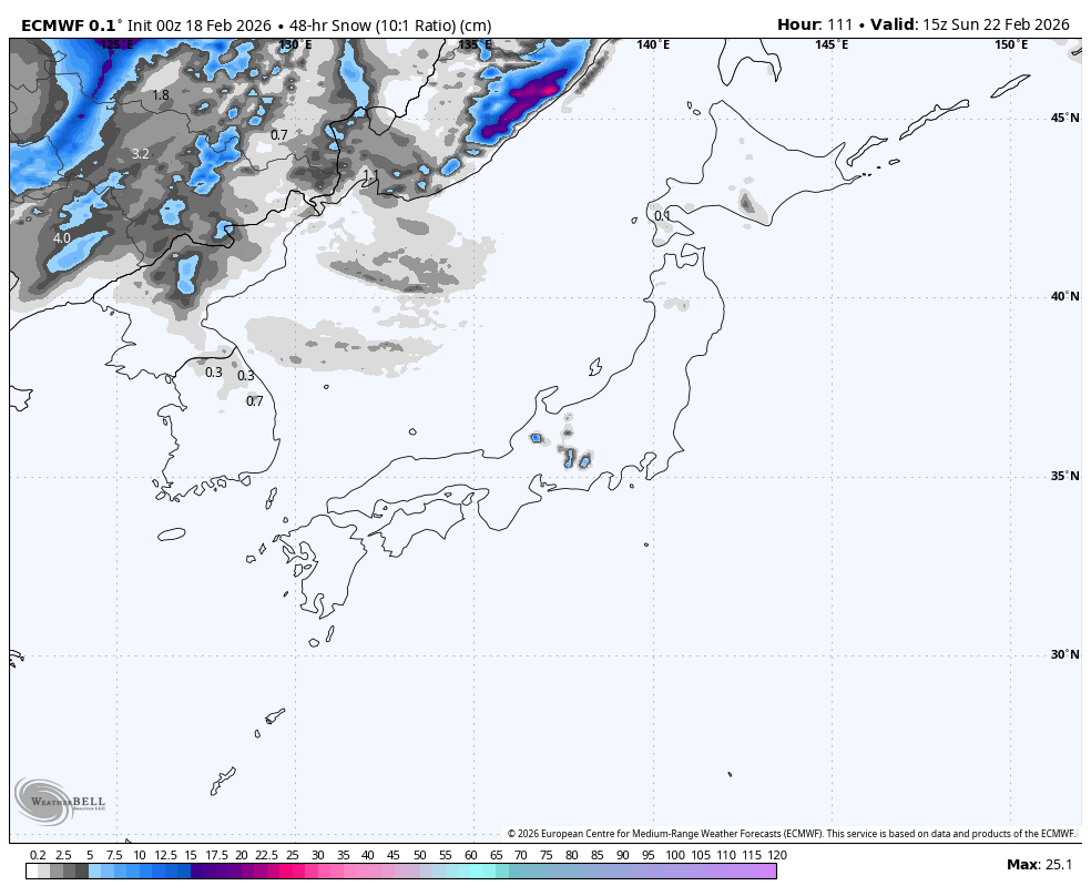
The next storm will arrive in the early hours of Monday and will benefit northern Honshu and Hokkaido with a fresh top-up of powder. However, the storm will start wet and warm again, and will be fairly short-lived, with snow mostly clearing late Monday into early Tuesday.
The storm will likely be a non-event for central and southwestern Honshu, where rain and high-level snow will predominantly fall on the Pacific side – away from the major ski resorts, thankfully – due to a southerly wind flow. Some resorts may pick up some light snow as colder westerlies arrive.
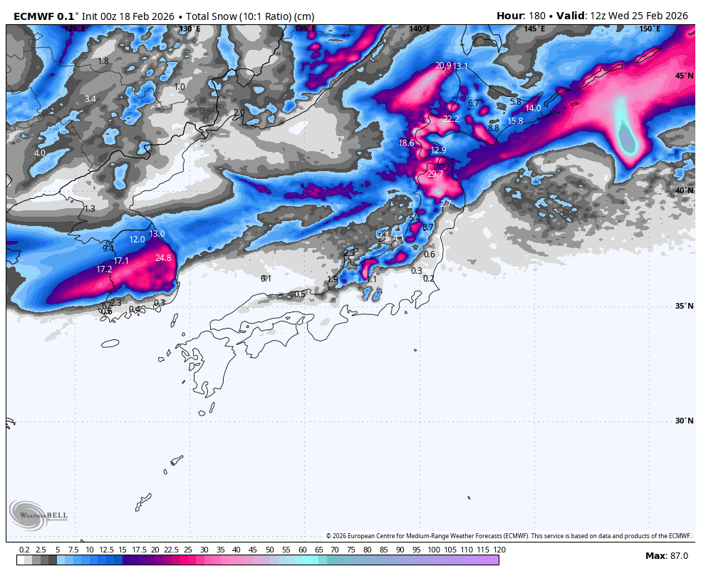
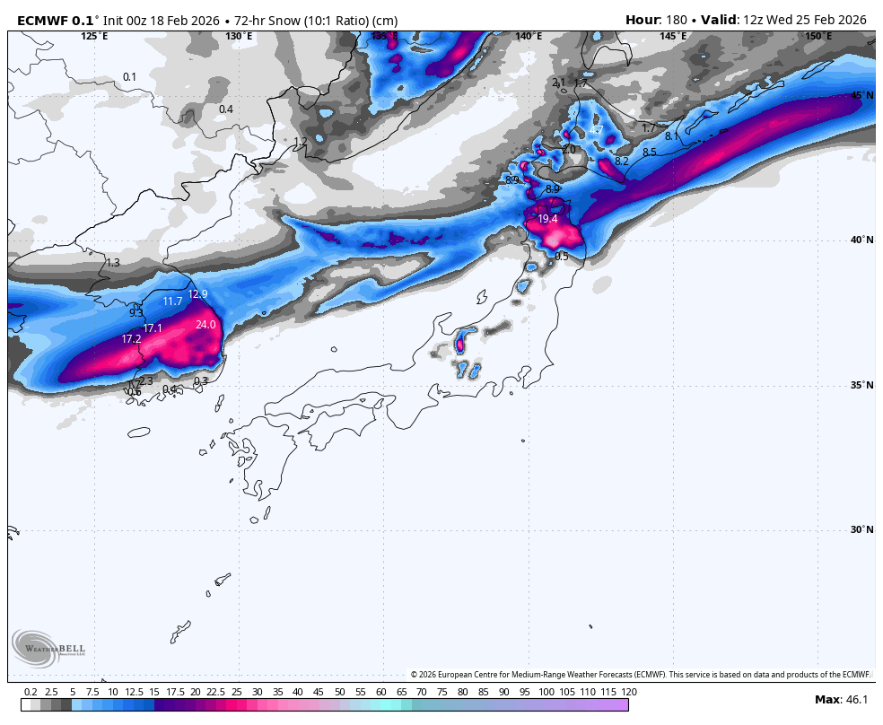
Another storm is picked to fly over the country from the southwest on Wednesday. This one doesn’t look great, likely bringing warm temperatures and heavy rain to Honshu, particuarly central parts, and possibly just a little snow to Hokkaido. It’s still early days, and models tend to get carried away this far out, so cross your poles and skis that this one doesn’t play out.
That’s all from me today, folks. Have a great week, and I’ll see you here next Thursday for another weekly rundown of Japan’s highlights and snowlights.
Grasshopper