2023-2024 Japanese Snow Season Outlook – Grasshopper’s February Update
Mountainwatch | The Grasshopper
We’re now at the halfway point in the Japanese snow season, with the best half still ahead of us. Despite good snowfall through January, which has been near average over central and northern Honshu and average-to-above on Hokkaido, snow depths across Japan are generally below average for this time of year. And although El Nino is waning in the Pacific, things are likely to stay the course which doesn’t bode well for a major turnaround.
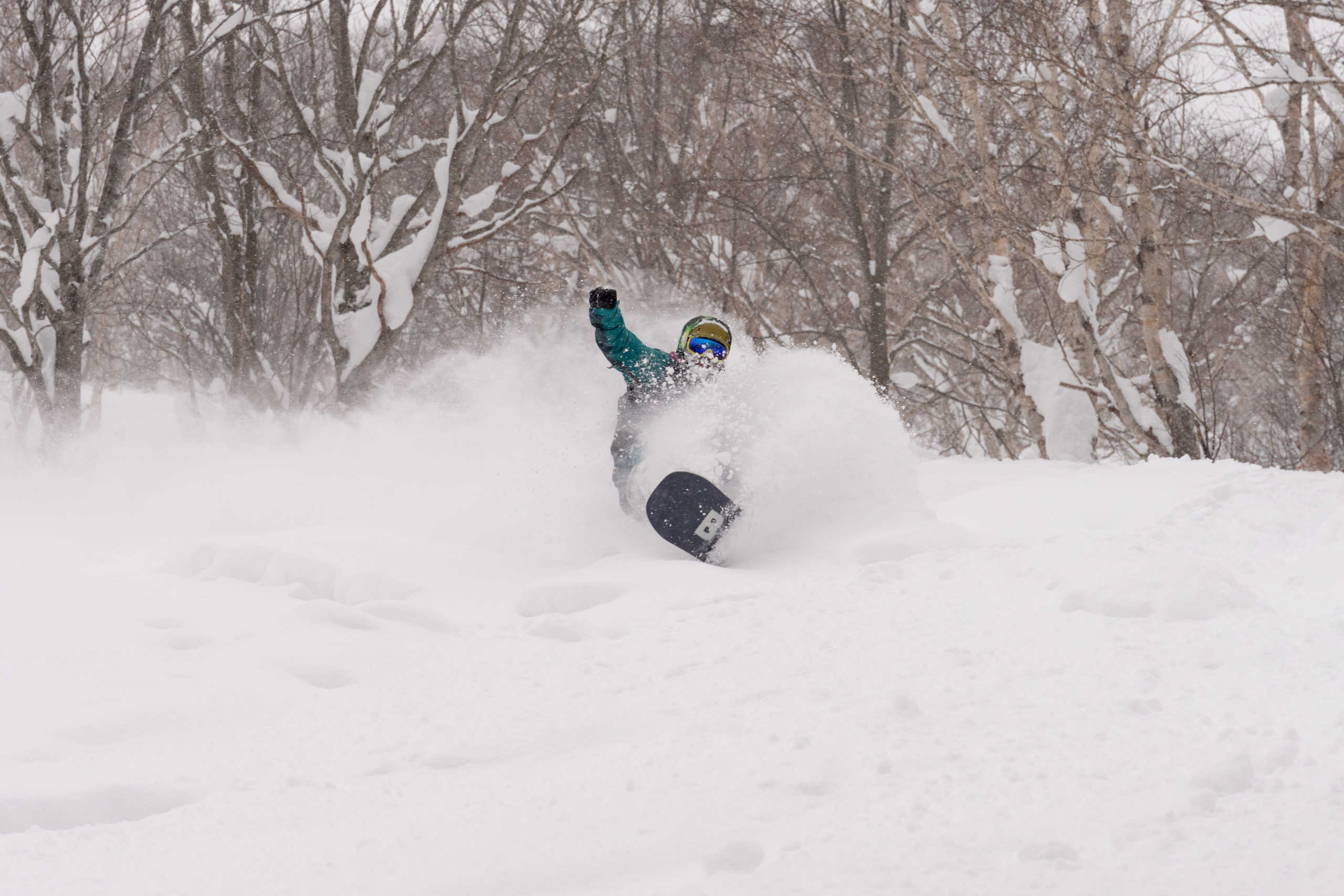
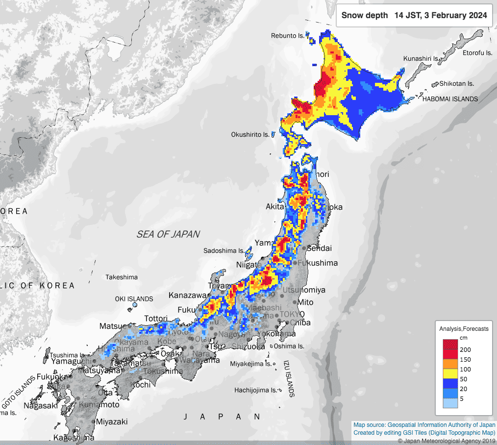
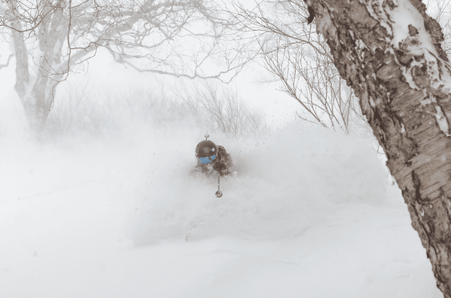
Snow depths at most major resorts currently sit within the bottom three when compared to depths from the past decade, making conditions a little scratchy off-piste, especially at lower elevations where there are still bushes poking through. The problem can’t be entirely attributed to a lack of snowfall – which we particularly saw plenty of between the 7th-17th and the 23rd-27th of January, coinciding with a couple of dips in the Arctic Oscillation Index (the first into negative values, the second remaining slightly positive) and the subsequent release of cold Arctic air – but perhaps has more to do with the rapid rise in temperatures in-between times, continuously setting us back a notch.
Overall, the first ten days of January were significantly warmer and sunnier than average along the Sea of Japan side of central & northern Honshu, with near average precipitation. The second ten-day period was warmer and sunnier too, but also wetter than average. That’s a little odd, because wet and sunny don’t normally go together, but highlights the fact that Japan has seen more than its fair share of those storm systems originating out of warmer climes to the west, bringing short, sharp doses of heavy rain and snow.
Hokkaido was also relatively warm over the first 10-days of January, then wet and sunny during the second 10-days, showing Hokkaido has been suffering a similar fate to Honshu. These come from JMA’s figures, from which the end of January hasn’t been released yet. But, as my little Grasshopper memory serves, the closing four days of the month saw little-to-no snowfall with climbing temperatures as high pressure moved in.
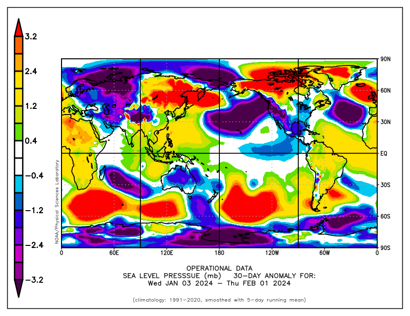
The Japanese Meteorological Agency (JMA) were bang-on when they issued their winter outlook back in mid-September 2023, which gave high chances for warmer than average temperatures throughout Japan and higher precipitation over the southern half of the country. Their outlook was heavily influenced by a season under the influence of a strong El Nino, which was well underway at that time.
Fast forward several months and we’re now past the peak of El Nino, which happened late in November. However, we’re still dealing with the fallout as it continues to weaken towards neutral thresholds, which are likely to be reached sometime during the Japanese spring.
El Nino conditions have mostly panned out so far, but there is still one month left in that earlier outlook before we pass final judgement, leaving plenty of time for things to go awry. However, scanning the vast array of seasonal forecasts that exist, as well as JMA’s latest outlooks, the warm and southern-wet theme is expected to continue through February and March, suggesting that El Nino conditions will stay the course.
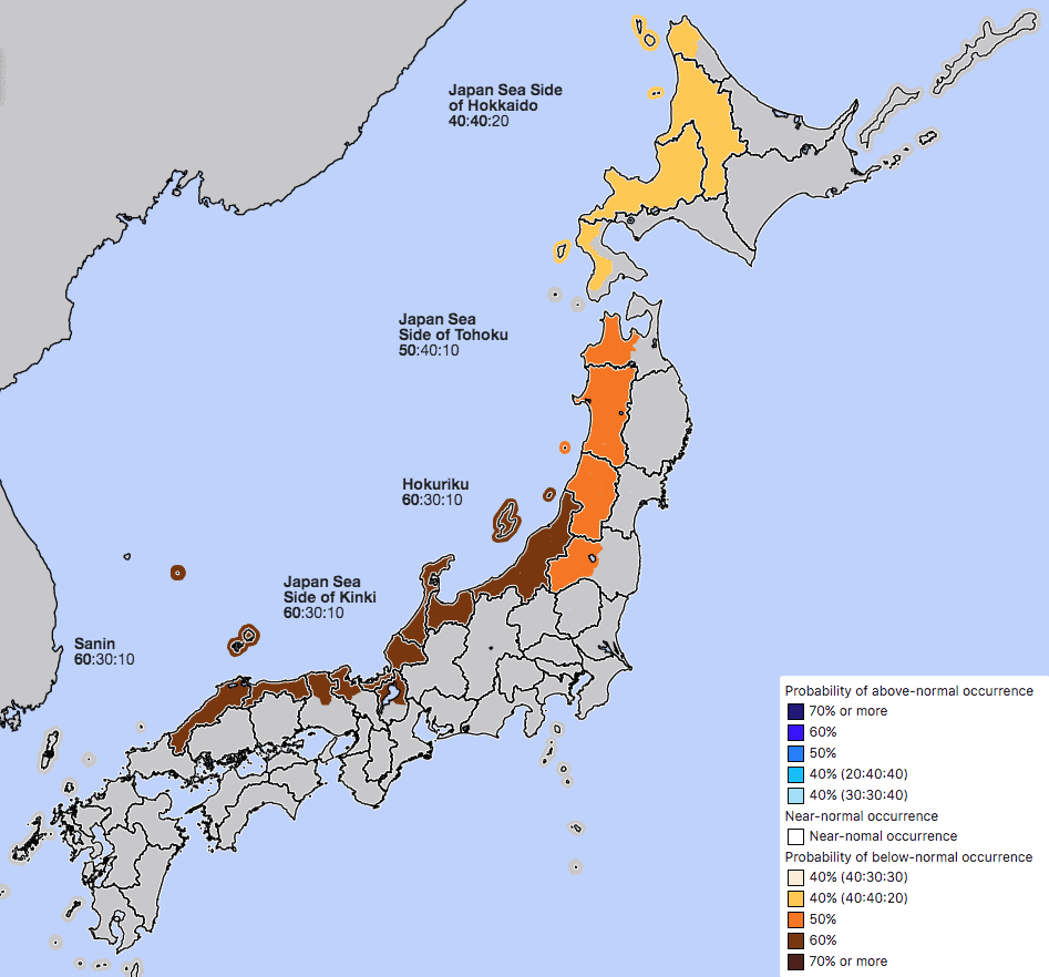
The JMA throw in one last parting shot with a high chance of below average snowfall during February, which is particularly galling considering snowfalls usually drop-off considerably during March. They also give a heightened chance for below average snowfall for the Feb-April period for northern Honshu and Hokkaido (central Honshu isn’t in this outlook).
And it’s not an unreasonable forecast either, considering the Madden-Julian Oscillation (MJO) is expected to linger over the Pacific for much of February, where it may strengthen for a time and enhance the effects of El Nino. For much of January, the MJO was active near or over the Maritime Continent, where it actually may have been holding back El Nino, and thus letting us off lightly.
As if to credence to all my yarning above, this week (Sunday 4th to Saturday 10th Feb) no less than three low-pressure systems will pop out of the west and scoot past Honshu on the Pacific side, providing plenty of precipitation over the southern half of the country. Overall, it’s likely to be a warm week for central Honshu, however temps should stay cold enough for decent snowfall to, or close to, base levels. Hokkaido on the other hand is likely to run cold with light snow showers coming and going.
That’s all from me folks. It’s peak season, and like I said, the best is still yet to come despite an outlook suggesting less Japow than usual. Remember, an El Niño pattern is dealing with averages over seasonal time frames, but you and I know it’s more often about timing. Plus, seasonal models and climate drivers quite often don’t go to plan. They’re only dealing with perhaps up to 10-20% of variation, the rest is like organised chaos, which is only reasonably forecastable out to 7-10 days. So be sure to keep on top of things with my weekly forecasts issued every Thursday, giving you all the highlights and snowlights of each coming week.
Grasshopper


