2025 New Zealand Snow Season Outlook – Grasshopper’s Mid-Season Update
Mountainwatch | The Grasshopper
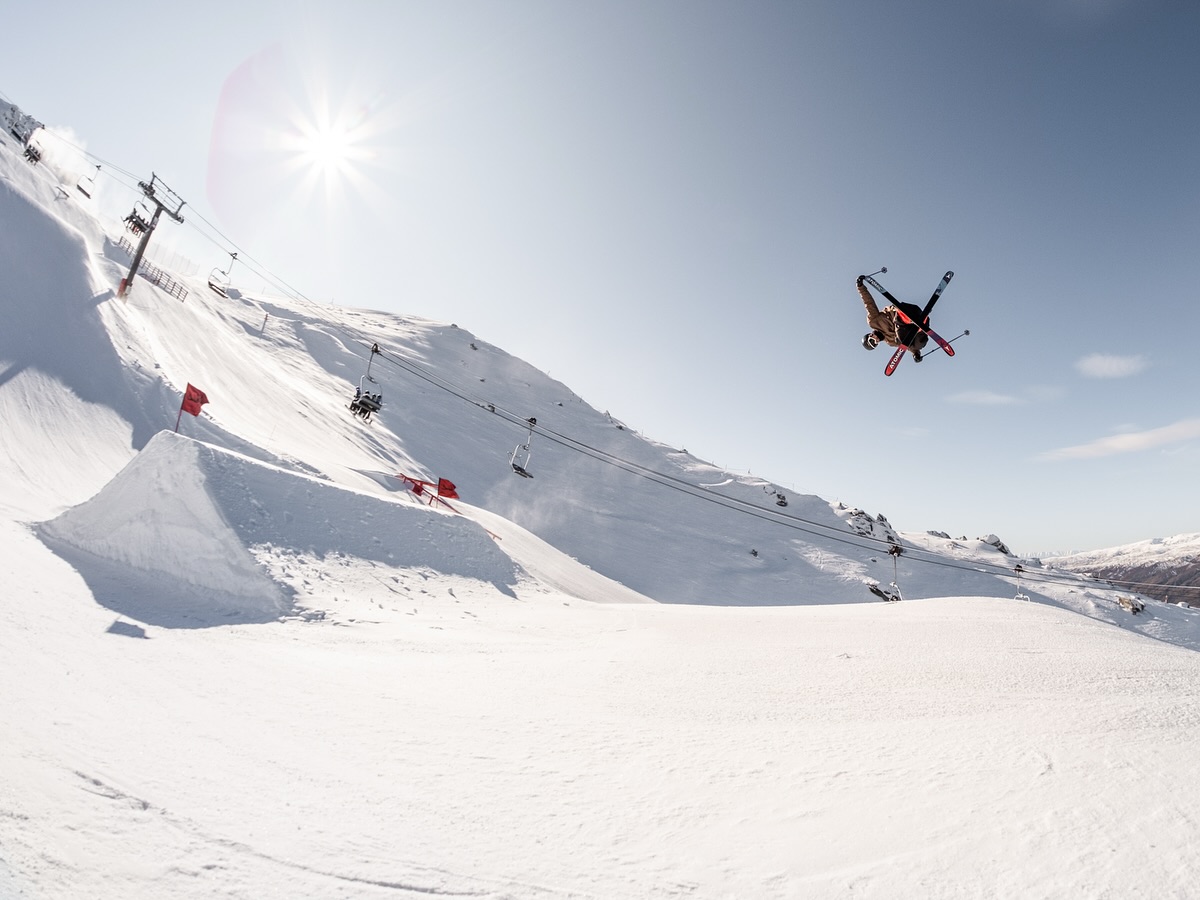
It’s July and after some early excitement there hasn’t been too much to talk about so far this NZ ski season and there has been some recent wet weather. However, there is some snow on the way in the short term with some snow expected from tomorrow.
Areas around Canterbury look to be best placed initially but over the next two weeks there does look to be a run of weather that should bring some welcome fresh stuff to most areas. But today we’re here to look at the longer term through the back end of the season.
Recap
Looking back at the state of play heading into this season we had reservations, particularly due to the forecast for a neutral ENSO (El Niño–Southern Oscillation) year which typically doesn’t spell the greatest of winters for the NZ ski fields. Although there can be the ‘wrong un’ which can deliver snow, many signs were pointing to a neutral to below average season.
Where are we now?
We are firmly sitting in neutral ENSO territory with no forecasted movement out of this until possibly over the end of the year with models suggesting a negative shift heading in the La Nina direction. But for right now, we remain neutral.
In other drivers the IOD (Indian Ocan Dipole) is becoming ever more likely to head into a negative event through the next three months. This more of an influence on Australian snowfall through an influx of available moisture to the north/northwest of Australia, but this can also act to help drive precipitation and snow bearing systems through to NZ.
What lies ahead?
Another story of the winter was above-average temperatures being the most likely outcome, partly driven by warm SST (Sea Surface Temps) encompassing the country and through an unfavourable pressure pattern typically experienced in neutral years.
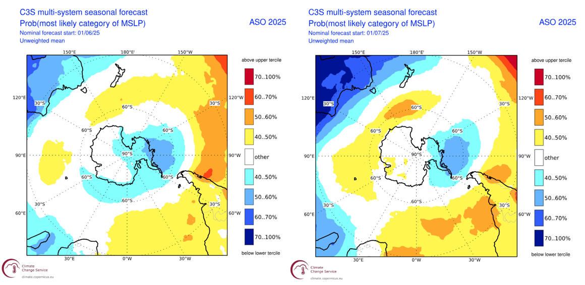
Below is the MSLP (mean sea level pressure) forecast for August-October period with the left image being the model run from last month and the right the most up to date run from this month. Last time we spoke about this we noted the forecast for higher-than-normal pressure to the south and lower than normal pressure to the north.
This pattern acts to drive east/northeasterly flow which is typically not advantageous for the NZ ski fields. Looking to the updated plot on the right we can see a deepening in these anomalies which suggests an increase confidence in this set up of high to the south and low to the north. It is most noticeable in the lower pressure forecast over Australia which can be linked to the increase in confidence of an IOD event.
Seasonal Products
To visualise what we have already discussed let’s look at some seasonal products. Below we have the three-monthly precipitation from the Copernicus Climate Change Service which combines many of the major met agencies into one averaged product. The negative IOD signal is prominent and visible in the Indian Ocean and throughout Australasia. For NZ it seems mostly neutral to above average for further northern locations.
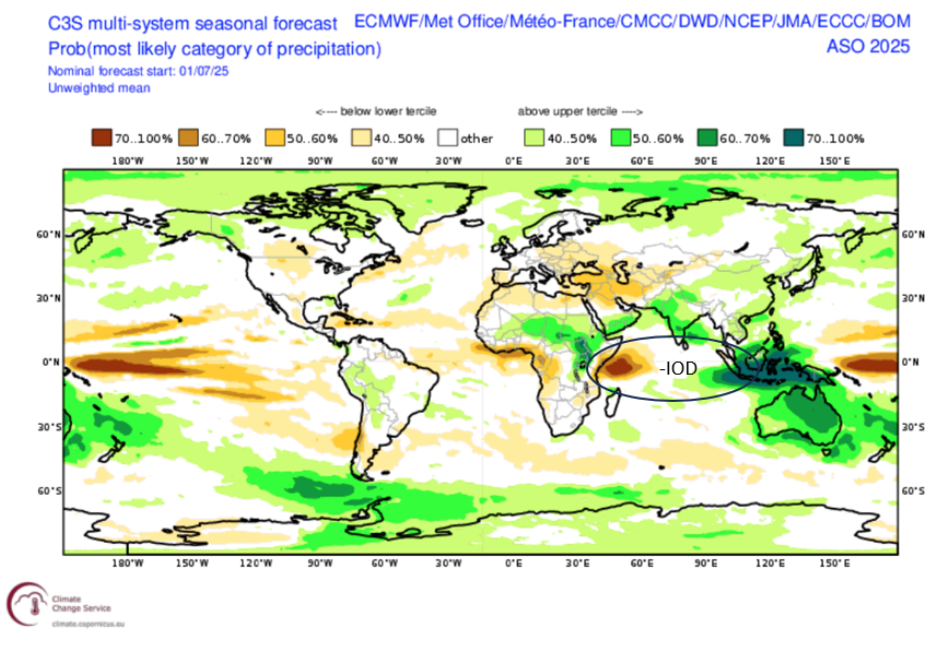
Global three monthly precipitation forecasts in a combined product from many of the major met agencies. We can see the presence of a negative IOD signal in the Indian Ocean and some neutral to above average precipitation for New Zealand. Source: Copernicus Climate Change Service.
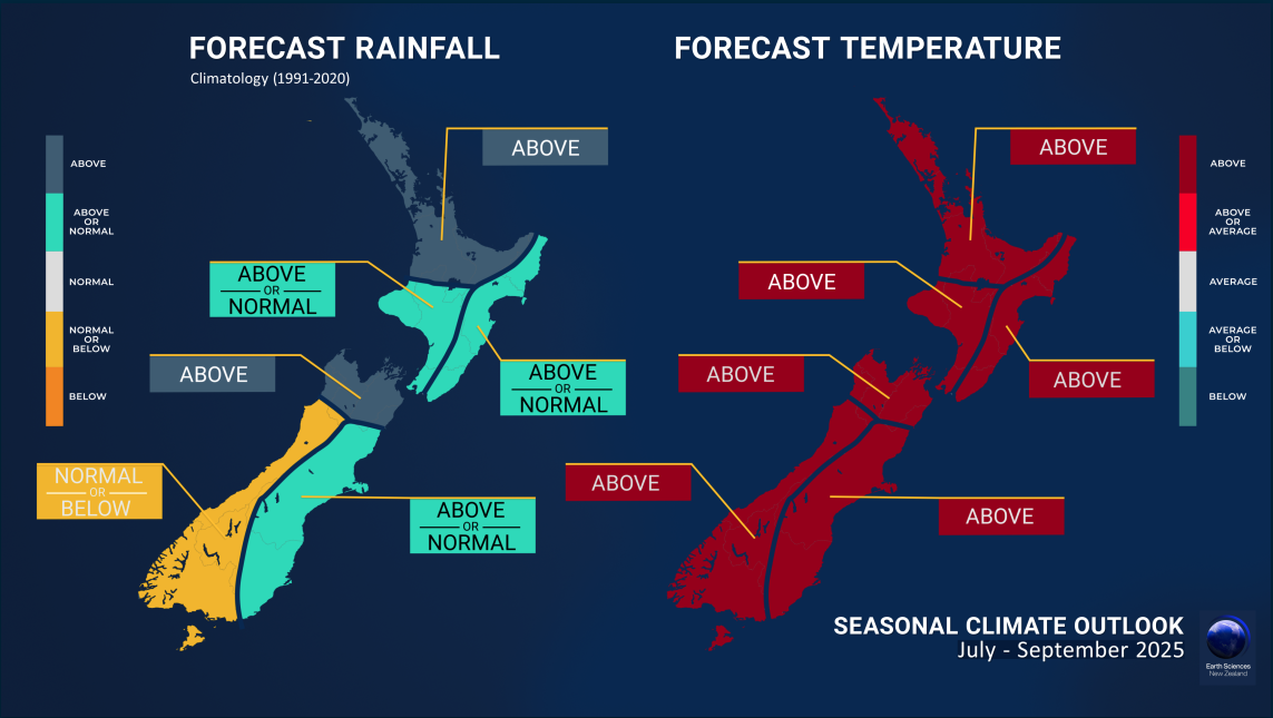
Next, staying closer to home, we have the New Zealand’s NIWA (National Institute of Water and Atmospheric Research) forecast to the end of September, which presents a somewhat expected picture. The forecast for above average temperatures has not changed and will hang around through the back end of the season. Again, the precipitation forecast looks like the above – remaining mostly neutral with the potential for slightly above average conditions on the east side of the South Island and further north. Conversely the west side of the South Island presents the potential for precipitation to be slightly below average. This sort of visual aligns with the pressure pattern we spoke about earlier, promoting an east northeasterly flow.
Wrapping Up
Overall, since the last update we see very much of the same signals that were present in our last investigation, albeit with slightly more confidence. Heading into the back end of the season warmer temperatures will pose a threat but also a possible lack of southwesterly flow to help drive deep snow bearing systems from the Southern Ocean up to NZ. In the short term though, some welcome snow over the next two weeks will provide some solid conditions with most places scoring at one point.
Hopefully we’ll get a few storms breaking through and you can stay across any incoming snow through my New Zealand forecasts on Monday,. Wednesday and Friday.


