Australian Forecast, June 12th – A Week of Snowmaking Ahead on top of Fresh Snow
Mountainwatch | The Grasshopper
Published early Wednesday 12th June 2024
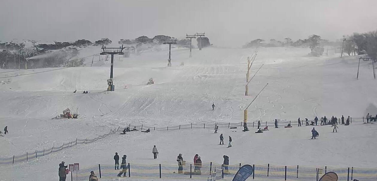
It was great watching as the rain turned to snow about the upper mountain yesterday. That has continued overnight, and snow levels are still on their way down will likely reach low levels by the time you read this. Snow totals vary across the resorts, favouring NSW where Perisher picked up 25cms, Thredbo has a similar amount at the top and 15cms mid-mountain, while Falls received 18cms, Mt Hotham 12cms but Buller missed out as expected, with just a 2cm dusting after temps dropped early this morning.
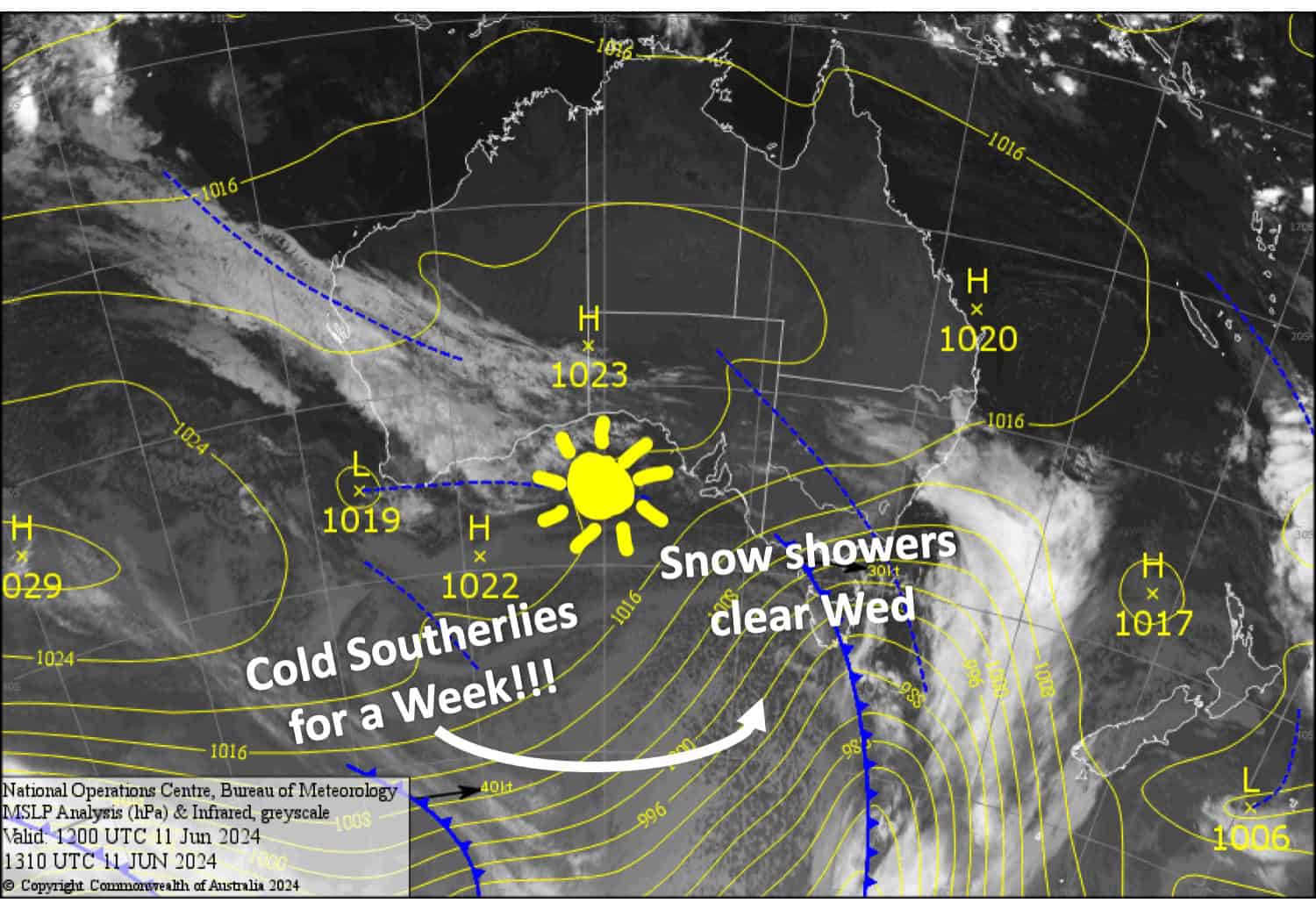
It’s the first substantial snowfall we’ve had in a while and resorts will be able to manufacture a tonne of snow over the next week or so as cold southerlies endlessly blow over the Australian Alps. It’s all thanks to a low which gets stuck in the Tasman Sea. We won’t see much in the way on natural snow during this time, and low level cloud will push up against us, clagging up the slopes at times.
Mt Baw Baw, Buller, Thredbo and Perisher have opened some terrain for beginners while the other resorts are waiting for conditions to improve. With a forecast like this, we should see that happen with good snowmaking conditions ahead.
Wednesday June 12th
Snow about the mid-upper slopes lowering base levels before dawn, then petering out later in the morning with clouds starting to break apart. However, light snow showers will linger into the afternoon on Baw Baw and Buller. Strong, chilly SW winds gradually abate.
Thursday June 13th
A partly cloudy day, with claggy, low visibility conditions possible at the start and end of the day. Cold southerlies ease.
Friday June 14th
A mostly fine day, but low cloud may reduce the visibility at the start and end of the day at some resorts, and light snow showers will show up late on Baw Baw. Cold E-SE breezes.
Saturday June 15th
A partially cloudy, partially sunny day, with a few snow flurries possible in the early part of the day with reduced visibility. Cold S-SE winds
Extended Forecast
Cold southerlies are expected to continue to blow over the Aussie Alps for a few more days before coming to an end around Wednesday 19th June. Resorts will get a good chance to continue making a tonne of snow and we may even see some light snow showers in this time.
The next snowfall event looks possible between Thursday June 20th and Saturday June 22nd.
That’s all from me today folks. Next forecast is Friday, see you then.
Grasshopper


