Australian Forecast, Monday June 13 – Perfect for Queens Today, Snow & Rain on Wednesday
Mountainwatch | The Grasshopper
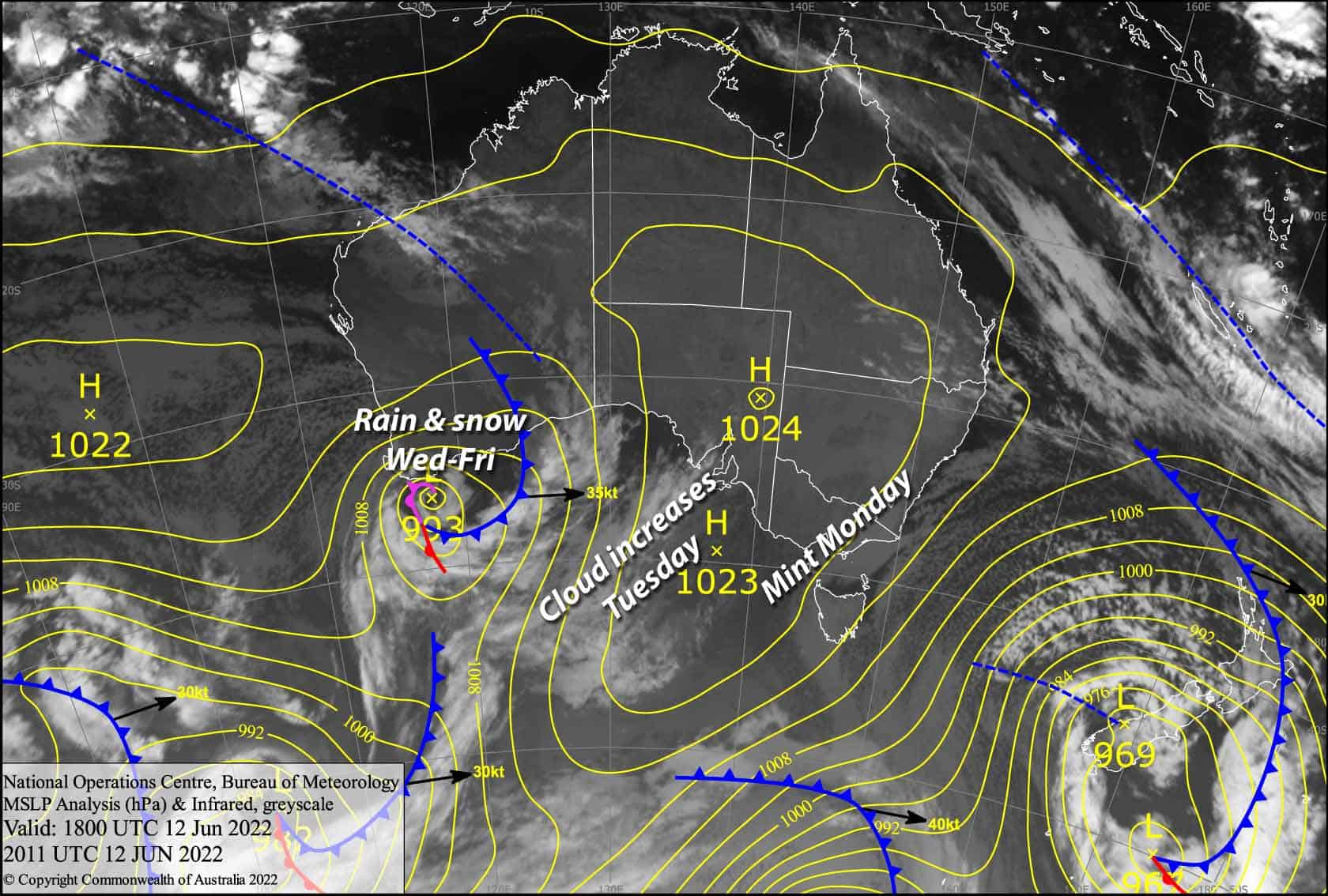
Valid Monday 13thJune to Wednesday 15thJune
Well the beast from down in the Southern Ocean has finally inched away, allowing a ridge of high pressure to set up perfect conditions for us to rip into the Queen’s Birthday holiday.
A weakening low approaching from the Bight will bring rain and showers during Wednesday. Freezing levels will lift to 1700-1900m, so it’ll fall as snow on mid-upper slopes.
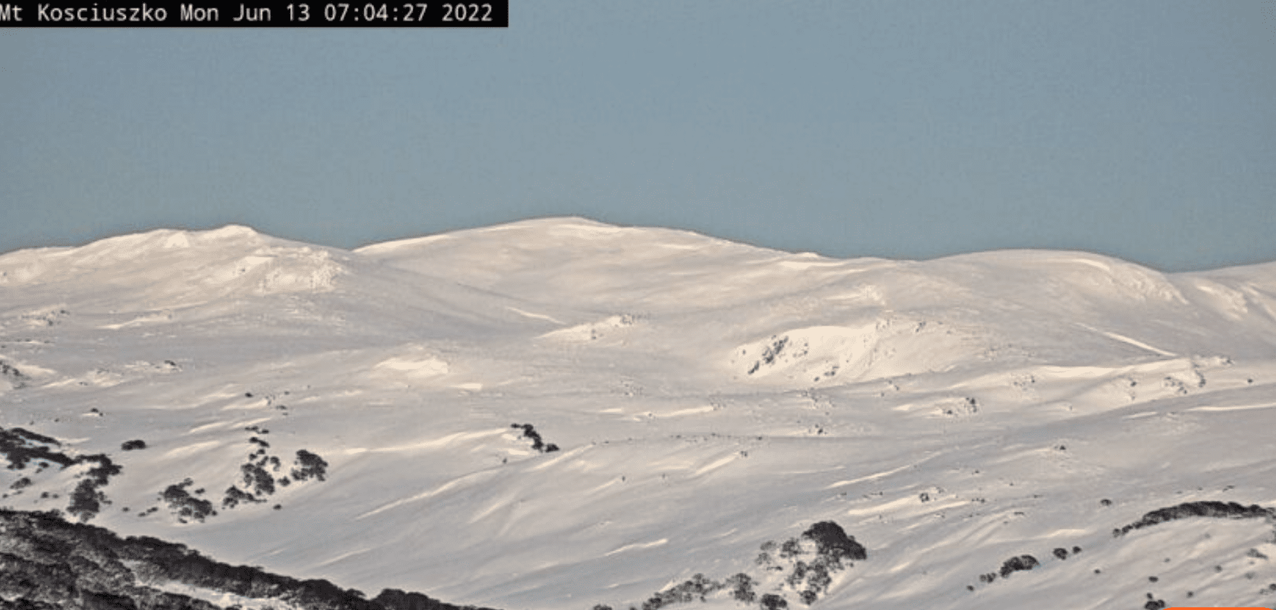
Monday 13th
Areas of cloud clearing this morning to a ripper of a day. Cold SW winds gradually easing.
Tuesday 14th
Plenty of sunshine to be had, just a little bit of cloud blowing in on a NW breeze. Cloud cover will increase during the afternoon, especially over Victorian resorts where there may also be a few snowflakes falling after dark.
Wednesday 15th
A few snowflakes falling over Victorian resorts will turn to showers/rain from late morning, which will fall as snow down to around 1700m as freezing levels lift to 1900m.
Some drizzle/flurries may kick up around midday in NSW, turning to showers/rain during the afternoon, with snow falling to 1500-1700m. NW winds strengthening everywhere.
Extended Forecast
The same mix of rain and snow will continue to fall Thursday into early Friday as the weakening low passes over Tasmania into the Tasman Sea. Freezing levels will hover around 1900m so we could expect something between 10-15cm to fall on high elevations.
Next weekend is looking mint with mostly calm, sunny weather thanks to a ridge of high pressure.
That’s all from me today folks, get out there and make the most of these great conditions. I’m sending out these forecasts every Monday, Wednesday and Friday.
Grasshopper


