Australian Forecast, Wed June 5th – Wet & Soupy Southeasterlies Continue, Potential Season Starter Storm Next Week
Mountainwatch | The Grasshopper
Published early Wednesday 5th June 2024
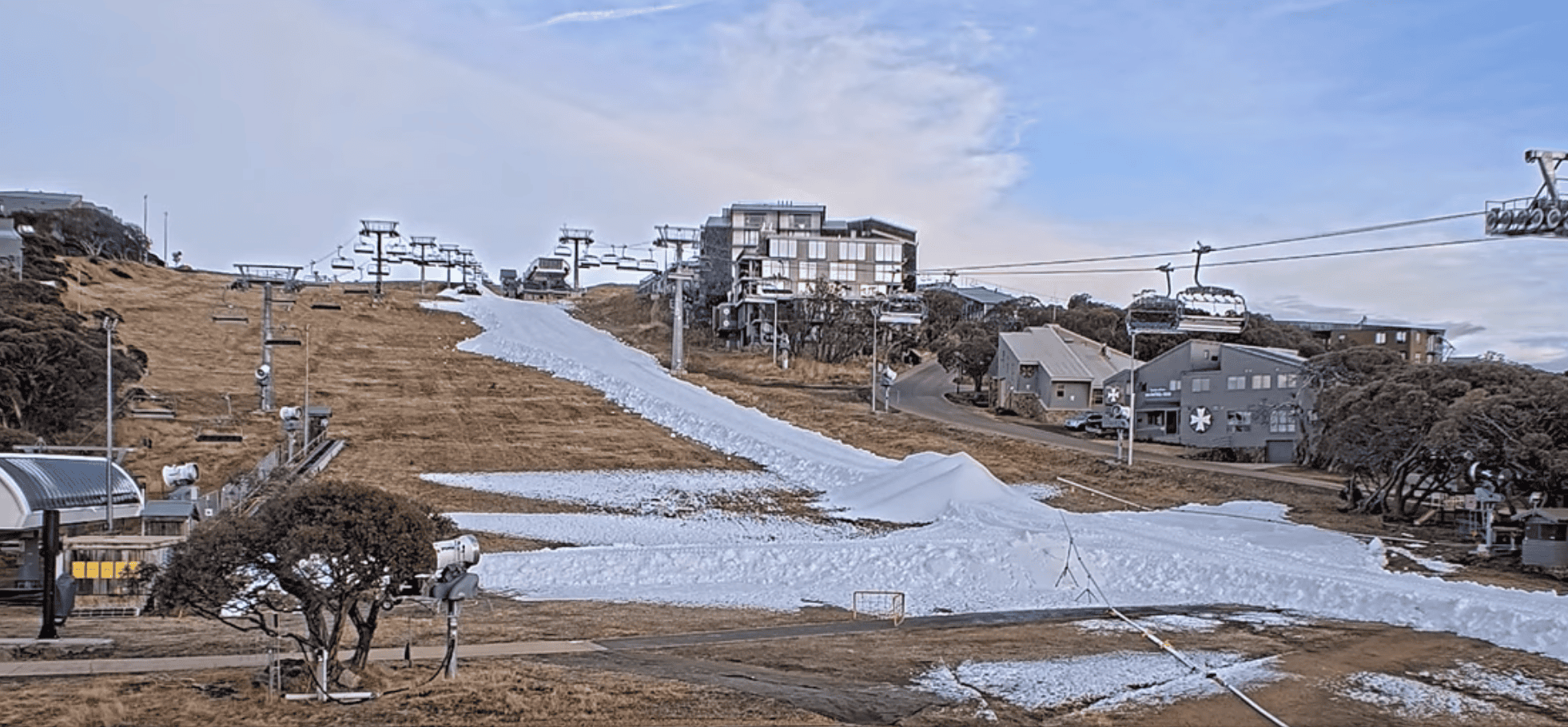
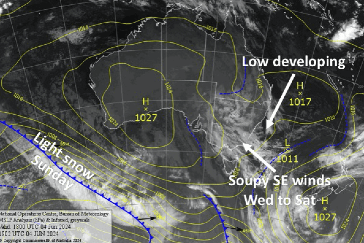
Wet, soupy conditions will continue over the next four days as another low develops off the east coast, pushing humid southeasterlies into the Aussie Alps. This will hammer all that man-made snow, especially that which has already been spread out on Thredbo and Perisher. It won’t do us any favours for Opening Weekend. The good news, however, is that next week is looking colder with the first possible snowstorm of the season.
Wednesday 5th
A cloudy, clagged-in ol’ day with drizzle developing on the NSW side any time from later this morning as a E-SE breeze kicks in. A little drizzle may also show up on the Vic side from late afternoon.
Thursday 6th June
A damp rainy/drizzly day with quite strong SE winds. The precip will be more persistent on the NSW side, but start out patchy in Victoria, becoming a little more persistent there during the day.
Friday 7th
Periods of rain and drizzle, which will be more persistent on the NSW side, and SE winds.
Saturday 8th June
Cloudy with periods of light rain or drizzle, especially on the NSW side. SE winds gradually turn to the south during the day, then cooler SW winds arrive overnight with light snowfall possible about the tops.
Extended Forecast
Sunday 9th June should see light snowfalls continue about the upper slopes before possibly lowering to base levels briefly as a cold front hits. We’ll take a break Monday 10th June as a fast moving ridge clears things up before the next storm hits.
This next storm should affect the Aussie Alps Tuesday 11th through Thursday 13th June. It’s likely we’ll see snowfalls build about the upper slopes as NW winds strengthen before the cold front arrives sometime Wednesday 14th June, which will turn the winds southwards and drop snow to low levels before petering out Thursday 13th June.
It’s too early to put numbers on this storm, but at this stage it’s looking like a moderate-heavy dump on upper slopes, and light-moderate on lower slopes. Hopefully it’s enough to kick off the season proper for the following weekend.
That’s all from me today folks. I’m sending out these forecasts every Monday, Wednesday and Friday, so I’ll see you again soon.
Grasshopper


