Grasshopper’s 2025 Australian Snow Season Outlook, August Update – How is it Looking for Spring?
Mountainwatch | The Grasshopper
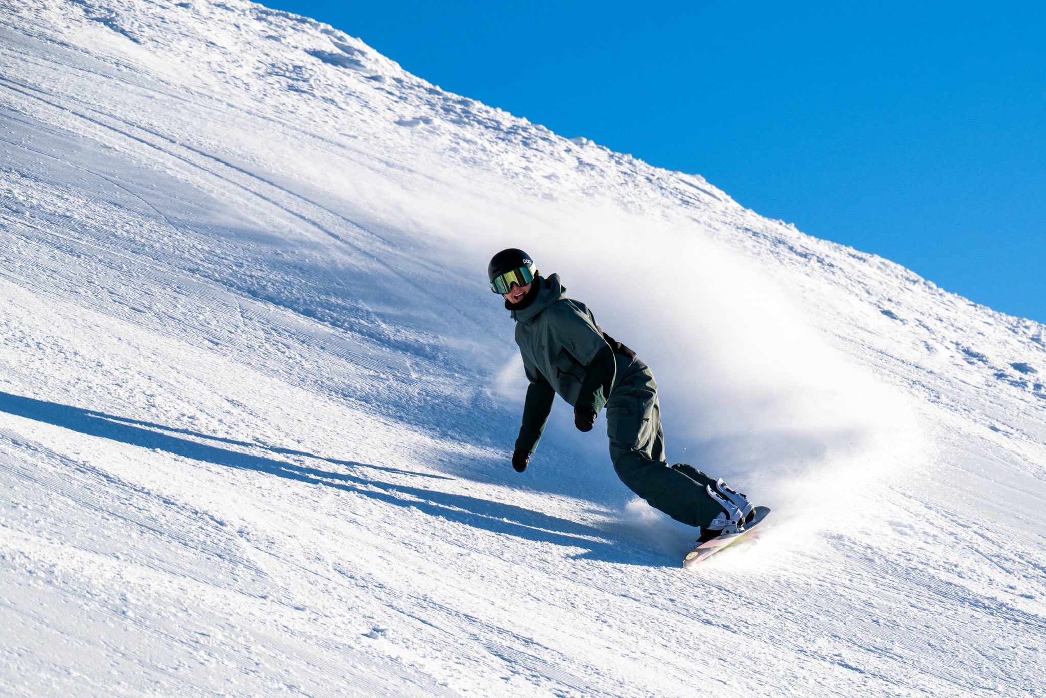
Approaching September and we’re in the peak of the Aussie snow season and conditions have been prime across many Australian resorts. In the past month we haven’t seen any huge dumps, but some light consistent work has kept the ship relatively steady. The past week has been particularly good, last weekend’s snowfalls, sunny days, cold temps and overnight snowmaking setting up some of the best days of the season.
In the short-term things are looking benign for the few days but, as I said in today’s forecast, there is a chance for some decent totals next week if the models are on the right track. The concern will be some warm temperatures due to high pressure dominating the scene with clear days ushering in a melt freeze cycle.

To recap our storyline this season with neutral drivers the outlook for the first half of the season was warmer than usual with average-to-below average snowfall totals before a possible IOD event developing supporting a late season increase in moisture potential.
Snowy Hydro’s snow depth reading at Spencers Creek reached a peak depth of 157.3cms on August 6th which is close to average. It remains to be seen whether we’ll see deeper depths than that over the final six weeks of the season.
Current Situation
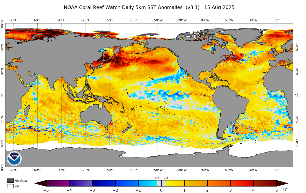
Conditions in the Pacific are still very comfortably neutral while the Indian Ocean is moving into Negative IOD territory. We are still a little while off an actual declared event, but signs are promising that is where we are headed. Below shows recent SST anomalies and we can see the development of some cooler waters in the western Indian Ocean while warmer waters collecting in the east.
In the past few weeks, the Southern Annular Mode (SAM) has remained neutral to positive, possibly helping to promote fewer major fronts hitting the Alps recently. It is moving back into neutral territory now but hopefully there are a few negative swings remaining in the season to help combine with some increased tropical moisture generated by an IOD event. When that happens, any cold fronts may be far enough north to cross the mountains
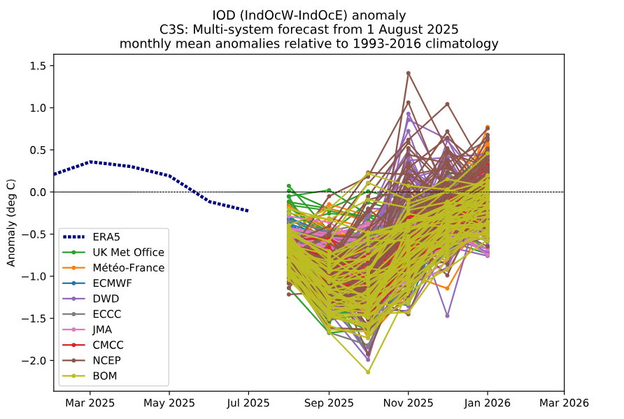
Below is a recent spaghetti plot showing the forecasted behaviour of the IOD through the remainder of the year. We can see the consensus is for some sort of negative IOD event to take place with differences in the strength but overall, some sort of negative event peaking through end of the southern hemisphere winter/spring which is the norm.
Outlooks
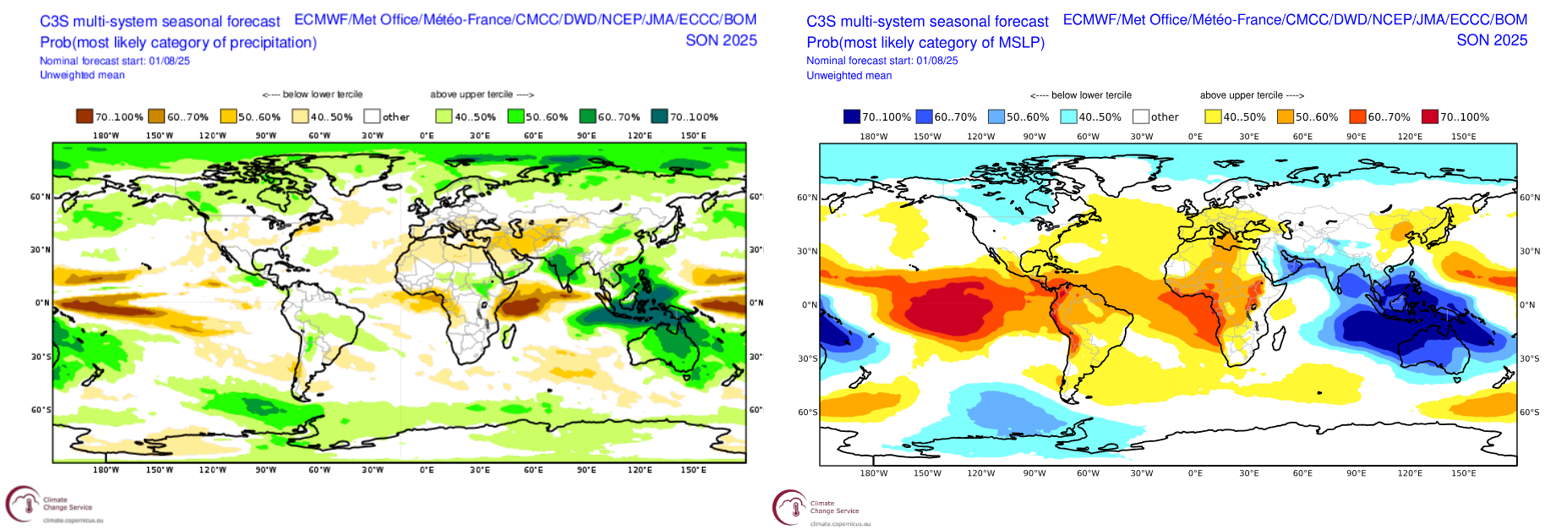
Affirming our most likely story for the rest of the winter below are some three-monthly outlooks of MSLP and precip from a multi-system product combining many of the largest met agencies around the world. Starting with the MSLP on the left we can see a high likelihood of lower-than-normal pressures across the Australian continent and to the northwest which lines up with an increase in precipitation on the left plot in the same area. This is indicative of a negative IOD event with an increase in moisture and rising motion at the surface seeing more activity in this area and hence more precipitation.
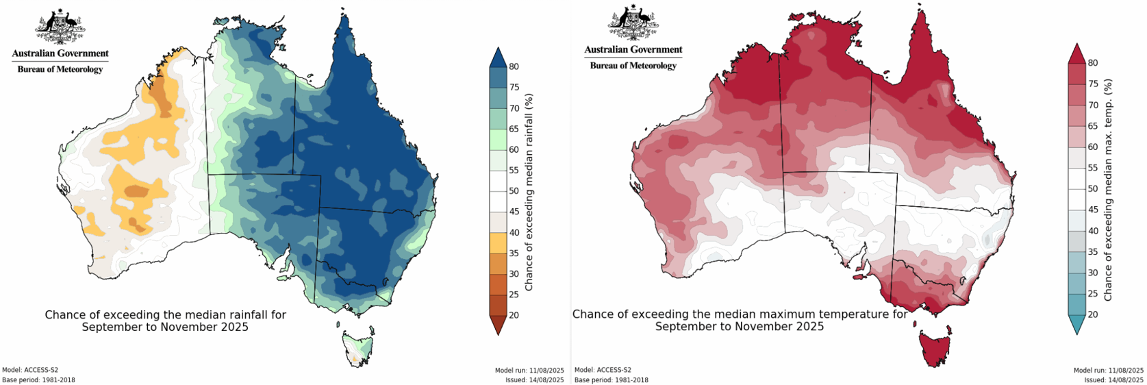
Focusing more on Australia now with the Bureau’s outlook for the same period September-November we see an obvious increase in precipitation compared to previous outlooks indicative of the increased confidence in the development of a negative IOD event. On the right the temperature is again a not so pretty sight with high chances for hotter than usual days throughout the Alpine region, so once again warming will be a critical factor.
Has much changed?
In short there are no major surprises to our thinking for the remainder of the season just things becoming more focused. The negative IOD swing looks like the most likely scenario now with increased precipitation the only limiting factor for increased chances of snow is going to be warming both between storms and during their onset with late season rain instead of snow a possibility. But overall, it looks promising for a few more second half of the season storms on top of an already healthy base in the mountains right now.
Stay across any incoming storms via my Australian forecasts every Monday, Wednesday and Friday while our on the ground independent snow reporters keep you up to date on daily conditions with their accurate and honest reports.
That’s it from me folks. If you’ve got a different theory on what’s going to happen this winter, or just want to provide feedback, then please hit me up on Facebook and hit the follow button while you’re at it.


