New Zealand Forecast , August 19th – A Little More Snow Before Polar Blast Winds Down, Deep Powder in Canterbury
Mountainwatch | The Grasshopper
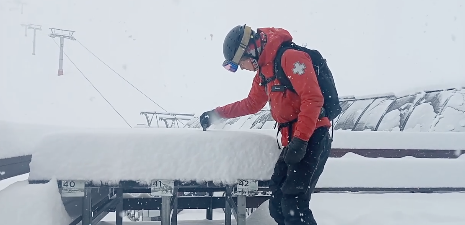
A polar blast swept over the South Island on Sunday, hitting Canterbury square-on, which brought heavy snowfall down to sea level and caused mayhem on the roads. Mt Hutt and Porter’s Pass are reporting storm tallies of 35cm, while the Craigieburn Range ski fields picked up a whopping 41-60+ cm. Conditions will be epic the next few days, but there’ll be some delays in these resorts opening today as they finish cleaning up.
The Southern Lakes, meanwhile, received a skiff of snow, The Remarkables reporting only 2cm. However, another strong surge of icy southwesterlies over the country today will bring between 1-5cm there, with similar amounts also falling in Canterbury later today.
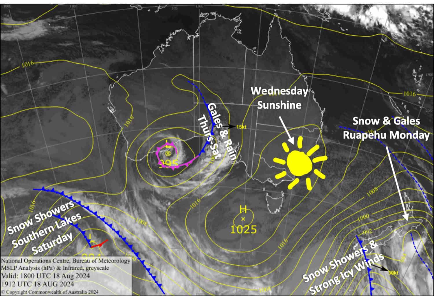
Mt Ruapehu will finally get its turn to receive powder, with 15-35cm expected today and an additional 5cm on Tuesday as winds begin to ease over the country. A ridge of high pressure will bring clear, calm skies on Wednesday before a front moves up the South Island on Thursday and Friday, bringing gale northwesterlies and rain.
Monday August 19th
Icy cold southwest winds for the Southern Lakes brings snow showers to very low levels, affecting roads and towns before clearing this afternoon.
Skies will be clear by the time Canterbury resorts open, but snow showers will spread northwards up the region this afternoon as cold westerly winds turn to an even more frigid and stronger southwesterly. The snow will fall to low levels and will clear out this evening.
Mt Ruapehu will receive solid snowfall to below base levels throughout the day, but west-to-southwest winds will blow a gale, creating blizzard conditions and likely disrupting lift operations.
Tuesday August 20th
Icy cold southwest winds blowing over the country will still be brisk in exposed areas of most resorts. The winds will blow in a bit of cloud over the Southern Lakes, but it’ll be clear and sunny for Canterbury. Mt Ruapehu will see snow showers throughout the day.
Wednesday August 21st
A nice, sunny day for all Kiwi resorts. A northwest breeze develops over the South Island, while a southwest breeze on Mt Ruapehu dies away.
Thursday August 22nd
Strong to gale northwesterlies over the South Island will bring mostly grey skies and will likely disrupt some lift operations. Rain spreads over the Southern Lakes in the afternoon and Canterbury in the evening.
Mt Ruapehu will have a fine day with a bit of afternoon cloud and a northwest breeze.
Extended Forecast
A front will move off the upper South Island and over the North Island on Saturday, taking rain and gale northwesterlies with it. A ridge of high pressure will calm things down for Sunday.
The weather looks to become unsettled again next week. It’ll start out warm, windy and wet, but will turn cold and snowy around mid-week.
That’s all from me today, folks. The next forecast is Wednesday. See you then, and have a great couple of days.
Grasshopper


