New Zealand Weekend Forecast, Friday, August 6 – Cold and Windy at Times for the Weekend
Mountainwatch | The Grasshopper
Flurries and cold temperatures are on the way for New Zealand with partly cloudy weather around the Southern Lakes today, snow early in Canterbury and cloudy with some flurries up north. The current weather is a result of a low-pressure system moving directly over the centre of the country.
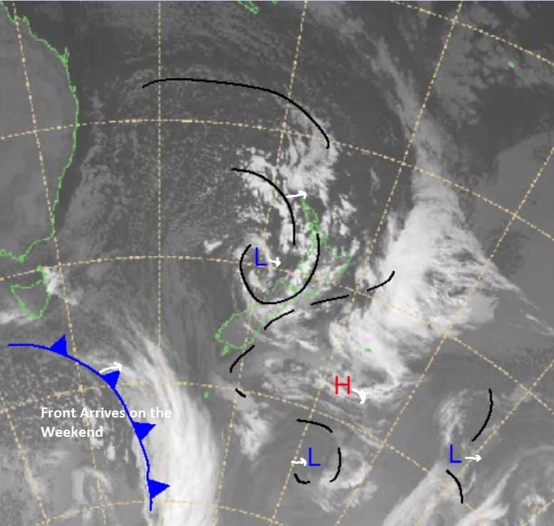
More precipitation should arrive over the weekend from the front to the southeast underneath Tasmania in the image below . This front was supposed to dump over the South Island but that’s looking increasingly less likely. Cold temps will mean snowmaking will be helping the cause though and with some fresh snow this week there’s bound to be some nice turns around.
Friday August 6
Ruapehu: Moderate northwesterly winds and some small amounts of snow early on. Freezing level about 1500m totals should be under 6cm.
South Island: In Canterbury expect west southwesterly winds through the day, not too strong. Some flurries and cloud are also expected due to the left-overs from the system on Thursday. In the Southern Lakes, early cloud trying to clear with a partly cloudy day. Winds strengthening through the day west northwesterly.
Saturday August 7
Ruapehu: Southwesterly flow with flurries in the middle of the day. Small totals expected and temperatures getting colder as we head through the day.
South Island: Westerlies around the Southern Lakes weakening later in the evening and some light snow. In Canterbury expect westerlies turning northwesterly into the evening. Snow through the day should be light.
Sunday August 8
Ruapehu: Snow expected totals looking like 9-25cm continuing into the early morning of Monday and most likely through the day. Winds strong at times west northwesterly turning southerly later in the night.
South Island: Partly cloudy around the Southern Lakes with some flurries. In Canterbury southwesterly winds moderate through the day strengthening overnight. Expect some flurries not amounting to much.
Extended Outlook
Looking to the weekend as we should see the front pictured above hit tomorrow in the south and make its way to the north. Originally some models were calling for big totals around the South Island from this front, but it’s looking more likely to amount to little amounts roughly sub 12cm. The north island may fare better with snow expected Sunday looking like 9-25cm and expected to carry into Monday.
Check out my daily forecast for the latest updates.


