New Zealand Weekend Forecast, Friday September 12th – More Rounds of Powder as the Storms Continue to Roll In
Mountainwatch | The Grasshopper
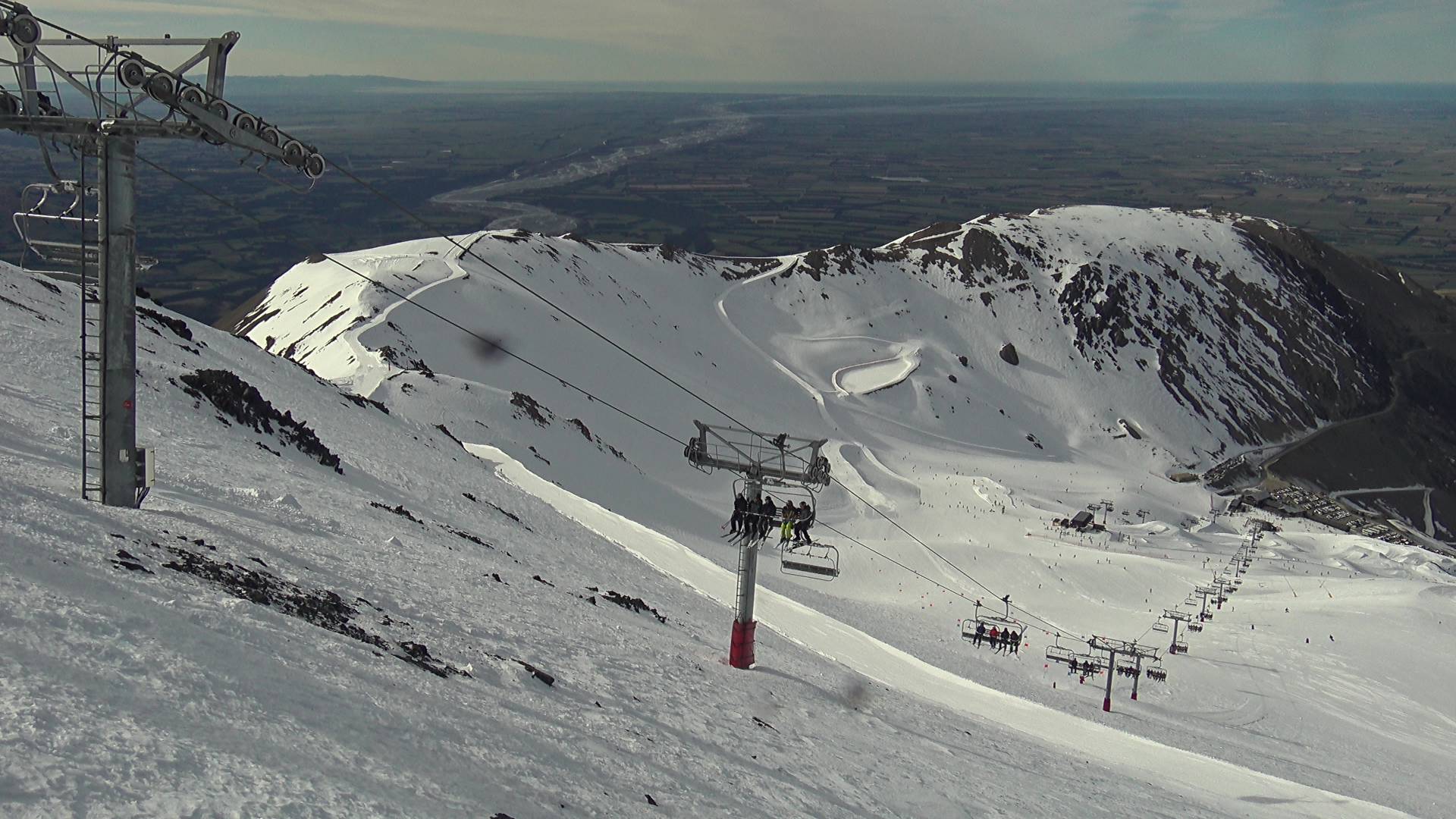
Kiwi ski fields scored a fresh coat of powder from a surge of cold air that came through on Wednesday. Reports mostly range from 7 to 20cm across the South Island, although Mt Hutt missed most of it and only received 1cm, while Ohau scored 30cm up top. Mt Ruapehu have also scored snow the last two days but latest readings haven’t come in yet.
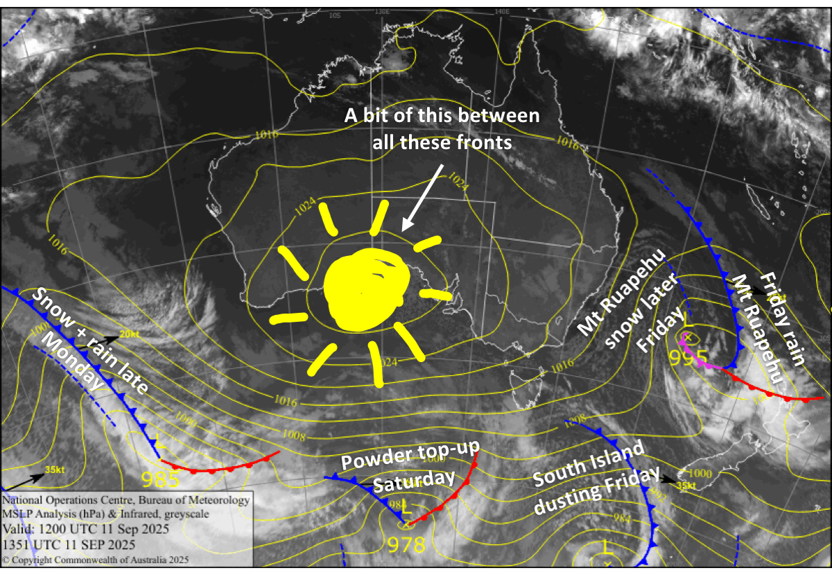
Over the next several days, ski fields will pick up a few more rounds of powder as this changeable, unsettled spring pattern continues. Passing fronts will see the South Island receive a dusting today, Friday, then bigger loads on Saturday and Monday night, although the latter will have rain mixed in at lower levels. Strong winds will also accompany these fronts and will likely cause operational headaches.
After an initial bout of rain today from a passing low-pressure system, Mt Ruapehu will also rack up deep totals thanks to persistent snowfalls, especially on mid and upper slopes.
Friday 12th September
A weak cold front moving up the South Island brings a few snow showers to the Southern Lakes in the morning, and then to Canterbury later in the afternoon, mostly about the frontal range where Mt Hutt is placed. Other than that, it’ll be mostly sunny. Just a dusting of up to 1-3cm is expected. Northwest winds turn southwest behind the front.
A low-pressure system rolls over the North Island, bringing heavy rain and then a quick top-up of snow to Mt Ruapehu as strong northerly winds turn southerly in the afternoon.
Saturday 13th September
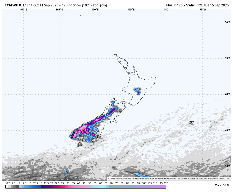
Another, stronger front spreads snow over the South Island early morning with heavy falls on the cards, especially for the Southern Lakes. The snowfall pins back to snow showers later in the morning as gale northwesters turn southwest, and then clears at night, leaving around 10-25cm over the Southern Lakes, and between 5 and 15cm in Canterbury, although Mt Hutt may see a little less.
On Mt Ruapehu, snow starts falling early and then builds into heavy falls in the afternoon as westerly winds rise to severe gale in exposed areas, although it may turn wet and sleety about the lower elevations for a time.
Sunday 14th September
Another fresh layer of powder lays over the South Island, while skies will be partly sunny, partly cloudy for the Southern Lakes and Canterbury will just see a little cloud in the afternoon. Strong, cold southwesterlies gradually abate and turn westwards.
Snowfall persists on Mt Ruapehu until late while severe gale southwesterlies gradually abate.
Monday 15th September
A partly cloudy day for the South Island. Showers of rain and high-level snow will start spilling over the Main Divide in the afternoon as a front approaches, which will bring heavier more widespread falls after dark. Northwest winds rise to gale in exposed areas of the Southern Lakes, but severe gale in Canterbury.
Southwest winds will continue to bring cloud and showers of rain and mid- to upper-level snow to Mt Ruapehu.
Tuesday 16th September
Skies clear over South Island ski fields early as southwest winds drop away, but clouds will build again later as northwest winds strengthen.
Cloud and showers of rain and high-level snow persist on Mt Ruapehu as strong westerly winds gradually ease and turn southwest.
Extended Forecast
Later next week, the unsettled spring pattern is likely to persist for several more days as a couple more frontal system pass over the country. Strong winds will be relentless, and we could see more rain than snow due to elevated snow levels.
That’s all from me today, folks. I’m sending out these forecasts every Monday, Wednesday and Friday throughout the season. Have a great Weekend, and I’ll see you back here on Monday.
Grasshopper


