NZ Snow Alert – Powder Days and Clear Skies
SNOW ALERT
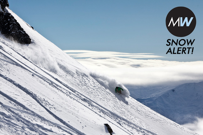
Snow likelihood rating: Forget potential, powder has arrived!
Mt Ruapehu, 15cm of snow and counting…At Treble cone, 10cm and at Mt Hutt, 12cm – This snow storm has arrived! North and South Island resorts are enjoying the first in what looks to be two few days of freshies but with the weather expected to clear following a solid 24 hours of snowfall throughout Friday and Saturday it’s the weekend that’ll be the pick of the days
The Grasshopper’s wise words on Friday 16 September:
_”The strong westerly flow across the Central Plateau continues on Friday with frequent snow showers. That snow will become more patchy on Saturday and winds will turn north-westerly as a low pressure system embedded in this flow approaches from the Tasman Sea. If the wind plays ball and eases as planned then it could be a great day on the behemoth that is Ruapehu.
That low will cross the northern half of the South Island from Saturday night into Sunday, bringing another burst of snow to Ruapehu on Sunday morning that should clear quite abruptly in the afternoon. Unfortunately this feature is coming through about 12 hours later than I thought it would a couple a days ago, and so Sunday has gone from looking completely fine to weather affected for the early part. Yet another front on Monday could see rain creep up the lower slopes.”_
If you have no weekend plans, or even if you do… get to the snowfields!
The Remarkables forecasts,
snow reports and
live snow cams.
Treble Cone forecasts,
snow reports and
live snow cams.
Snow Park forecasts,
snow reports and
live snow cams.
Cardrona forecasts,
snow reports and
live snow cams.
Turoa forecasts,
snow reports and
live snow cams.
Coronet Peak forecasts,
snow reports and
live snow cams.
Whakapapa forecasts,
snow reports and
live snow cams.
Mount Hutt forecasts,
snow reports and
live snow cams.


