Storm Watch NZ – The big easterly
STORM WATCH by The Grasshopper
Brought to you by ESS Boardstores
Updated Thursday 2 August at 1pm
We’re giving this storm a bronze over the Southern Lakes and a silver over Canterbury, but it could have been better, and it has a chance to go for gold tomorrow.
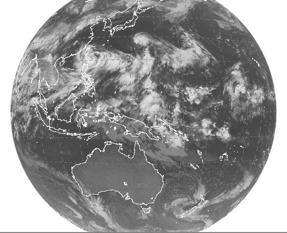
The satellite image above is from Tuesday when we’d had 15 to 30cm over the Southern Lakes and it was just getting started for Canterbury. You can see the cloud spinning around the low to the west of the North Island, and the thick band of cloud being drawn over the lower South Island.
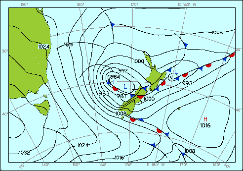
In the analysis image below the tightly spaced isobars are clues to some gale force easterly winds converging along the eastern foothills of the Southern Alps and generating some very decent rain and snow.
Unfortunately things were pretty slushy at the bottom for Mt Hutt when this event started and I think we lost about 40cm of potential snow as rain because it was just too warm. But they’ve still put on 60cm+ up top, and other Canterbury fields are on board with similar or better amounts.
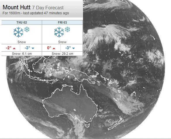
Thankfully we’re not done yet. In the satellite image below from this morning you can see a circular mass of cloud to the west of New Zealand, proof that our low is still spinning away. Forecast models bring more moisture into Canterbury on an easterly over the next two days, and it’s nice and cold so no problems with rain. We could see another 15 to 30cm.
See today’s forecast data update here:

The Remarkables forecasts,
snow reports and
live snow cams.
Treble Cone forecasts,
snow reports and
live snow cams.
Cardrona forecasts,
snow reports and
live snow cams.
Coronet Peak forecasts,
snow reports and\
live snow cams.