Weekly Japan Forecast, Thursday Feb 15th – Fresh Powder on Friday Before More Sunshine and Another Meltdown
Mountanwatch | The Grasshopper
Written Thursday morning 15th February (Japan Standard Time)
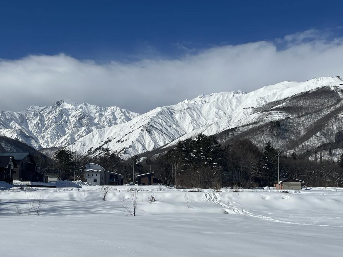
The weekend brought a nice load of fresh powder to Japan, but the days since have been sunny and warm, which is great for t-shirt runs and the goggle tan, but not great for the snowpack. But fret not, cold air and fresh snow is on its way!
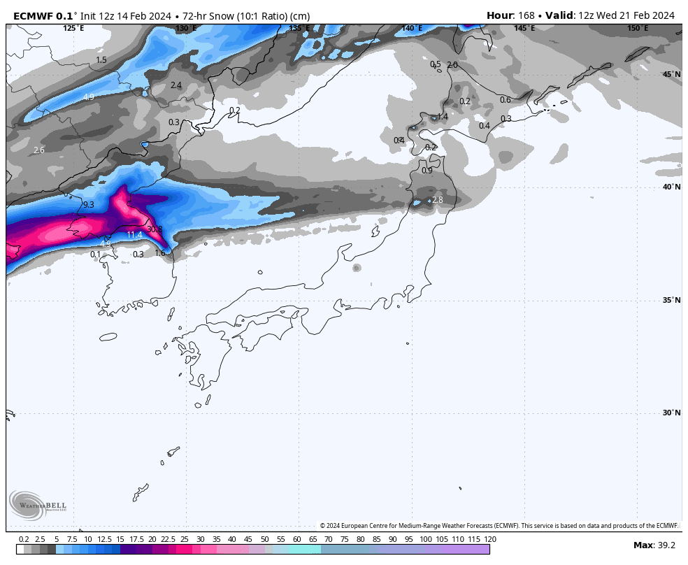
Cold air is currently washing out the muck on Hokkaido as we speak, and it’ll hit Honshu tonight/overnight with a short’n sharp dump of powder, which should stack up to about 10-30cm, although we could see up to 40cm in the north of the Island.
This weekend, we’ll repeat the cycle of the past 7-days once again, where temps will climb and the sun will shine. It’ll be fun, no doubt, especially for you fair-weather fiends, and you’ll want to make the most of it before rain arrives early next week. It won’t be pretty, but the next cold outbreak and fresh snow is likely later in the week.
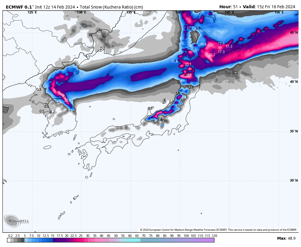
Thursday Feb 15th & Friday Feb 16th
Well, the big meltdown of the last few days is nearly at an end. But first, today, Thursday, we have a stationary front lying over the northern half of Northern Honshu where rainfall will build throughout the day into quite heavy falls as the front strengthens.
North of this, cold air will finally sneak down over Hokkaido, bringing light snowfall at first. Snowfall will then become heavier over the southern half of the Island later today as the cold air runs into the front.
The rest of Honshu is in for another mainly fine day, with warm S-SW winds, but cloud will start to build from afternoon as a low approaches from the west, with rain spreading north and eastwards from this evening.
On Friday, the low from the west passes over Honshu in the early hours, allowing cold northerlies to flush down over Japan, washing away the heat and humidity of the previous days.
On Honshu, snow levels will fall off a cliff with the sudden arrival of this cold air, and there’ll be a short’n sharp dump in the hours before dawn. Light snowfall will then gradually taper off throughout the day as cold NW winds abate. Hokkaido will also see light snowfalls tapering off through the day, the heaviest falls being in the south during the pre-dawn hours.
Snowfall accumulations for this event will mostly be within the 10-30cm range throughout Japan, but 20-40cm in the very north of Honshu and possibly parts of southern Hokkaido.
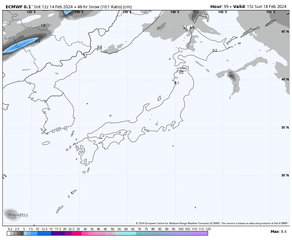
Saturday Feb 17th & Sunday Feb 18th
This weekend, temperatures will steadily climb again as the passage of high pressure sees warm S-SW winds strengthen over the country, winds becoming quite strong over Hokkaido and northern Honshu during Sunday. Skies will also be remarkably clear and sunny, with most of the cloud and any remaining flurries in the northern half of Japan clearing early Saturday.
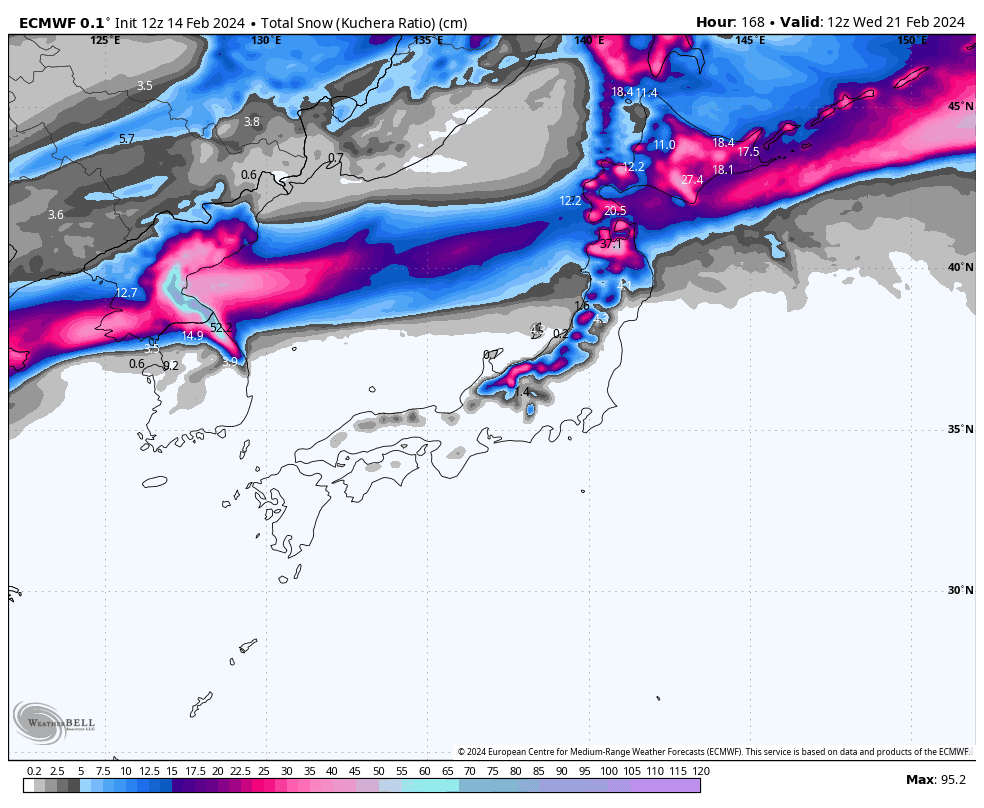
Monday Feb 19th to Wednesday Feb 21st
Monday, warm S-SW winds will continue to strengthen over Japan as a low-pressure system enters the Sea of Japan from the continent. Rain will arrive in Hokkaido during the second half of the day, before swooping down over Honshu at night after what would have been a mostly sunny day there.
Cold air will again flush over Hokkaido and the far north of Northern Honshu during Tuesday, but the accompanying snowfall is mostly likely to be light and scattered after perhaps an initial period of slightly heavier falls.
Wednesday, the cold air will stall over northern Honshu with heavier snowfalls getting underway there late in the piece, and just light snow showers continuing to fall over Hokkaido. Central Honshu, meanwhile, will be stuck in the rain-band south of the cold front, where warm S-SW winds will continue to blow – yuk!
Extended Outlook
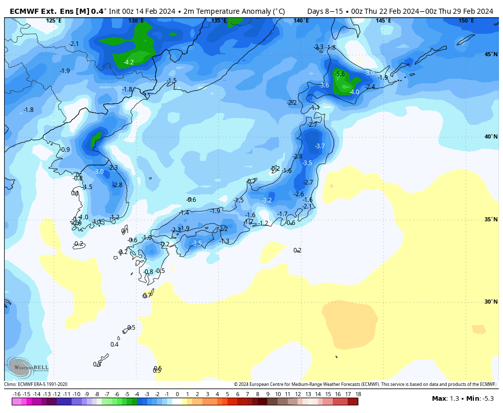
A low is likely to shoot out of the west next Thursday, 22nd Feb. This should see cold air and fresh snow over Hokkaido spreading to Honshu, which may persist well into next weekend.]
The following week may stay chilly, and possibly snowy, through the first half before warming up during the latter half with less ideal conditions for snowfall.
That’s all from me today. Have a great week, see you next Thursday.
Grasshopper


