Weekly North America Forecast, Jan 4th– The West to Make A Comeback This Week
Mountainwatch | The Grasshopper
Written Thursday morning 4th January (Pacific Time)
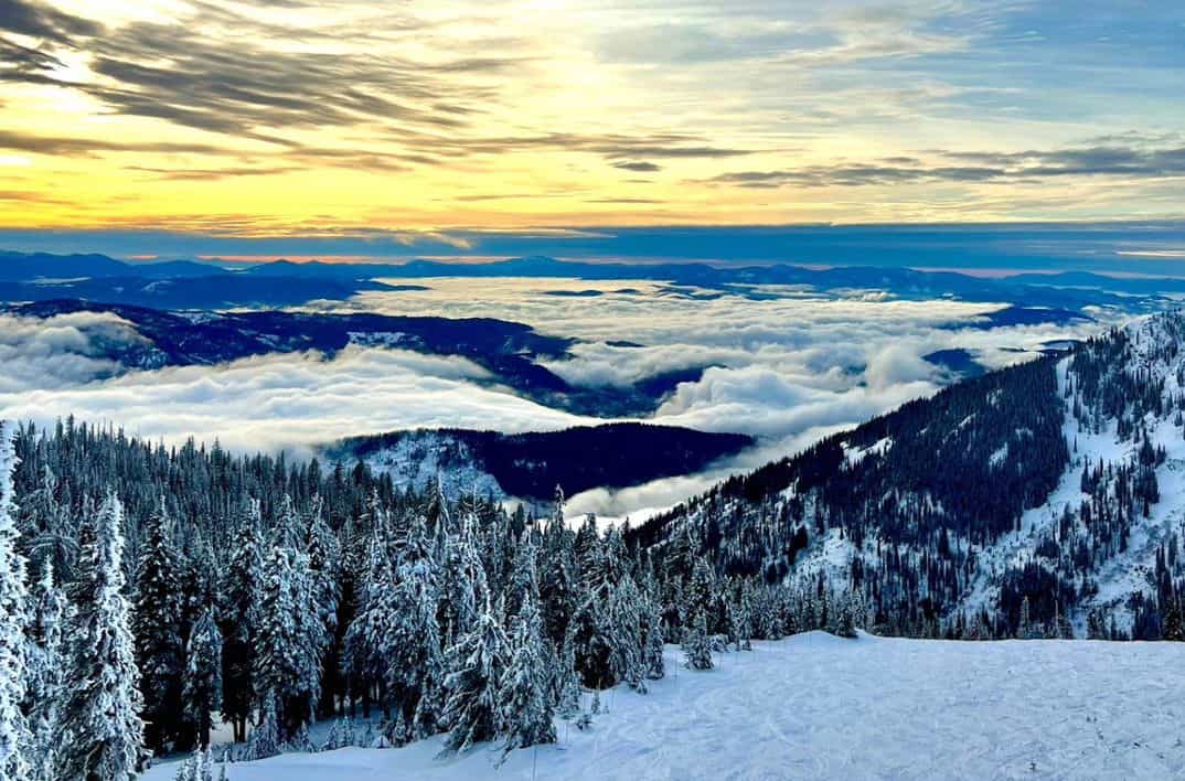
It’s been a quiet week in the North American West. However, the Sierras still managed to pick up 30-50cm during a quick ‘n heavy dump over the last 48hrs, while some resorts in British Columbia received 10-20cm during several days of light falls. Colorado meanwhile picked up next to nuthin!
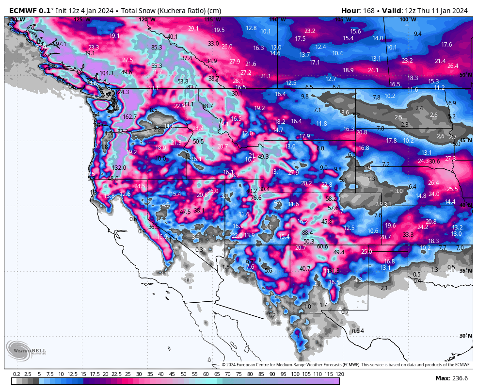
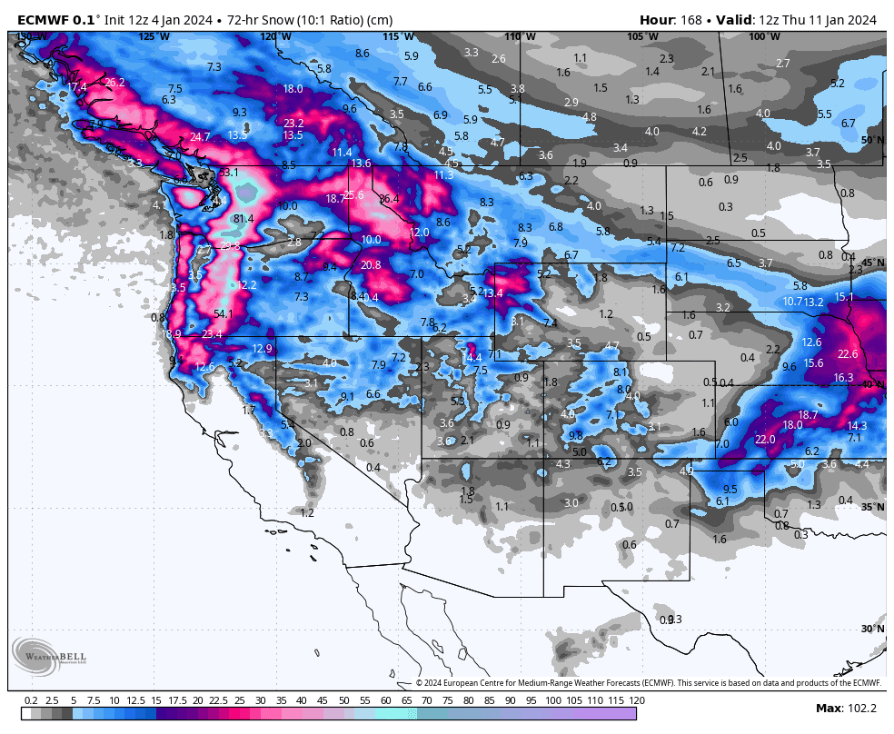
Snow returns this week in a big way, and the storm cycle will build over the next several days, before heading into The Never-Ending Storm, which could see snow continuously falling from Monday through into next weekend. This week’s snowfall accumulation chart paints a very different picture from last week, with deep totals expected everywhere, getting up over a metre at some lucky resorts.
Thursday Jan 4th & Friday Jan 5th
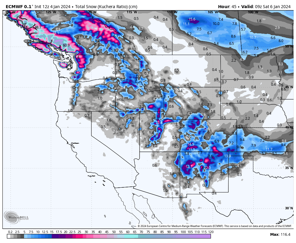
The storm that dumped on the Sierras has worked its way inland to the southern Rockies, and with continued moisture in the north pushing in from the Pacific, it’ll only be the Sierra’s themselves that don’t receive any new snow today. New Mexico and southern Colorado will do well with totals of 20-30cm+ of high-quality powder coming out of a fairly chilly airmass. Most others will receive something in the ballpark of 10-20cm, although the central Rockies are likely to be on the low end of that scale or even below.
Friday, temperatures will continue to creep downwards as that moist, but chilly Pacific air slides down the length of the Rockies, where this time it’ll be central parts making the most of it with totals getting up between 10-30cm.
Also on Friday, a powerful storm hits the NW, bringing heavy snowfall to the Canadian Coast Mountains, spreading to the Cascades by the end of the day, with light-moderate falls also reaching the northern Rockies.
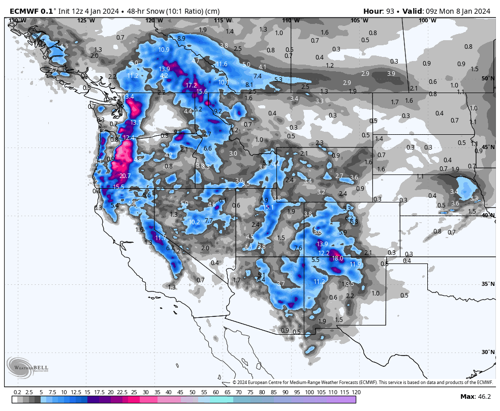
Saturday 6th & Sunday 7th
This weekend, the powerful storm in the NW will continue to plow southwards and eastwards, giving the entire West a solid dump of high-quality powder. Around 10-30cm is likely for most, but higher totals are possible in the Pacific NW and southern Rockies.
Monday Jan 8th to Wednesday Jan 10th
Monday will herald the start of a seemingly endless storm cycle to the West, which, if forecasts are correct, should bring continuous snowfall to the area through into next weekend.
First, a powerful cold front pushes over the north during Monday. Heavy snowfalls will continue up there Tuesday as new weather systems continue to pour in, while also creeping southwards, with lighter snowfall reaching the Sierras and central Rockies by the end of the day.
Wednesday, the storm will keep on giving in northern and central parts, while continuing to spread southwards over the southern Rockies.
Extended Outlook
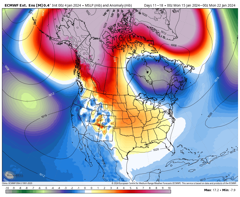
After the never-ending storm looks to wrap up next weekend, models expect the following week, starting 15th Jan, will begin with a cold and settled spell, before storms start rolling in again through the back half of the week.
That’s all from me today. Have a great week, see you next Thursday.
Grasshopper


