Weekly North America Forecast, Thursday February 12th – Bye Bye Doldrums, Hello Powder Days
Mountainwatch | The Grasshopper
Written Wednesday, 11th February (Pacific Standard Time)
The doldrums of the last several weeks are now in the rearview mirror as we head into a wilder, stormier stretch of the season. Both the northern and southern tiers are set to receive a healthy top-up of snow over the next few days, ahead of an even more active and colder storm cycle, which balloons out across the West from Sunday and Monday. The Sierras are favoured for the deepest totals, but no matter where you are in the West, you’ll be ripping through fresh powder before long.
Thursday February 12th to Saturday February 14th
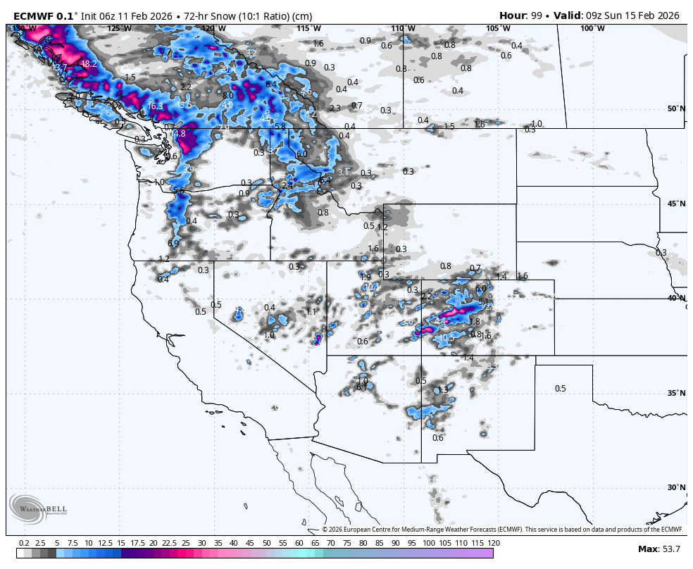
Lingering low pressure will continue to bring snow to the central and southern U.S. Rockies during Thursday and Friday before high pressure brings dry weather Saturday. Utah and Colorado will likely be favoured on Thursday, and then Colorado again on Friday alongside Arizona and New Mexico as a storm system surges up from the south. Models are still at odds as to who gets what, but a general range of 10-30cm can be expected across most resorts here. Temperatures will be on the warm side, so snow levels will be marginal for the lower slopes.
In the north, a much colder storm hitting the Alaska Panhandle and northern BC will spread to the southern Coast Range during Thursday, before reaching the Cascades and then the northern Rockies as far south as northern Idaho and Montana on Friday. Snowfall dries up in the north of this area on Saturday, while it continues in the south as a new storm enters the Pacific Northwest. Accumulations will be similar to those in the south, with 10-30cm across much of BC, the Cascades, and northern Rockies, but Alberta will receive lighter falls of 5-10cm or less.
Sunday February 15th to Wednesday February 18th
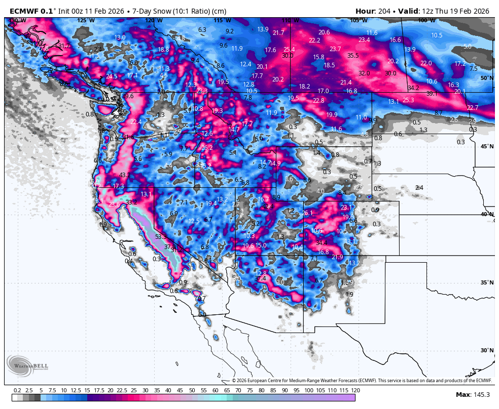
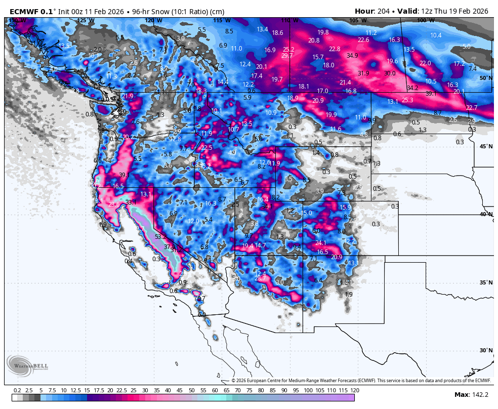
The storm cycle ramps up big-time across western North America during this period as the season looks to bounce back after the long, quiet spell of the last several weeks. The action kicks off in the Sierras on Sunday, before becoming widespread from Monday as a dizzying array of cold winter storms engulf much of the West.
The Sierras will cop the heaviest snowfall and deepest 4-day totals (Sunday to Wednesday) with 0.5-1.5m on the cards. Other areas of the U.S will see about half as much, while Canada will see about a quarter as much.
The active storm cycle will continue for at least several more days, with even colder temperatures and higher-quality powder expected.
That’s all from me today, folks. Have a great week, and I’ll see you back here next Thursday for another weekly rundown of North America’s highlights and snowlights.
Grasshopper


